 |
|
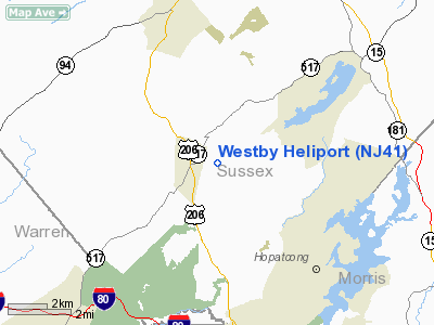
Location & QuickFacts
| FAA Information Effective: | 2008-09-25 |
| Airport Identifier: | NJ41 |
| Airport Status: | Operational |
| Longitude/Latitude: | 074-43-30.5900W/40-59-16.3520N
-74.725164/40.987876 (Estimated) |
| Elevation: | 870 ft / 265.18 m (Estimated) |
| Land: | 0 acres |
| From nearest city: | 1 nautical miles E of Andover, NJ |
| Location: | Sussex County, NJ |
| Magnetic Variation: | 12W (1985) |
Owner & Manager
| Ownership: | Privately owned |
| Owner: | Mmic Reinsurance |
| Address: | 270 Stan Hope Rd
Andover, NJ 07821 |
| Phone number: | 973-786-5794 |
| Manager: | David Klemm |
| Address: | 300 Rose Ville Rd
Andover, NJ 07821 |
| Phone number: | 973-786-7838 |
Airport Operations and Facilities
| Airport Use: | Private |
| Wind indicator: | Yes |
| Segmented Circle: | No |
| Control Tower: | No |
| Lighting Schedule: | PHONE REQ
FOR PERIMETER LGTS CALL 201-786-7838. |
| Sectional chart: | New York |
| Region: | AEA - Eastern |
| Boundary ARTCC: | ZNY - New York |
| Tie-in FSS: | MIV - Millville |
| FSS on Airport: | No |
| FSS Toll Free: | 1-800-WX-BRIEF |
Runway Information
Helipad H1
| Dimension: | 50 x 50 ft / 15.2 x 15.2 m |
| Surface: | CONC, |
| |
Runway H1 |
Runway |
| Traffic Pattern: | Left | Left |
|
Radio Navigation Aids
| ID |
Type |
Name |
Ch |
Freq |
Var |
Dist |
| EWR | FAN MARKER | Maryann | | | 11W | 29.8 nm |
| SKU | FAN MARKER | Stanwyck | | | 12W | 44.7 nm |
| CAT | NDB | Chatham | | 254.00 | 11W | 20.0 nm |
| PNJ | NDB | Paterson | | 347.00 | 12W | 26.2 nm |
| SW | NDB | Neely | | 335.00 | 14W | 37.4 nm |
| UKT | NDB | Quakertown | | 208.00 | 12W | 42.7 nm |
| DYL | NDB | Doylestown | | 237.00 | 10W | 43.2 nm |
| SKU | NDB | Stanwyck | | 261.00 | 12W | 44.7 nm |
| OGY | NDB | Bridge | | 414.00 | 12W | 45.9 nm |
| MS | NDB | Monga | | 359.00 | 12W | 47.2 nm |
| LQX | NDB | Carbon | | 339.00 | 12W | 48.1 nm |
| PO | NDB | Meier | | 403.00 | 12W | 49.2 nm |
| STW | VOR/DME | Stillwater | 033X | 109.60 | 11W | 6.5 nm |
| BWZ | VOR/DME | Broadway | 089X | 114.20 | 11W | 12.2 nm |
| SBJ | VOR/DME | Solberg | 076X | 112.90 | 10W | 24.3 nm |
| HUO | VOR/DME | Huguenot | 108X | 116.10 | 11W | 26.1 nm |
| TEB | VOR/DME | Teterboro | 021X | 108.40 | 11W | 31.2 nm |
| LGA | VOR/DME | La Guardia | 078X | 113.10 | 12W | 40.4 nm |
| CRI | VOR/DME | Canarsie | 070X | 112.30 | 11W | 44.0 nm |
| CKZ | VOR/DME | Pennridge | 025Y | 108.85 | 12W | 44.1 nm |
| ARD | VOR/DME | Yardley | 019X | 108.20 | 10W | 44.9 nm |
| COL | VOR/DME | Colts Neck | 101X | 115.40 | 11W | 48.1 nm |
| JFK | VOR/DME | Kennedy | 106X | 115.90 | 12W | 48.4 nm |
| SAX | VORTAC | Sparta | 104X | 115.70 | 11W | 9.7 nm |
| FJC | VORTAC | Allentown | 122X | 117.50 | 10W | 36.7 nm |
| LHY | VORTAC | Lake Henry | 045X | 110.80 | 10W | 45.1 nm |
| LVZ | VORTAC | Wilkes-barre | 053X | 111.60 | 10W | 46.9 nm |
| RBV | VORTAC | Robbinsville | 085X | 113.80 | 10W | 48.4 nm |
| JFK | VOT | Kennedy | | 115.10 | | 48.0 nm |
Remarks
- CTC MORRISTOWN ATCT TO COORDINATE THE NEED FOR NON-STANDARD TFC PATTERNS.
Images and information placed above are from
http://www.airport-data.com/airport/NJ41/
We thank them for the data!
| General Info
|
| Country |
United States
|
| State |
NEW JERSEY
|
| FAA ID |
NJ41
|
| Latitude |
40-59-16.352N
|
| Longitude |
074-43-30.590W
|
| Elevation |
870 feet
|
| Near City |
ANDOVER
|
We don't guarantee the information is fresh and accurate. The data may
be wrong or outdated.
For more up-to-date information please refer to other sources.
|
|


