 |
|
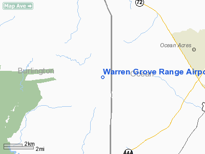
Warren Grove Range Airport |
Location & QuickFacts
| FAA Information Effective: | 2008-09-25 |
| Airport Identifier: | NJ24 |
| Airport Status: | Operational |
| Longitude/Latitude: | 074-24-00.0000W/39-42-48.0000N
-74.400000/39.713333 (Estimated) |
| Elevation: | 105 ft / 32.00 m (Estimated) |
| Land: | 0 acres |
| From nearest city: | 3 nautical miles SW of Burlington County, NJ |
| Location: | Burlington County, NJ |
| Magnetic Variation: | 12W (1995) |
Owner & Manager
| Ownership: | Army owned |
| Owner: | Nj Air National Guard |
| Address: | 33-27 Charles Blvd
Mc Guire Afb, NJ 08641 |
| Phone number: | 609724-2414 |
| Address: |
|
Airport Operations and Facilities
| Airport Use: | Private |
| Segmented Circle: | No |
| Control Tower: | No |
| Lighting Schedule: | RDO-CTL
RY 15/33 LGTS ACTVT - 121.95. |
| Sectional chart: | Washington |
| Region: | AEA - Eastern |
| Boundary ARTCC: | ZNY - New York |
| Tie-in FSS: | MIV - Millville |
| FSS on Airport: | No |
| FSS Toll Free: | 1-800-WX-BRIEF |
Runway Information
Runway 15/33
| Dimension: | 1800 x 150 ft / 548.6 x 45.7 m |
| Surface: | CONC, |
| Edge Lights: | Non-standard lighting system
GREEN RY LGTS. |
| |
Runway 15 |
Runway 33 |
| Traffic Pattern: | Left | Left |
|
Radio Navigation Aids
| ID |
Type |
Name |
Ch |
Freq |
Var |
Dist |
| NEL | NDB | Lakehurst | | 396.00 | 13W | 20.1 nm |
| RNB | NDB | Rainbow | | 363.00 | 11W | 38.4 nm |
| NXX | NDB | Willow Grove | | 388.00 | 12W | 44.7 nm |
| ING | NDB | Ambler | | 275.00 | 11W | 47.8 nm |
| NEL | TACAN | Lakehurst | 055X | | 11W | 19.6 nm |
| NXX | TACAN | Willow Grove | 061X | | 10W | 44.9 nm |
| NEL | UHF/NDB | Lakehurst | | 274.80 | 13W | 20.1 nm |
| PNE | VOR | North Philadelphia | | 112.00 | 10W | 35.8 nm |
| COL | VOR/DME | Colts Neck | 101X | 115.40 | 11W | 37.6 nm |
| ARD | VOR/DME | Yardley | 019X | 108.20 | 10W | 40.0 nm |
| CYN | VORTAC | Coyle | 081X | 113.40 | 10W | 6.4 nm |
| ACY | VORTAC | Atlantic City | 023X | 108.60 | 10W | 17.5 nm |
| GXU | VORTAC | Mc Guire | 043X | 110.60 | 11W | 20.0 nm |
| VCN | VORTAC | Cedar Lake | 099X | 115.20 | 10W | 28.3 nm |
| RBV | VORTAC | Robbinsville | 085X | 113.80 | 10W | 29.7 nm |
| SIE | VORTAC | Sea Isle | 095X | 114.80 | 09W | 41.5 nm |
| OOD | VORTAC | Woodstown | 075X | 112.80 | 10W | 42.0 nm |
| PHL | VOT | Philadelphia Intl | | 109.80 | | 40.2 nm |
Remarks
Images and information placed above are from
http://www.airport-data.com/airport/NJ24/
We thank them for the data!
| General Info
|
| Country |
United States
|
| State |
NEW JERSEY
|
| FAA ID |
NJ24
|
| Latitude |
39-42-48.000N
|
| Longitude |
074-24-00.000W
|
| Elevation |
105 feet
|
| Near City |
BURLINGTON COUNTY
|
We don't guarantee the information is fresh and accurate. The data may
be wrong or outdated.
For more up-to-date information please refer to other sources.
|
|


