|
|
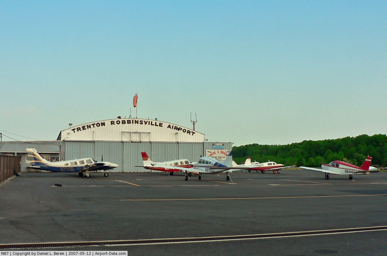
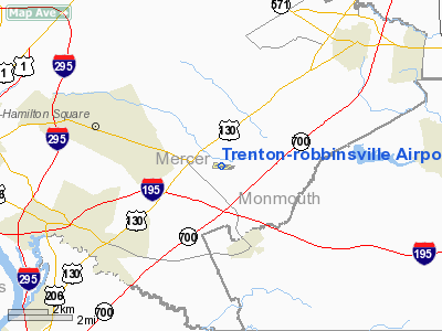
Trenton-robbinsville Airport |
| Trenton-Robbinsville Airport |
 |
| IATA: none – ICAO: none – FAA LID: N87 |
| Summary |
| Airport type |
Public |
| Operator |
TRA Inc. |
| Location |
Robbinsville, New Jersey |
| Elevation AMSL |
119 ft / 36 m |
| Coordinates |
40°12′50.19″N 74°36′06.46″W / 40.2139417°N 74.6017944°W / 40.2139417; -74.6017944Coordinates: 40°12′50.19″N 74°36′06.46″W / 40.2139417°N 74.6017944°W / 40.2139417; -74.6017944 |
| Runways |
| Direction |
Length |
Surface |
| ft |
m |
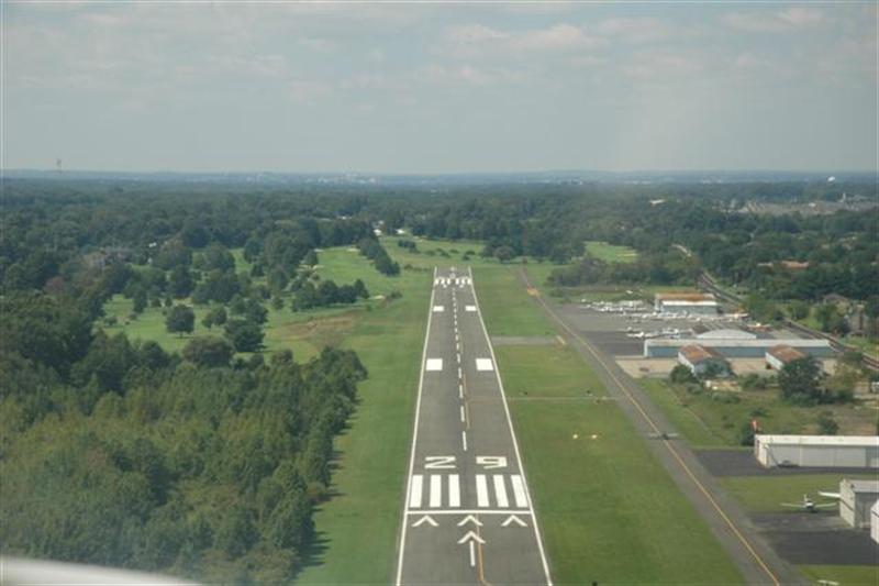
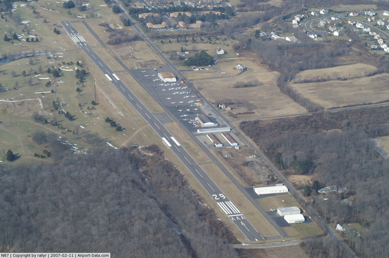
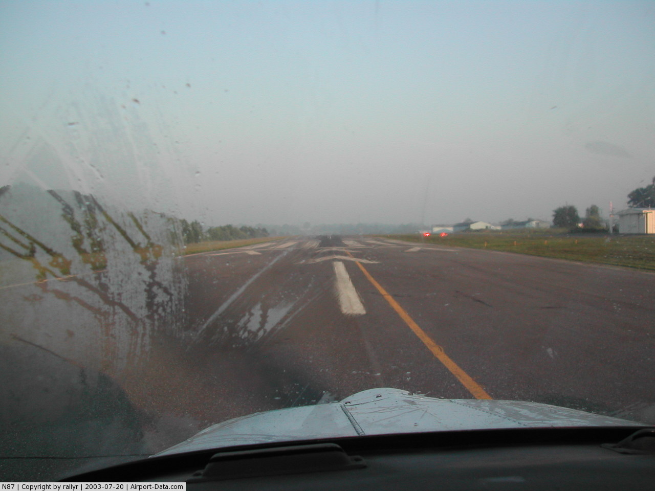
| 11/29 |
4,275 |
1,303 |
Asphalt |
Trenton-Robbinsville Airport (FAA LID: N87) is a privately owned, public use airport in Robbinsville, New Jersey.
The above content comes from Wikipedia and is published under free licenses – click here to read more.
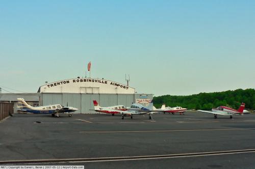 |
(Click on the photo to enlarge) |
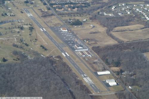 |
(Click on the photo to enlarge) |
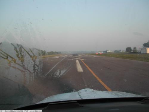 |
(Click on the photo to enlarge) |
Location & QuickFacts
| FAA Information Effective: | 2008-09-25 |
| Airport Identifier: | N87 |
| Airport Status: | Operational |
| Longitude/Latitude: | 074-36-06.4610W/40-12-50.1960N
-74.601795/40.213943 (Estimated) |
| Elevation: | 119 ft / 36.27 m (Estimated) |
| Land: | 139 acres |
| From nearest city: | 1 nautical miles E of Robbinsville, NJ |
| Location: | Mercer County, NJ |
| Magnetic Variation: | 13W (2000) |
Owner & Manager
| Ownership: | Privately owned |
| Owner: | Tra Inc. |
| Address: | 106b Sharon Road
Robbinsville, NJ 08691 |
| Phone number: | 609-259-1059 |
| Manager: | William Dey |
| Address: | 106b Sharon Road
Robbinsville, NJ 08691 |
| Phone number: | 609-259-1059 |
Airport Operations and Facilities
| Airport Use: | Open to public |
| Wind indicator: | Yes |
| Segmented Circle: | Yes |
| Control Tower: | No |
| Lighting Schedule: | DUSK-DAWN
ACTVT MIRL RY 11/29 - 123.3. |
| Beacon Color: | Clear-Green (lighted land airport) |
| Landing fee charge: | No |
| Sectional chart: | New York |
| Region: | AEA - Eastern |
| Traffic Pattern Alt: | 981 ft |
| Boundary ARTCC: | ZDC - Washington |
| Responsible ARTCC: | ZNY - New York |
| Tie-in FSS: | MIV - Millville |
| FSS on Airport: | No |
| FSS Toll Free: | 1-800-WX-BRIEF |
| NOTAMs Facility: | MIV (NOTAM-d service avaliable) |
| Federal Agreements: | NGY |
Airport Communications
| CTAF: | 123.000 |
| Unicom: | 123.000 |
Airport Services
| Fuel available: | 100LL
SELF SVC FUEL SYS MID-FIELD APRON. |
| Airframe Repair: | MAJOR |
| Power Plant Repair: | MAJOR |
Runway Information
Runway 11/29
| Dimension: | 4275 x 80 ft / 1303.0 x 24.4 m |
| Surface: | ASPH, Fair Condition |
| Weight Limit: | Single wheel: 25000 lbs. |
| Edge Lights: | Medium |
| |
Runway 11 |
Runway 29 |
| Longitude: | 074-36-33.8380W | 074-35-38.9850W |
| Latitude: | 40-12-52.2210N | 40-12-48.1480N |
| Elevation: | 107.00 ft | 117.00 ft |
| Alignment: | 96 | 127 |
| Traffic Pattern: | Left | Right |
| Markings: | Non-precision instrument, Good Condition | Non-precision instrument, Good Condition |
| Crossing Height: | 46.00 ft | 29.00 ft |
| Displaced threshold: | 400.00 ft | 300.00 ft |
| VASI: | 2-light PAPI on left side | 2-light PAPI on right side |
| Visual Glide Angle: | 4.50° | 4.00° |
| Runway End Identifier: | No | No |
| Obstruction: | 73 ft trees, 259.0 ft from runway, 181 ft left of centerline
RWY 11 APCH SLOPE 9:1 TO DSPLCD THLD.
RWY 11 38 FT TREE 120 FT FROM RY END 115 FT LEFT. | 60 ft trees, 200.0 ft from runway, 176 ft left of centerline
APCH SLOPE 8:1 TO DSPLCD THLD.
RY 29 ROAD WITH 15 FT VEHICLES 40 FR FM RY END CROSSING CNTRLN. |
|
Radio Navigation Aids
| ID |
Type |
Name |
Ch |
Freq |
Var |
Dist |
| EWR | FAN MARKER | Maryann | | | 11W | 35.0 nm |
| NEL | NDB | Lakehurst | | 396.00 | 13W | 15.9 nm |
| DYL | NDB | Doylestown | | 237.00 | 10W | 25.0 nm |
| NXX | NDB | Willow Grove | | 388.00 | 12W | 25.0 nm |
| ING | NDB | Ambler | | 275.00 | 11W | 31.8 nm |
| CAT | NDB | Chatham | | 254.00 | 11W | 32.6 nm |
| UKT | NDB | Quakertown | | 208.00 | 12W | 34.3 nm |
| OGY | NDB | Bridge | | 414.00 | 12W | 39.2 nm |
| PNJ | NDB | Paterson | | 347.00 | 12W | 48.6 nm |
| NEL | TACAN | Lakehurst | 055X | | 11W | 15.6 nm |
| NXX | TACAN | Willow Grove | 061X | | 10W | 25.0 nm |
| NEL | UHF/NDB | Lakehurst | | 274.80 | 13W | 15.9 nm |
| PNE | VOR | North Philadelphia | | 112.00 | 10W | 20.3 nm |
| ARD | VOR/DME | Yardley | 019X | 108.20 | 10W | 14.2 nm |
| COL | VOR/DME | Colts Neck | 101X | 115.40 | 11W | 21.1 nm |
| SBJ | VOR/DME | Solberg | 076X | 112.90 | 10W | 23.1 nm |
| CKZ | VOR/DME | Pennridge | 025Y | 108.85 | 12W | 33.2 nm |
| BWZ | VOR/DME | Broadway | 089X | 114.20 | 11W | 36.5 nm |
| CRI | VOR/DME | Canarsie | 070X | 112.30 | 11W | 40.3 nm |
| TEB | VOR/DME | Teterboro | 021X | 108.40 | 11W | 45.4 nm |
| JFK | VOR/DME | Kennedy | 106X | 115.90 | 12W | 45.6 nm |
| LGA | VOR/DME | La Guardia | 078X | 113.10 | 12W | 47.8 nm |
| STW | VOR/DME | Stillwater | 033X | 109.60 | 11W | 48.6 nm |
| RBV | VORTAC | Robbinsville | 085X | 113.80 | 10W | 5.0 nm |
| GXU | VORTAC | Mc Guire | 043X | 110.60 | 11W | 12.3 nm |
| CYN | VORTAC | Coyle | 081X | 113.40 | 10W | 25.1 nm |
| PTW | VORTAC | Pottstown | 112X | 116.50 | 09W | 44.0 nm |
| VCN | VORTAC | Cedar Lake | 099X | 115.20 | 10W | 44.0 nm |
| ACY | VORTAC | Atlantic City | 023X | 108.60 | 10W | 45.6 nm |
| OOD | VORTAC | Woodstown | 075X | 112.80 | 10W | 47.4 nm |
| FJC | VORTAC | Allentown | 122X | 117.50 | 10W | 49.7 nm |
| PHL | VOT | Philadelphia Intl | | 109.80 | | 36.1 nm |
| JFK | VOT | Kennedy | | 115.10 | | 45.3 nm |
Remarks
- VFR DEP RY 29; FOR NOISE ABATEMEMT CLIMB STRAIGHT AHEAD UNTIL REACHING 700 FT AGL BEFORE TURNING. AVOID OVERFLIGHT OF SHARON ELEMENTARY SCHOOL .75 NM NORTHEAST.
- MEN AND EQUIP FM ADJACENT GOLF COURSE FREQUENTLY CROSS RWY AND TWYS.
- BUILT IN 1945.
Images and information placed above are from
http://www.airport-data.com/airport/N87/
We thank them for the data!
| General Info
|
| Country |
United States
|
| State |
NEW JERSEY
|
| FAA ID |
N87
|
| Latitude |
40-12-50.196N
|
| Longitude |
074-36-06.461W
|
| Elevation |
119 feet
|
| Near City |
ROBBINSVILLE
|
We don't guarantee the information is fresh and accurate. The data may
be wrong or outdated.
For more up-to-date information please refer to other sources.
|
|