 |
|
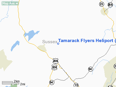
Location & QuickFacts
| FAA Information Effective: | 2008-09-25 |
| Airport Identifier: | 6NJ2 |
| Airport Status: | Operational |
| Longitude/Latitude: | 074-42-47.5900W/41-09-15.3460N
-74.713219/41.154263 (Estimated) |
| Elevation: | 490 ft / 149.35 m (Estimated) |
| Land: | 50 acres |
| From nearest city: | 2 nautical miles E of Branchville, NJ |
| Location: | Sussex County, NJ |
| Magnetic Variation: | 12W (1985) |
Owner & Manager
| Ownership: | Privately owned |
| Owner: | Patrick M. Goerig |
| Address: | 65 George Hill Road
Branchville, NJ 07826 |
| Phone number: | 201-875-6615 |
| Manager: | Patrick M. Goerig |
| Address: | 65 George Hill Road
Branchville, NJ 07826 |
| Phone number: | 201-875-6615 |
Airport Operations and Facilities
| Airport Use: | Private |
| Wind indicator: | Yes |
| Segmented Circle: | No |
| Control Tower: | No |
| Landing fee charge: | No |
| Sectional chart: | New York |
| Region: | AEA - Eastern |
| Boundary ARTCC: | ZNY - New York |
| Tie-in FSS: | MIV - Millville |
| FSS on Airport: | No |
| FSS Toll Free: | 1-800-WX-BRIEF |
Runway Information
Helipad H1
| Dimension: | 100 x 100 ft / 30.5 x 30.5 m |
| Surface: | TURF, |
| |
Runway H1 |
Runway |
| Traffic Pattern: | Left | Left |
|
Radio Navigation Aids
| ID |
Type |
Name |
Ch |
Freq |
Var |
Dist |
| EWR | FAN MARKER | Maryann | | | 11W | 36.1 nm |
| SKU | FAN MARKER | Stanwyck | | | 12W | 37.6 nm |
| CAT | NDB | Chatham | | 254.00 | 11W | 28.0 nm |
| PNJ | NDB | Paterson | | 347.00 | 12W | 28.4 nm |
| SW | NDB | Neely | | 335.00 | 14W | 29.6 nm |
| MS | NDB | Monga | | 359.00 | 12W | 37.4 nm |
| SKU | NDB | Stanwyck | | 261.00 | 12W | 37.6 nm |
| PO | NDB | Meier | | 403.00 | 12W | 42.2 nm |
| STW | VOR/DME | Stillwater | 033X | 109.60 | 11W | 11.9 nm |
| HUO | VOR/DME | Huguenot | 108X | 116.10 | 11W | 16.3 nm |
| BWZ | VOR/DME | Broadway | 089X | 114.20 | 11W | 21.9 nm |
| SBJ | VOR/DME | Solberg | 076X | 112.90 | 10W | 34.4 nm |
| TEB | VOR/DME | Teterboro | 021X | 108.40 | 11W | 34.8 nm |
| LGA | VOR/DME | La Guardia | 078X | 113.10 | 12W | 43.9 nm |
| CRI | VOR/DME | Canarsie | 070X | 112.30 | 11W | 49.4 nm |
| SAX | VORTAC | Sparta | 104X | 115.70 | 11W | 9.5 nm |
| LHY | VORTAC | Lake Henry | 045X | 110.80 | 10W | 39.7 nm |
| FJC | VORTAC | Allentown | 122X | 117.50 | 10W | 42.4 nm |
| LVZ | VORTAC | Wilkes-barre | 053X | 111.60 | 10W | 44.7 nm |
Remarks
- PRVDD TREES ARE REMOVED TO ENSURE CLNC OF IMAGINARY SURFACES.
Images and information placed above are from
http://www.airport-data.com/airport/6NJ2/
We thank them for the data!
| General Info
|
| Country |
United States
|
| State |
NEW JERSEY
|
| FAA ID |
6NJ2
|
| Latitude |
41-09-15.346N
|
| Longitude |
074-42-47.590W
|
| Elevation |
490 feet
|
| Near City |
BRANCHVILLE
|
We don't guarantee the information is fresh and accurate. The data may
be wrong or outdated.
For more up-to-date information please refer to other sources.
|
|


