|
|
| Sussex Airport |
 |
| IATA: none – ICAO: KFWN – FAA LID: FWN |
| Summary |
| Airport type |
Public |
| Owner |
Sussex Airport, Inc. |
| Serves |
Sussex, New Jersey |
| Elevation AMSL |
421 ft / 128 m |
| Coordinates |
41°12′01″N 074°37′23″W / 41.20028°N 74.62306°W / 41.20028; -74.62306 |
| Runways |
| Direction |
Length |
Surface |
| ft |
m |
| 3/21 |
3,499 |
1,066 |
Asphalt |
| Statistics (2008) |
| Aircraft operations |
19,257 |
| Based aircraft |
131 |
| Source: Federal Aviation Administration |
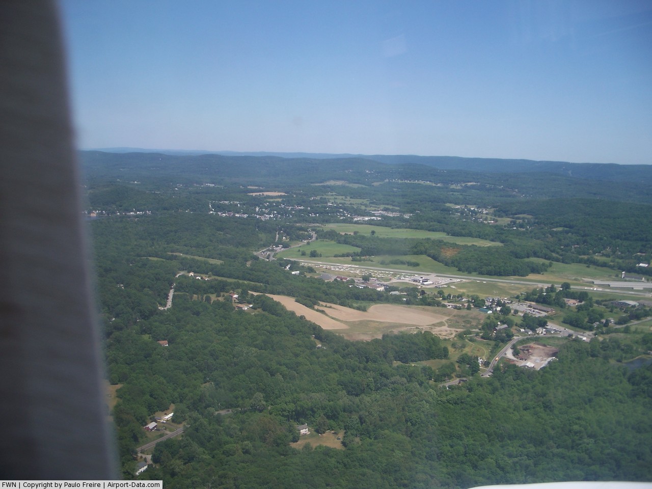
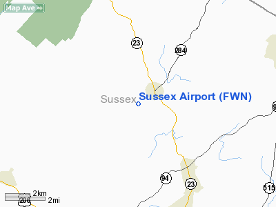
Sussex Airport (ICAO: KFWN, FAA LID: FWN) is a small general aviation airport located one nautical mile (1.85 km) southwest of Sussex in Wantage Township, Sussex County, New Jersey, United States. It is just outside of Sussex Borough. This public-use airport is privately-owned by Sussex Airport, Inc.
The airport used to host the Sussex Airshow but the owner has stopped holding the shows while he tries to sell the airport. The township of Wantage is currently studying the feasibility of purchasing the airport.
Although most U.S. airports use the same three-letter location identifier for the FAA and IATA, this airport is assigned FWN by the FAA but has no designation from the IATA. Facilities
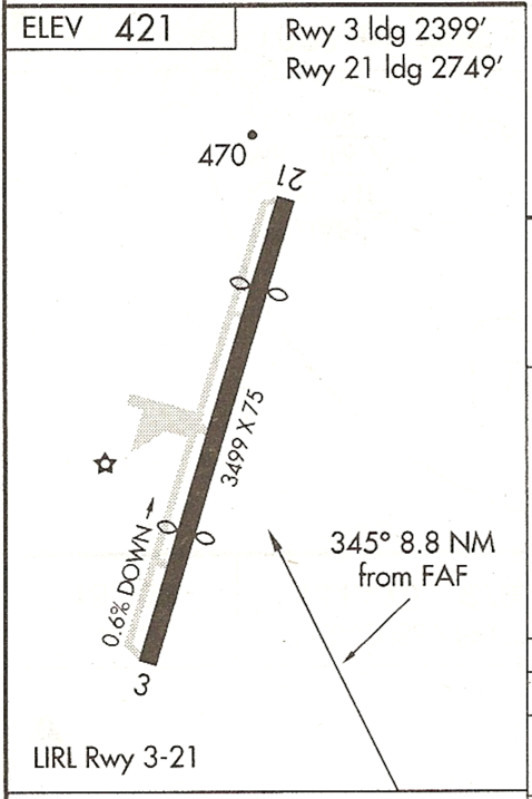
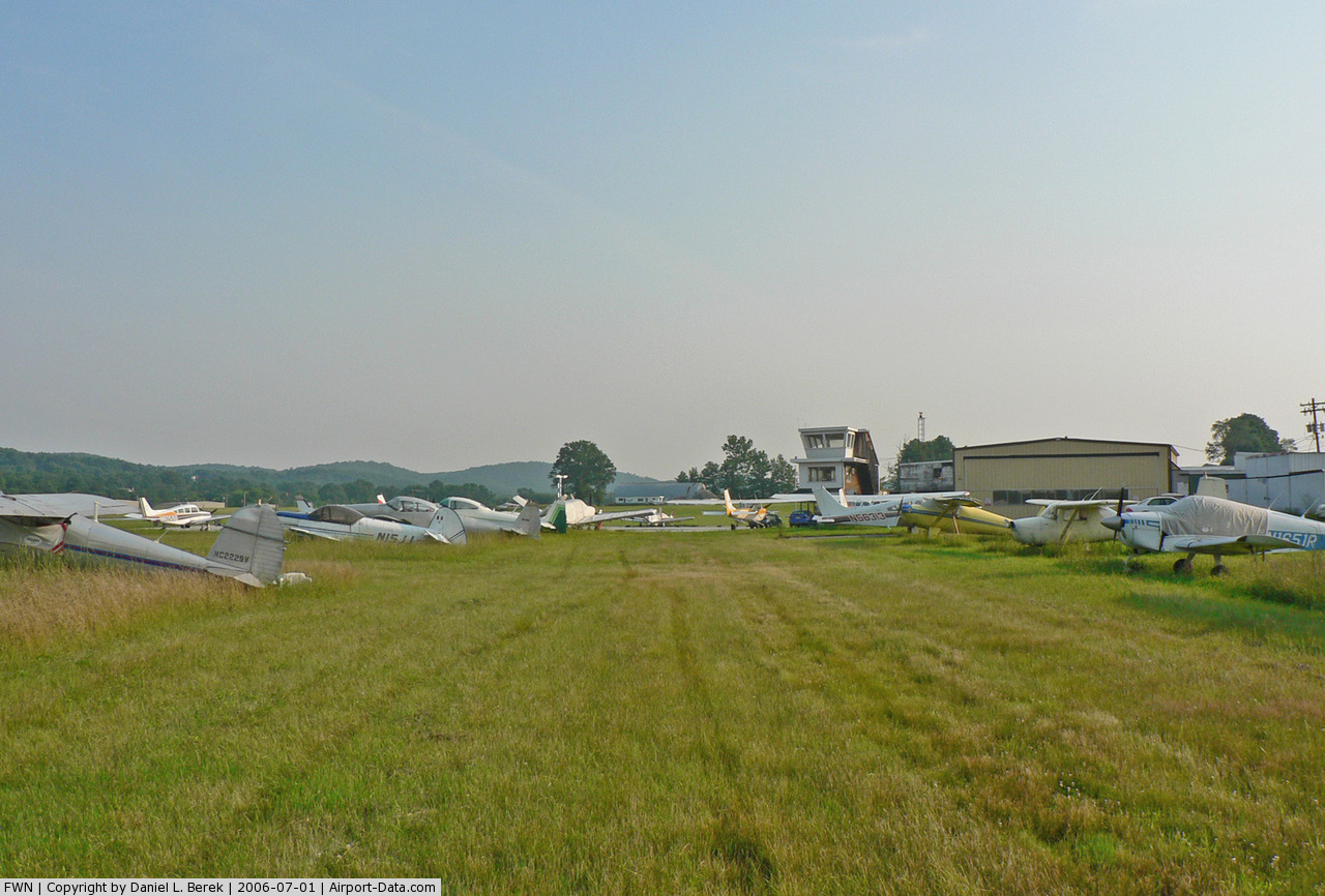
Sussex Airport covers an area of 96 acres (39 ha) at an elevation of 421 feet (128 m) above mean sea level. It has one runway designated 3/21 with an asphalt surface measuring 3,499 by 75 feet (1,066 x 23 m). For the 12-month period ending June 1, 2008, the airport had 19,257 general aviation aircraft operations, an average of 52 per day. At that time there were 131 aircraft based at this airport: 95% single-engine and 5% multi-engine.
The airport does not have an Air traffic control (ATC), but instead uses a UNICOM where pilots talk on radios using a common frequency to coordinate runway and taxiway usage.
Runway information
- Rwy 3 Threshold displaced 1,100 feet (340 m)
- Rwy 21 Threshold displaced 750 feet (230 m)
- LIRL Non-standard: color. Rwy End lts. missing, displaced threshold lts. missing. Rotating beacon operating intermittently. After 24:00 lights on request by phone.
- GPS Rwy 3
- VOR or GPS-A
On field
- Fuel: 100LL, Jet-A
- Major frame service
- Major powerplant service
- Diving school
- Parking
- Tie-downs
- Hangars
- Airport Grill
Off field
- Several small diner restaurants in the Borough and surrounding Wantage Township, one directly adjacent to the airfield.
- Sussex Inn, 9 Main St, Sussex, NJ (973) 875-3000 1 mi
- Shopping and other activities (including Mountain Creek Ski Resort/Waterpark) within 10 miles (16 km) of airport.
Controversies
In 2009, the airport's owner, Paul Styger, pleaded guilty to Federal charges of embezzlement. This stemmed from his misuse of $375,000 of grant money provided for airport improvements. He faces up to two years in prison. Wantage Township officials admittedly knew that Styger was under investigation for embezzlement, but were asked to keep silent by state and federal agencies in an attempt to preserve the integrity of the investigation.
The above content comes from Wikipedia and is published under free licenses – click here to read more.
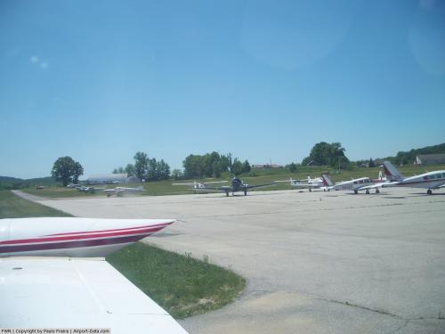 |
(Click on the photo to enlarge) |
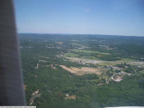 |
(Click on the photo to enlarge) |
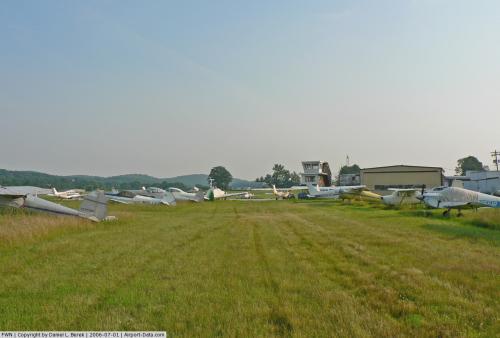 |
(Click on the photo to enlarge) |
Location & QuickFacts
| FAA Information Effective: | 2008-09-25 |
| Airport Identifier: | FWN |
| Airport Status: | Operational |
| Longitude/Latitude: | 074-37-22.9820W/41-12-00.7440N
-74.623051/41.200207 (Estimated) |
| Elevation: | 421 ft / 128.32 m (Surveyed) |
| Land: | 96 acres |
| From nearest city: | 1 nautical miles SW of Sussex, NJ |
| Location: | Sussex County, NJ |
| Magnetic Variation: | 13W (1995) |
Owner & Manager
| Ownership: | Privately owned |
| Owner: | Sussex Airport, Inc. |
| Address: | Po Box 311
Sussex, NJ 07461 |
| Phone number: | 973-875-7337 |
| Manager: | Paul Styger |
| Address: | Po Box 311
Sussex, NJ 07461 |
| Phone number: | 973-875-7337 |
Airport Operations and Facilities
| Airport Use: | Open to public |
| Wind indicator: | Yes |
| Segmented Circle: | No |
| Control Tower: | No |
| Lighting Schedule: | DUSK-DAWN
ACTVT MIRL RY 03-21 AND REIL RYS 03 & 21-CTAF. |
| Beacon Color: | Clear-Green (lighted land airport) |
| Landing fee charge: | No |
| Sectional chart: | New York |
| Region: | AEA - Eastern |
| Traffic Pattern Alt: | 1200 ft |
| Boundary ARTCC: | ZNY - New York |
| Tie-in FSS: | MIV - Millville |
| FSS on Airport: | No |
| FSS Toll Free: | 1-800-WX-BRIEF |
| NOTAMs Facility: | MIV (NOTAM-d service avaliable) |
| Federal Agreements: | N |
Airport Communications
| CTAF: | 122.700 |
| Unicom: | 122.700 |
Airport Services
| Fuel available: | 100LLA
SELF-SERVICE. |
| Airframe Repair: | MAJOR |
| Power Plant Repair: | MAJOR |
| Bottled Oxygen: | NONE |
| Bulk Oxygen: | NONE |
Runway Information
Runway 03/21
| Dimension: | 3499 x 75 ft / 1066.5 x 22.9 m |
| Surface: | ASPH, Fair Condition |
| Edge Lights: | Medium |
| |
Runway 03 |
Runway 21 |
| Longitude: | 074-37-29.2190W | 074-37-16.6570W |
| Latitude: | 41-11-44.0940N | 41-12-17.3370N |
| Elevation: | 421.00 ft | 401.00 ft |
| Alignment: | 16 | 127 |
| Traffic Pattern: | Left | Left |
| Markings: | Basic, Good Condition | Basic, Good Condition |
| Crossing Height: | 40.00 ft | 0.00 ft |
| Displaced threshold: | 457.00 ft | 750.00 ft |
| VASI: | 2-light PAPI on left side | |
| Visual Glide Angle: | 4.00° | 0.00° |
| Runway End Identifier: | Yes | Yes |
| Obstruction: | 19 ft bldg, 261.0 ft from runway, 47 ft right of centerline, 3:1 slope to clear
RY 03 APCH RATIO 37:1 TO DSPLCD THLD.
RY 03 18 FT TREE, 135 FT FM RY END, 58 FT R. | 31 ft pole, 221.0 ft from runway, 59 ft right of centerline
RWY 21 APCH RATIO 31:1 TO DSPLCD THLD.
RY 21 10 FT BRUSH, 72 FT FM RY END, 25 FT R. |
|
Radio Navigation Aids
| ID |
Type |
Name |
Ch |
Freq |
Var |
Dist |
| SKU | FAN MARKER | Stanwyck | | | 12W | 32.7 nm |
| EWR | FAN MARKER | Maryann | | | 11W | 35.8 nm |
| SW | NDB | Neely | | 335.00 | 14W | 24.8 nm |
| PNJ | NDB | Paterson | | 347.00 | 12W | 26.3 nm |
| CAT | NDB | Chatham | | 254.00 | 11W | 29.0 nm |
| SKU | NDB | Stanwyck | | 261.00 | 12W | 32.7 nm |
| MS | NDB | Monga | | 359.00 | 12W | 35.7 nm |
| PO | NDB | Meier | | 403.00 | 12W | 37.3 nm |
| HUO | VOR/DME | Huguenot | 108X | 116.10 | 11W | 12.7 nm |
| STW | VOR/DME | Stillwater | 033X | 109.60 | 11W | 16.6 nm |
| BWZ | VOR/DME | Broadway | 089X | 114.20 | 11W | 25.8 nm |
| TEB | VOR/DME | Teterboro | 021X | 108.40 | 11W | 33.1 nm |
| SBJ | VOR/DME | Solberg | 076X | 112.90 | 10W | 37.5 nm |
| LGA | VOR/DME | La Guardia | 078X | 113.10 | 12W | 41.9 nm |
| IGN | VOR/DME | Kingston | 123X | 117.60 | 12W | 45.7 nm |
| CMK | VOR/DME | Carmel | 113X | 116.60 | 12W | 47.3 nm |
| CRI | VOR/DME | Canarsie | 070X | 112.30 | 11W | 48.4 nm |
| SAX | VORTAC | Sparta | 104X | 115.70 | 11W | 8.9 nm |
| LHY | VORTAC | Lake Henry | 045X | 110.80 | 10W | 42.2 nm |
| FJC | VORTAC | Allentown | 122X | 117.50 | 10W | 47.3 nm |
| LVZ | VORTAC | Wilkes-barre | 053X | 111.60 | 10W | 48.4 nm |
Remarks
- PARACHUTE JUMPING. DROP ZONE LOCATED SW SIDE OF RUNWAY
- TWYS IN POOR CONDITION WITH POTHOLES, CRACKS, AND ASPHALT BREAKING UP.
- NO TWY MARKINGS.
- GCO AVBL ON FREQ 121.725 THRU ISLIP FSS.
- BUILT PRIOR TO 1959.
Images and information placed above are from
http://www.airport-data.com/airport/FWN/
We thank them for the data!
| General Info
|
| Country |
United States
|
| State |
NEW JERSEY
|
| FAA ID |
FWN
|
| Latitude |
41-12-00.744N
|
| Longitude |
074-37-22.982W
|
| Elevation |
421 feet
|
| Near City |
SUSSEX
|
We don't guarantee the information is fresh and accurate. The data may
be wrong or outdated.
For more up-to-date information please refer to other sources.
|
|