 |
|
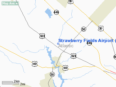
Strawberry Fields Airport |
Location & QuickFacts
| FAA Information Effective: | 2008-09-25 |
| Airport Identifier: | 89NJ |
| Airport Status: | Operational |
| Longitude/Latitude: | 074-43-25.0000W/39-29-21.0000N
-74.723611/39.489167 (Estimated) |
| Elevation: | 45 ft / 13.72 m (Surveyed) |
| Land: | 220 acres |
| From nearest city: | 2 nautical miles N of Mays Landing, NJ |
| Location: | Atlantic County, NJ |
| Magnetic Variation: | 12W (1990) |
Owner & Manager
| Ownership: | Publicly owned |
| Owner: | Dept/environ Protect & Energy |
| Address: | Cn404/bur Forest Fire Mgt
Trenton, NJ 08625 |
| Phone number: | 609-292-2520 |
| Manager: | David Harrison |
| Address: | Cn404/bur Forest Fire Mgt
Trenton, NJ 08625 |
| Phone number: | 609-292-2520 |
Airport Operations and Facilities
| Airport Use: | Private |
| Wind indicator: | Yes |
| Segmented Circle: | No |
| Control Tower: | No |
| Sectional chart: | Washington |
| Region: | AEA - Eastern |
| Boundary ARTCC: | ZDC - Washington |
| Tie-in FSS: | MIV - Millville |
| FSS on Airport: | No |
| FSS Toll Free: | 1-800-WX-BRIEF |
Runway Information
Runway 14/32
| Dimension: | 2200 x 100 ft / 670.6 x 30.5 m |
| Surface: | TURF-SAND, Fair Condition |
| |
Runway 14 |
Runway 32 |
| Traffic Pattern: | Left | Left |
| Obstruction: | | 125 ft tower, 7920.0 ft from runway |
|
Radio Navigation Aids
| ID |
Type |
Name |
Ch |
Freq |
Var |
Dist |
| RNB | NDB | Rainbow | | 363.00 | 11W | 19.6 nm |
| NEL | NDB | Lakehurst | | 396.00 | 13W | 37.9 nm |
| ING | NDB | Ambler | | 275.00 | 11W | 46.2 nm |
| NXX | NDB | Willow Grove | | 388.00 | 12W | 46.4 nm |
| NEL | TACAN | Lakehurst | 055X | | 11W | 37.1 nm |
| DOV | TACAN | Dover | 037X | | 09W | 40.7 nm |
| NXX | TACAN | Willow Grove | 061X | | 10W | 46.7 nm |
| NEL | UHF/NDB | Lakehurst | | 274.80 | 13W | 37.9 nm |
| PNE | VOR | North Philadelphia | | 112.00 | 10W | 38.0 nm |
| ARD | VOR/DME | Yardley | 019X | 108.20 | 10W | 46.7 nm |
| ATR | VOR/DME | Waterloo | 073X | 112.60 | 09W | 46.7 nm |
| ACY | VORTAC | Atlantic City | 023X | 108.60 | 10W | 7.1 nm |
| VCN | VORTAC | Cedar Lake | 099X | 115.20 | 10W | 11.7 nm |
| CYN | VORTAC | Coyle | 081X | 113.40 | 10W | 23.9 nm |
| SIE | VORTAC | Sea Isle | 095X | 114.80 | 09W | 23.9 nm |
| OOD | VORTAC | Woodstown | 075X | 112.80 | 10W | 28.3 nm |
| GXU | VORTAC | Mc Guire | 043X | 110.60 | 11W | 31.8 nm |
| ENO | VORTAC | Smyrna | 051X | 111.40 | 09W | 39.9 nm |
| DQO | VORTAC | Dupont | 087X | 114.00 | 10W | 42.5 nm |
| RBV | VORTAC | Robbinsville | 085X | 113.80 | 10W | 44.1 nm |
| PHL | VOT | Philadelphia Intl | | 109.80 | | 33.3 nm |
Remarks
- OBSTRUCTIONS EXIST WHICH PRECLUDE SAFE OPNS.
Images and information placed above are from
http://www.airport-data.com/airport/89NJ/
We thank them for the data!
| General Info
|
| Country |
United States
|
| State |
NEW JERSEY
|
| FAA ID |
89NJ
|
| Latitude |
39-29-21.000N
|
| Longitude |
074-43-25.000W
|
| Elevation |
45 feet
|
| Near City |
MAYS LANDING
|
We don't guarantee the information is fresh and accurate. The data may
be wrong or outdated.
For more up-to-date information please refer to other sources.
|
|


