 |
|
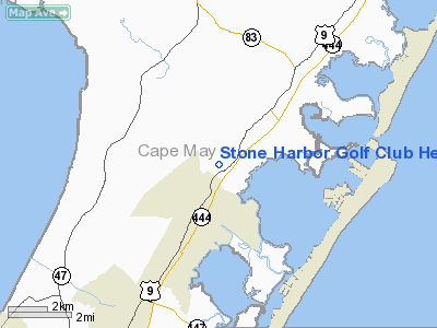
Stone Harbor Golf Club Heliport |
Location & QuickFacts
| FAA Information Effective: | 2008-09-25 |
| Airport Identifier: | NJ08 |
| Airport Status: | Operational |
| Longitude/Latitude: | 074-48-28.5990W/39-06-24.4090N
-74.807944/39.106780 (Estimated) |
| Elevation: | 14 ft / 4.27 m (Estimated) |
| Land: | 1 acres |
| From nearest city: | 2 nautical miles NE of Cape May Court House, NJ |
| Location: | Cape May County, NJ |
| Magnetic Variation: | 12W (1990) |
Owner & Manager
| Ownership: | Privately owned |
| Owner: | Stone Harbor Golf Club Corp |
| Address: | 905 Rte 9 N
Cape May Crt House, NJ 08210 |
| Phone number: | 609-465-9270 |
| Manager: | Harry Bittner |
| Address: | 905 Rte 9 N
Cape May Crt House, NJ 08210 |
| Phone number: | 609-465-9270 |
Airport Operations and Facilities
| Airport Use: | Private |
| Wind indicator: | Yes |
| Segmented Circle: | No |
| Control Tower: | No |
| Sectional chart: | Washington |
| Region: | AEA - Eastern |
| Boundary ARTCC: | ZDC - Washington |
| Tie-in FSS: | MIV - Millville |
| FSS on Airport: | No |
| FSS Toll Free: | 1-800-WX-BRIEF |
Runway Information
Helipad H1
| Dimension: | 50 x 50 ft / 15.2 x 15.2 m |
| Surface: | TURF, |
| |
Runway H1 |
Runway |
| Traffic Pattern: | Left | Left |
|
Radio Navigation Aids
| ID |
Type |
Name |
Ch |
Freq |
Var |
Dist |
| RNB | NDB | Rainbow | | 363.00 | 11W | 24.1 nm |
| OX | NDB | Landy | | 407.00 | 12W | 48.3 nm |
| DOV | TACAN | Dover | 037X | | 09W | 30.8 nm |
| ATR | VOR/DME | Waterloo | 073X | 112.60 | 09W | 26.0 nm |
| SIE | VORTAC | Sea Isle | 095X | 114.80 | 09W | 0.8 nm |
| ACY | VORTAC | Atlantic City | 023X | 108.60 | 10W | 23.6 nm |
| VCN | VORTAC | Cedar Lake | 099X | 115.20 | 10W | 26.9 nm |
| ENO | VORTAC | Smyrna | 051X | 111.40 | 09W | 33.8 nm |
| OOD | VORTAC | Woodstown | 075X | 112.80 | 10W | 39.3 nm |
| CYN | VORTAC | Coyle | 081X | 113.40 | 10W | 46.1 nm |
Remarks
- HELIPORT ON GOLF COURSE.
- (E111-1) PRVDD ALL PARTIES MADE AWARE OF LOCATION OF HELIPAD & ITS OPN, LNDG/TKOF AREA BE ATTENDED BY SUFFICIENT PERSONNEL TO PRECLUDE ENTRY OF PERSONS & OR VEHICLES PRIOR & DURG ACTUAL HELICOPTER OPS.
- PRVDD PEDESTRIAN & VEHICULAR TFC WITHIN 50 FT BE PRECLUDED DURG OPS; GOLFING ACTIVITIES BE CONDUCTED IN A REVERSE AWAY FM AREA; FACILITY MUST LIE TOTALLY WITHIN PHYSICAL CONFINES OF GOLF CLUB & ACCESS RESTRICTED TO CLUB MEMBERS & THEIR GUESTS.
Images and information placed above are from
http://www.airport-data.com/airport/NJ08/
We thank them for the data!
| General Info
|
| Country |
United States
|
| State |
NEW JERSEY
|
| FAA ID |
NJ08
|
| Latitude |
39-06-24.409N
|
| Longitude |
074-48-28.599W
|
| Elevation |
14 feet
|
| Near City |
CAPE MAY COURT HOUSE
|
We don't guarantee the information is fresh and accurate. The data may
be wrong or outdated.
For more up-to-date information please refer to other sources.
|
|


