 |
|
Location & QuickFacts
| FAA Information Effective: | 2008-09-25 |
| Airport Identifier: | NJ92 |
| Airport Status: | Operational |
| Longitude/Latitude: | 074-10-37.5200W/40-44-09.3640N
-74.177089/40.735934 (Estimated) |
| Elevation: | 90 ft / 27.43 m (Surveyed) |
| Land: | 3 acres |
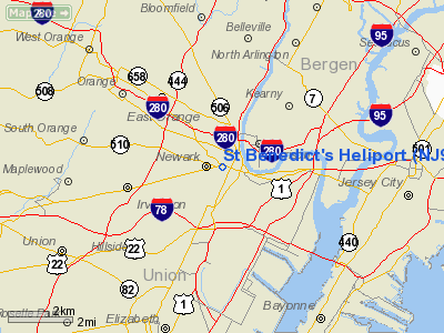
| From nearest city: | 0 nautical miles N of Newark, NJ |
| Location: | Essex County, NJ |
| Magnetic Variation: | 13W (1985) |
Owner & Manager
| Ownership: | Privately owned |
| Owner: | St Benedict's Prep School |
| Address: | 520 Martin Luther King Blvd
Newark, NJ 07102 |
| Phone number: | 201-643-4800 |
| Manager: | Pab Aviation |
| Address: | 3405 Airport Road
Allentown, PA 18103 |
| Phone number: | 201-938-4821 |
Airport Operations and Facilities
| Airport Use: | Private |
| Segmented Circle: | No |
| Control Tower: | No |
| Sectional chart: | New York |
| Region: | AEA - Eastern |
| Boundary ARTCC: | ZNY - New York |
| Tie-in FSS: | MIV - Millville |
| FSS on Airport: | No |
| FSS Toll Free: | 1-800-WX-BRIEF |
Runway Information
Helipad H1
| Dimension: | 75 x 75 ft / 22.9 x 22.9 m |
| Surface: | TURF, |
| |
Runway H1 |
Runway |
| Traffic Pattern: | Left | Left |
|
Radio Navigation Aids
| ID |
Type |
Name |
Ch |
Freq |
Var |
Dist |
| EWR | FAN MARKER | Maryann | | | 11W | 2.0 nm |
| SKU | FAN MARKER | Stanwyck | | | 12W | 48.0 nm |
| CAT | NDB | Chatham | | 254.00 | 11W | 11.5 nm |
| PNJ | NDB | Paterson | | 347.00 | 12W | 12.7 nm |
| OGY | NDB | Bridge | | 414.00 | 12W | 16.8 nm |
| BBN | NDB | Babylon | | 275.00 | 14W | 36.3 nm |
| NEL | NDB | Lakehurst | | 396.00 | 13W | 42.2 nm |
| SW | NDB | Neely | | 335.00 | 14W | 45.1 nm |
| SKU | NDB | Stanwyck | | 261.00 | 12W | 48.0 nm |
| DYL | NDB | Doylestown | | 237.00 | 10W | 49.4 nm |
| NEL | TACAN | Lakehurst | 055X | | 11W | 42.8 nm |
| NEL | UHF/NDB | Lakehurst | | 274.80 | 13W | 42.2 nm |
| TEB | VOR/DME | Teterboro | 021X | 108.40 | 11W | 8.6 nm |
| LGA | VOR/DME | La Guardia | 078X | 113.10 | 12W | 14.0 nm |
| CRI | VOR/DME | Canarsie | 070X | 112.30 | 11W | 14.9 nm |
| JFK | VOR/DME | Kennedy | 106X | 115.90 | 12W | 19.5 nm |
| COL | VOR/DME | Colts Neck | 101X | 115.40 | 11W | 25.5 nm |
| SBJ | VOR/DME | Solberg | 076X | 112.90 | 10W | 27.3 nm |
| BWZ | VOR/DME | Broadway | 089X | 114.20 | 11W | 29.6 nm |
| STW | VOR/DME | Stillwater | 033X | 109.60 | 11W | 35.1 nm |
| DPK | VOR/DME | Deer Park | 124X | 117.70 | 12W | 39.9 nm |
| CMK | VOR/DME | Carmel | 113X | 116.60 | 12W | 42.4 nm |
| ARD | VOR/DME | Yardley | 019X | 108.20 | 10W | 44.2 nm |
| HUO | VOR/DME | Huguenot | 108X | 116.10 | 11W | 44.6 nm |
| SAX | VORTAC | Sparta | 104X | 115.70 | 11W | 25.8 nm |
| RBV | VORTAC | Robbinsville | 085X | 113.80 | 10W | 35.2 nm |
| GXU | VORTAC | Mc Guire | 043X | 110.60 | 11W | 47.7 nm |
| JFK | VOT | Kennedy | | 115.10 | | 19.1 nm |
| ISP | VOT | Long Island Mac Arthur | | 109.40 | | 49.4 nm |
Remarks
Images and information placed above are from
http://www.airport-data.com/airport/NJ92/
We thank them for the data!
| General Info
|
| Country |
United States
|
| State |
NEW JERSEY
|
| FAA ID |
NJ92
|
| Latitude |
40-44-09.364N
|
| Longitude |
074-10-37.520W
|
| Elevation |
90 feet
|
| Near City |
NEWARK
|
We don't guarantee the information is fresh and accurate. The data may
be wrong or outdated.
For more up-to-date information please refer to other sources.
|
|


