 |
|
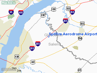
Spitfire Aerodrome Airport |
| Spitfire Aerodrome |
| IATA: none – ICAO: none – FAA LID: 7N7 |
| Summary |
| Airport type |
Public use |
| Owner |
Spitfire Aerospace Technologies Inc. |
| Serves |
Pedricktown, New Jersey |
| Elevation AMSL |
40 ft / 12 m |
| Coordinates |
39°44′08″N 075°23′52″W / 39.73556°N 75.39778°W / 39.73556; -75.39778 |
| Runways |
| Direction |
Length |
Surface |
| ft |
m |
| 7/25 |
2,419 |
737 |
Asphalt |
| Statistics (2008) |
| Aircraft operations |
16,971 |
| Based aircraft |
21 |
| Source: Federal Aviation Administration |
Spitfire Aerodrome (FAA LID: 7N7) is a public use airport located two nautical miles (3.7 km) south of the central business district of Pedricktown, in Oldmans Township, Salem County, New Jersey, United States. It is privately owned by Spitfire Aerospace Technologies Inc. The airport was known as Old Mans Airport until it was renamed in 2001.
Facilities and aircraft
Spitfire Aerodrome covers an area of 48 acres (19 ha) at an elevation of 40 feet (12 m) above mean sea level. It has one asphalt paved runway designated 7/25 which measures 2,419 by 60 feet (737 x 18 m).
For the 12-month period ending April 19, 2008, the airport had 16,971 general aviation aircraft operations, an average of 46 per day. At that time there were 21 aircraft based at this airport: 83% single-engine and 17% helicopter.
The above content comes from Wikipedia and is published under free licenses – click here to read more.
Location & QuickFacts
| FAA Information Effective: | 2008-09-25 |
| Airport Identifier: | 7N7 |
| Airport Status: | Operational |
| Longitude/Latitude: | 075-23-51.7960W/39-44-08.0280N
-75.397721/39.735563 (Estimated) |
| Elevation: | 40 ft / 12.19 m (Surveyed) |
| Land: | 48 acres |
| From nearest city: | 2 nautical miles S of Pedricktown, NJ |
| Location: | Salem County, NJ |
| Magnetic Variation: | 11W (1990) |
Owner & Manager
| Ownership: | Privately owned |
| Owner: | Spitfire Aerospace Technologies Inc |
| Address: | Po Box 410
Pedricktown, NJ 08067 |
| Phone number: | 856-351-9300 |
| Manager: | Jack Fetsko |
| Address: | Po Box 410
Pedricktown, NJ 08067 |
| Phone number: | 856-351-9300 |
Airport Operations and Facilities
| Airport Use: | Open to public |
| Wind indicator: | Yes |
| Segmented Circle: | No |
| Control Tower: | No |
| Lighting Schedule: | DUSK-DAWN
ACTVT MIRL, REILS AND PAPIS RY 07/25 - 122.7. |
| Beacon Color: | Clear-Green (lighted land airport) |
| Landing fee charge: | No |
| Sectional chart: | Washington |
| Region: | AEA - Eastern |
| Boundary ARTCC: | ZDC - Washington |
| Responsible ARTCC: | ZNY - New York |
| Tie-in FSS: | MIV - Millville |
| FSS on Airport: | No |
| FSS Toll Free: | 1-800-WX-BRIEF |
| NOTAMs Facility: | MIV (NOTAM-d service avaliable) |
| Federal Agreements: | N |
Airport Communications
| CTAF: | 122.700 |
| Unicom: | 122.700 |
Airport Services
| Fuel available: | 100LLA |
| Airframe Repair: | MAJOR |
| Power Plant Repair: | MAJOR |
Runway Information
Runway 07/25
| Dimension: | 2419 x 60 ft / 737.3 x 18.3 m |
| Surface: | ASPH, Good Condition |
| Edge Lights: | Medium |
| |
Runway 07 |
Runway 25 |
| Longitude: | 075-24-05.5440W | 075-23-38.0470W |
| Latitude: | 39-44-02.5360N | 39-44-13.5200N |
| Elevation: | 38.00 ft | 35.00 ft |
| Alignment: | 63 | 127 |
| Traffic Pattern: | Left | Left |
| Markings: | Non-precision instrument, Good Condition | Non-precision instrument, Good Condition |
| Crossing Height: | 20.00 ft | 20.00 ft |
| Displaced threshold: | 198.00 ft | 0.00 ft |
| VASI: | 2-light PAPI on left side | 2-light PAPI on right side |
| Visual Glide Angle: | 4.00° | 4.00° |
| Runway End Identifier: | Yes | Yes |
| Obstruction: | 73 ft tree, 201.0 ft from runway, 226 ft right of centerline
RY 07 APCH RATIO 5:1 AT DSPLCD THLD.
RY 07 +10 FT RD 15 FT FM RY END ON CNTRLN. | 55 ft tree, 201.0 ft from runway, 156 ft right of centerline
RY 25 75 FT TREES 156 FT R CNTRLN 0-200 FT FM RY END. |
|
Radio Navigation Aids
| ID |
Type |
Name |
Ch |
Freq |
Var |
Dist |
| RNB | NDB | Rainbow | | 363.00 | 11W | 22.6 nm |
| ING | NDB | Ambler | | 275.00 | 11W | 24.0 nm |
| NXX | NDB | Willow Grove | | 388.00 | 12W | 29.6 nm |
| APG | NDB | Aberdeen | | 349.00 | 11W | 34.9 nm |
| DYL | NDB | Doylestown | | 237.00 | 10W | 38.2 nm |
| UKT | NDB | Quakertown | | 208.00 | 12W | 41.7 nm |
| NXX | TACAN | Willow Grove | 061X | | 10W | 29.9 nm |
| DOV | TACAN | Dover | 037X | | 09W | 36.4 nm |
| PNE | VOR | North Philadelphia | | 112.00 | 10W | 27.5 nm |
| ARD | VOR/DME | Yardley | 019X | 108.20 | 10W | 38.4 nm |
| PPM | VOR/DME | Phillips | 021X | 108.40 | 09W | 39.3 nm |
| CKZ | VOR/DME | Pennridge | 025Y | 108.85 | 12W | 39.7 nm |
| OOD | VORTAC | Woodstown | 075X | 112.80 | 10W | 7.4 nm |
| DQO | VORTAC | Dupont | 087X | 114.00 | 10W | 10.3 nm |
| MXE | VORTAC | Modena | 079X | 113.20 | 09W | 16.7 nm |
| VCN | VORTAC | Cedar Lake | 099X | 115.20 | 10W | 23.2 nm |
| PTW | VORTAC | Pottstown | 112X | 116.50 | 09W | 30.2 nm |
| ENO | VORTAC | Smyrna | 051X | 111.40 | 09W | 30.8 nm |
| GXU | VORTAC | Mc Guire | 043X | 110.60 | 11W | 40.5 nm |
| ACY | VORTAC | Atlantic City | 023X | 108.60 | 10W | 41.6 nm |
| CYN | VORTAC | Coyle | 081X | 113.40 | 10W | 44.9 nm |
| LRP | VORTAC | Lancaster | 120X | 117.30 | 09W | 47.2 nm |
| SIE | VORTAC | Sea Isle | 095X | 114.80 | 09W | 47.4 nm |
| PHL | VOT | Philadelphia Intl | | 109.80 | | 10.7 nm |
Remarks
- DEER AND BIRDS ON AND INVOF ARPT.
- ARPT ACCESS ROAD NEAR APCH END RY 07.
- PROVIDED TREES ARE REMOVED TO PROVIDE 20:1 APPROACHES.
Images and information placed above are from
http://www.airport-data.com/airport/7N7/
We thank them for the data!
| General Info
|
| Country |
United States
|
| State |
NEW JERSEY
|
| FAA ID |
7N7
|
| Latitude |
39-44-08.028N
|
| Longitude |
075-23-51.796W
|
| Elevation |
40 feet
|
| Near City |
PEDRICKTOWN
|
We don't guarantee the information is fresh and accurate. The data may
be wrong or outdated.
For more up-to-date information please refer to other sources.
|
|


