|
|
Somerset Airport
George Walker Field |
 |
| IATA: none – ICAO: KSMQ – FAA LID: SMQ |
| Summary |
| Airport type |
Public |
| Owner |
Somerset Air Service, Inc. |
| Serves |
Somerset County |
| Location |
Somerville, New Jersey |
| Elevation AMSL |
105 ft / 32 m |
| Coordinates |
40°37′34″N 074°40′13″W / 40.62611°N 74.67028°W / 40.62611; -74.67028 |
| Website |
www.SomersetAirport.com |
| Runways |
| Direction |
Length |
Surface |
| ft |
m |
| 12/30 |
2,733 |
833 |
Asphalt |
| 8/26 |
2,200 |
671 |
Turf |
| 17/35 |
1,821 |
555 |
Turf |
| Statistics (2000) |
| Aircraft operations |
40,764 |
| Based aircraft |
208 |
| Sources: FAA and airport web site |
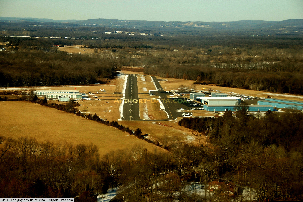
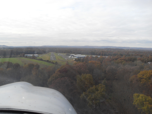
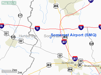
Somerset Airport (ICAO: KSMQ, FAA LID: SMQ) is a public-use airport in Somerset County, New Jersey, United States. It is located three miles (5 km) north of the central business district of Somerville and is privately owned by Somerset Air Service, Inc. The airport is also known as George Walker Field.
Although most U.S. airports use the same three-letter location identifier for the FAA and IATA, Somerset Airport is assigned SMQ by the FAA but has no designation from the IATA (which assigned SMQ to Sampit Airport in Central Kalimantan, Indonesia on the island of Borneo).
Facilities and aircraft
Somerset Airport covers an area of 210 acres (85 ha) which contains three runways:
- Runway 12/30: 2,733 x 65 ft (833 x 20 m), Surface: Asphalt
- Runway 8/26: 2,200 x 100 ft (671 x 30 m), Surface: Turf
- Runway 17/35: 1,821 x 200 ft (555 x 61 m), Surface: Turf
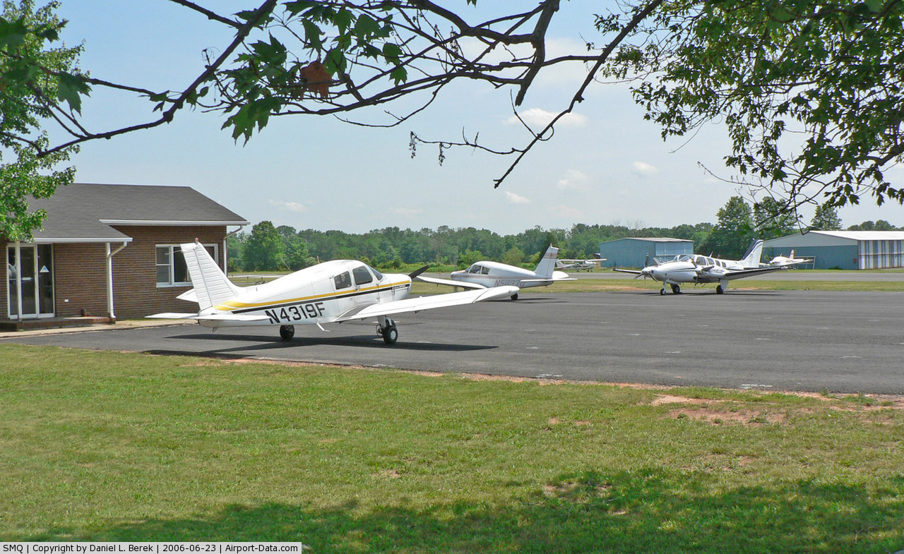
For the 12-month period ending January 4, 2000, the airport had 40,764 aircraft operations, an average of 111 per day, all of which were general aviation. There are 208 aircraft based at this airport: 83% single engine, 12% multi-engine, 5% gliders and <1% helicopters.
The above content comes from Wikipedia and is published under free licenses – click here to read more.
 |
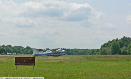
(Click on the photo to enlarge) |
 |
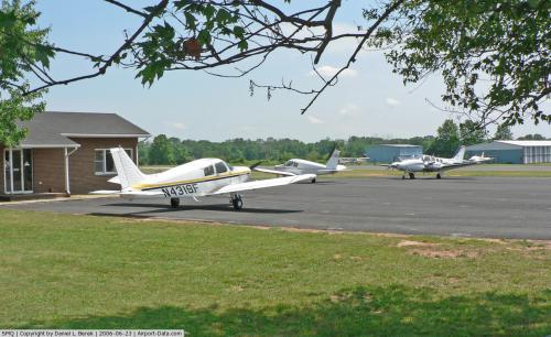
(Click on the photo to enlarge) |
 |
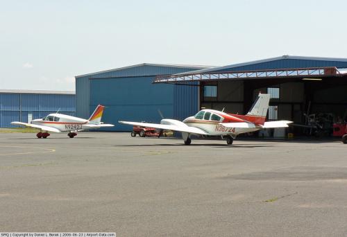
(Click on the photo to enlarge) |
 |
(Click on the photo to enlarge) |
Location & QuickFacts
| FAA Information Effective: | 2008-09-25 |
| Airport Identifier: | SMQ |
| Airport Status: | Operational |
| Longitude/Latitude: | 074-40-12.8760W/40-37-33.5670N
-74.670243/40.625991 (Estimated) |
| Elevation: | 105 ft / 32.00 m (Surveyed) |
| Land: | 210 acres |
| From nearest city: | 3 nautical miles N of Somerville, NJ |
| Location: | Somerset County, NJ |
| Magnetic Variation: | 13W (2000) |
Owner & Manager
| Ownership: | Privately owned |
| Owner: | Somerset Air Service, Inc |
| Address: | Po Box 1007
Bedminster, NJ 07921 |
| Phone number: | 908-722-2444 |
| Manager: | G.d. Walker, Pres. |
| Address: | Po Box 1007
Bedminster, NJ 07921 |
| Phone number: | 908-722-2444 |
Airport Operations and Facilities
| Airport Use: | Open to public |
| Wind indicator: | Yes |
| Segmented Circle: | No |
| Control Tower: | No |
| Lighting Schedule: | DUSK-DAWN
FOR MIRL RY 12/30 & ROTG BCN CALL 908-722-2444/2474. |
| Beacon Color: | Clear-Green (lighted land airport) |
| Sectional chart: | New York |
| Region: | AEA - Eastern |
| Traffic Pattern Alt: | 995 ft |
| Boundary ARTCC: | ZNY - New York |
| Tie-in FSS: | MIV - Millville |
| FSS on Airport: | No |
| FSS Toll Free: | 1-800-WX-BRIEF |
| NOTAMs Facility: | SMQ (NOTAM-d service avaliable) |
| Federal Agreements: | NGY |
Airport Communications
| CTAF: | 123.000 |
| Unicom: | 123.000 |
Airport Services
| Fuel available: | 100LLA |
| Airframe Repair: | MAJOR |
| Power Plant Repair: | MAJOR |
| Bottled Oxygen: | NONE |
| Bulk Oxygen: | NONE |
Runway Information
Runway 08/26
| Dimension: | 2200 x 100 ft / 670.6 x 30.5 m |
| Surface: | TURF, Fair Condition |
| |
Runway 08 |
Runway 26 |
| Longitude: | 074-40-21.5760W | 074-39-54.9850W |
| Latitude: | 40-37-32.3670N | 40-37-40.2470N |
| Elevation: | 101.00 ft | 101.00 ft |
| Alignment: | 69 | 127 |
| Traffic Pattern: | Left | Left |
| Obstruction: | 51 ft tree, 200.0 ft from runway, 50 ft left of centerline, 3:1 slope to clear | 45 ft tree, 10.0 ft from runway, 140 ft right of centerline |
|
Runway 12/30
| Dimension: | 2733 x 65 ft / 833.0 x 19.8 m |
| Surface: | ASPH, Good Condition |
| Edge Lights: | Medium |
| |
Runway 12 |
Runway 30 |
| Longitude: | 074-40-30.8870W | 074-39-57.3620W |
| Latitude: | 40-37-36.8620N | 40-37-28.0860N |
| Elevation: | 83.00 ft | 101.00 ft |
| Alignment: | 109 | 127 |
| Traffic Pattern: | Left | Left |
| Markings: | Non-precision instrument, Fair Condition | Basic, Fair Condition |
| Displaced threshold: | 0.00 ft | 600.00 ft |
| Obstruction: | 55 ft trees, 210.0 ft from runway, 150 ft right of centerline
RY 12 +30 FT TREES 80 FT 'L' CNTRLN AT THLD. | 62 ft tree, 210.0 ft from runway, 245 ft right of centerline
APCH RATIO 20:1 TO DSPLCD THLD.
RY 30 +10 FT PRIVATE ROAD 0-200 FT FM THLD 125 FT 'L'. |
|
Runway 17/35
| Dimension: | 1821 x 200 ft / 555.0 x 61.0 m |
| Surface: | TURF, Fair Condition |
| |
Runway 17 |
Runway 35 |
| Longitude: | 074-40-19.0760W | 074-40-13.5750W |
| Latitude: | 40-37-40.8670N | 40-37-23.3680N |
| Elevation: | 100.00 ft | 105.00 ft |
| Alignment: | 127 | 127 |
| Traffic Pattern: | Left | Left |
| Obstruction: | 65 ft trees, 20.0 ft from runway, 120 ft right of centerline | 22 ft trees, 10.0 ft from runway, 90 ft left of centerline |
|
Radio Navigation Aids
| ID |
Type |
Name |
Ch |
Freq |
Var |
Dist |
| EWR | FAN MARKER | Maryann | | | 11W | 22.5 nm |
| CAT | NDB | Chatham | | 254.00 | 11W | 13.0 nm |
| DYL | NDB | Doylestown | | 237.00 | 10W | 27.0 nm |
| PNJ | NDB | Paterson | | 347.00 | 12W | 30.5 nm |
| UKT | NDB | Quakertown | | 208.00 | 12W | 31.1 nm |
| NXX | NDB | Willow Grove | | 388.00 | 12W | 34.1 nm |
| OGY | NDB | Bridge | | 414.00 | 12W | 36.1 nm |
| NEL | NDB | Lakehurst | | 396.00 | 13W | 38.2 nm |
| ING | NDB | Ambler | | 275.00 | 11W | 41.2 nm |
| NXX | TACAN | Willow Grove | 061X | | 10W | 33.9 nm |
| NEL | TACAN | Lakehurst | 055X | | 11W | 38.3 nm |
| NEL | UHF/NDB | Lakehurst | | 274.80 | 13W | 38.1 nm |
| PNE | VOR | North Philadelphia | | 112.00 | 10W | 36.2 nm |
| SBJ | VOR/DME | Solberg | 076X | 112.90 | 10W | 4.2 nm |
| BWZ | VOR/DME | Broadway | 089X | 114.20 | 11W | 12.5 nm |
| STW | VOR/DME | Stillwater | 033X | 109.60 | 11W | 24.0 nm |
| ARD | VOR/DME | Yardley | 019X | 108.20 | 10W | 24.9 nm |
| COL | VOR/DME | Colts Neck | 101X | 115.40 | 11W | 30.0 nm |
| TEB | VOR/DME | Teterboro | 021X | 108.40 | 11W | 30.8 nm |
| CKZ | VOR/DME | Pennridge | 025Y | 108.85 | 12W | 31.6 nm |
| CRI | VOR/DME | Canarsie | 070X | 112.30 | 11W | 35.4 nm |
| LGA | VOR/DME | La Guardia | 078X | 113.10 | 12W | 37.4 nm |
| JFK | VOR/DME | Kennedy | 106X | 115.90 | 12W | 41.0 nm |
| ETX | VOR/DME | East Texas | 039X | 110.20 | 09W | 46.3 nm |
| HUO | VOR/DME | Huguenot | 108X | 116.10 | 11W | 47.2 nm |
| RBV | VORTAC | Robbinsville | 085X | 113.80 | 10W | 26.7 nm |
| SAX | VORTAC | Sparta | 104X | 115.70 | 11W | 27.2 nm |
| FJC | VORTAC | Allentown | 122X | 117.50 | 10W | 36.3 nm |
| GXU | VORTAC | Mc Guire | 043X | 110.60 | 11W | 37.2 nm |
| PTW | VORTAC | Pottstown | 112X | 116.50 | 09W | 47.4 nm |
| CYN | VORTAC | Coyle | 081X | 113.40 | 10W | 49.8 nm |
| JFK | VOT | Kennedy | | 115.10 | | 40.6 nm |
Remarks
- DEPARTURES RY 30 TURN RIGHT 10 DEG FOLLOWED BY A WIDE LEFT TURN - AVOID RESIDENTIAL AREAS.
- GLIDER OPNS.
- GLIDER TRAFFIC USES RY 08/26; RY 26 RIGHT HAND TRAFFIC FOR GLIDERS.
- RY 12/30 TWY HOLD MARKINGS NON-STANDARD PLACEMENT 'S' SIDE OF RY.
- RY 12 ARRIVALS & DEPARTURES MAY NOT BE ABLE TO SEE EACH OTHER.
- RY 12 TREES ON BOTH SIDES OF RUNWAY NEAR THRESHOLD.
- DEER ON AND INVOF ARPT.
- ESTAB 1946.
Images and information placed above are from
http://www.airport-data.com/airport/SMQ/
We thank them for the data!
| General Info
|
| Country |
United States
|
| State |
NEW JERSEY
|
| FAA ID |
SMQ
|
| Latitude |
40-37-33.567N
|
| Longitude |
074-40-12.876W
|
| Elevation |
105 feet
|
| Near City |
SOMERVILLE
|
We don't guarantee the information is fresh and accurate. The data may
be wrong or outdated.
For more up-to-date information please refer to other sources.
|
|