|
|
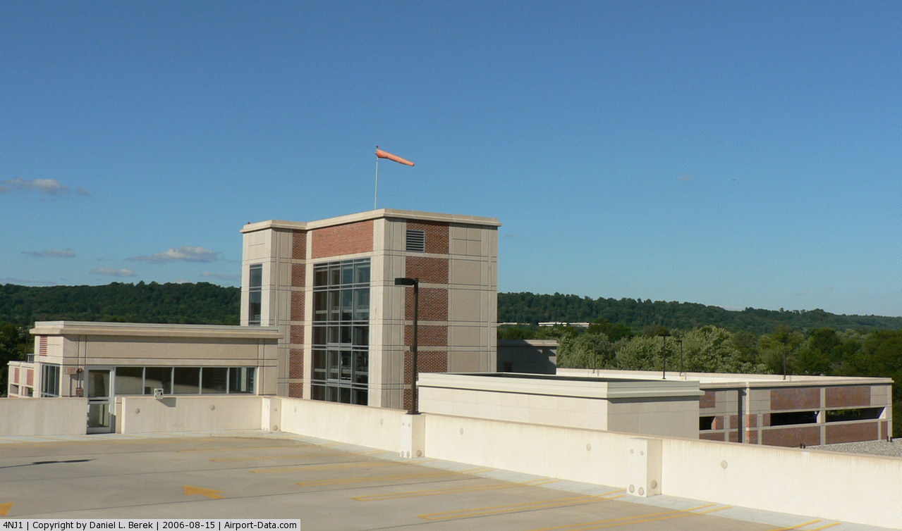
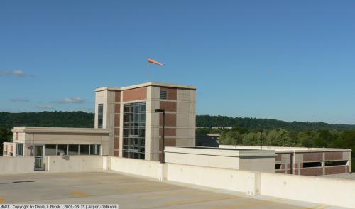
Somerset Medical Center Heliport |
 |
(Click on the photo to enlarge) |
Location & QuickFacts
| FAA Information Effective: | 2008-09-25 |
| Airport Identifier: | 4NJ1 |
| Airport Status: | Operational |
| Longitude/Latitude: | 074-35-39.5660W/40-34-04.3700N
-74.594324/40.567881 (Estimated) |
| Elevation: | 87 ft / 26.52 m (Estimated) |
| Land: | 13 acres |
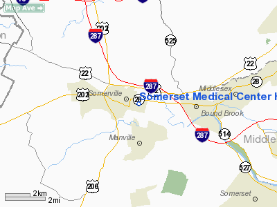
| From nearest city: | 0 nautical miles N of Somerville, NJ |
| Location: | Somerset County, NJ |
| Magnetic Variation: | 12W (1985) |
Owner & Manager
| Ownership: | Privately owned |
| Owner: | Somerset Medical Center |
| Address: | 110 Rehill Ave
Somerville, NJ 08876-2598 |
| Phone number: | 201-685-2200 |
| Manager: | Somerset Medical Center |
| Address: | 110 Rehill Ave
Somerville, NJ 08876-2598 |
| Phone number: | 201-685-2200 |
Airport Operations and Facilities
| Airport Use: | Private
MEDICAL USE. |
| Wind indicator: | Yes |
| Segmented Circle: | No |
| Control Tower: | No |
| Lighting Schedule: | PHONE REQ
FOR PERIMETER LGTS CALL 201-685-2200. |
| Sectional chart: | New York |
| Region: | AEA - Eastern |
| Boundary ARTCC: | ZNY - New York |
| Tie-in FSS: | MIV - Millville |
| FSS on Airport: | No |
| FSS Toll Free: | 1-800-WX-BRIEF |
Runway Information
Helipad H1
| Dimension: | 100 x 100 ft / 30.5 x 30.5 m |
| Surface: | CONC, |
| |
Runway H1 |
Runway |
| Traffic Pattern: | Left | Left |
|
Radio Navigation Aids
| ID |
Type |
Name |
Ch |
Freq |
Var |
Dist |
| EWR | FAN MARKER | Maryann | | | 11W | 20.3 nm |
| CAT | NDB | Chatham | | 254.00 | 11W | 12.8 nm |
| DYL | NDB | Doylestown | | 237.00 | 10W | 27.9 nm |
| PNJ | NDB | Paterson | | 347.00 | 12W | 30.4 nm |
| OGY | NDB | Bridge | | 414.00 | 12W | 32.5 nm |
| UKT | NDB | Quakertown | | 208.00 | 12W | 33.3 nm |
| NEL | NDB | Lakehurst | | 396.00 | 13W | 33.6 nm |
| NXX | NDB | Willow Grove | | 388.00 | 12W | 34.0 nm |
| ING | NDB | Ambler | | 275.00 | 11W | 41.3 nm |
| NEL | TACAN | Lakehurst | 055X | | 11W | 33.8 nm |
| NXX | TACAN | Willow Grove | 061X | | 10W | 33.8 nm |
| NEL | UHF/NDB | Lakehurst | | 274.80 | 13W | 33.6 nm |
| PNE | VOR | North Philadelphia | | 112.00 | 10W | 34.9 nm |
| SBJ | VOR/DME | Solberg | 076X | 112.90 | 10W | 6.8 nm |
| BWZ | VOR/DME | Broadway | 089X | 114.20 | 11W | 17.3 nm |
| ARD | VOR/DME | Yardley | 019X | 108.20 | 10W | 23.7 nm |
| COL | VOR/DME | Colts Neck | 101X | 115.40 | 11W | 25.1 nm |
| STW | VOR/DME | Stillwater | 033X | 109.60 | 11W | 28.6 nm |
| TEB | VOR/DME | Teterboro | 021X | 108.40 | 11W | 29.5 nm |
| CRI | VOR/DME | Canarsie | 070X | 112.30 | 11W | 32.1 nm |
| CKZ | VOR/DME | Pennridge | 025Y | 108.85 | 12W | 33.5 nm |
| LGA | VOR/DME | La Guardia | 078X | 113.10 | 12W | 35.3 nm |
| JFK | VOR/DME | Kennedy | 106X | 115.90 | 12W | 37.8 nm |
| ETX | VOR/DME | East Texas | 039X | 110.20 | 09W | 49.8 nm |
| RBV | VORTAC | Robbinsville | 085X | 113.80 | 10W | 22.4 nm |
| SAX | VORTAC | Sparta | 104X | 115.70 | 11W | 30.1 nm |
| GXU | VORTAC | Mc Guire | 043X | 110.60 | 11W | 33.6 nm |
| FJC | VORTAC | Allentown | 122X | 117.50 | 10W | 40.4 nm |
| CYN | VORTAC | Coyle | 081X | 113.40 | 10W | 45.7 nm |
| PTW | VORTAC | Pottstown | 112X | 116.50 | 09W | 48.9 nm |
| JFK | VOT | Kennedy | | 115.10 | | 37.4 nm |
Remarks
- PRVDD PRIMARY ROUTE FM THE NE IS USED FOR INGRESS/EGRESS; LGT POLES ADJACENT TO LNDG AREA REMOVED & OTHER LGT POLES ARE LOWERED.
Images and information placed above are from
http://www.airport-data.com/airport/4NJ1/
We thank them for the data!
| General Info
|
| Country |
United States
|
| State |
NEW JERSEY
|
| FAA ID |
4NJ1
|
| Latitude |
40-34-04.370N
|
| Longitude |
074-35-39.566W
|
| Elevation |
87 feet
|
| Near City |
SOMERVILLE
|
We don't guarantee the information is fresh and accurate. The data may
be wrong or outdated.
For more up-to-date information please refer to other sources.
|
|