|
|
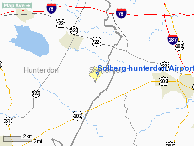
Solberg-hunterdon Airport |
| Solberg-Hunterdon Airport |
| IATA: none – ICAO: none – FAA LID: N51 |
| Summary |
| Airport type |
Public use |
| Owner |
Solberg Aviation Company |
| Operator |
T.& L. Solberg & S. Nagle |
| Serves |
Readington Township, New Jersey |
| Location |
Hunterdon County, New Jersey |
| Elevation AMSL |
195 ft / 59.4 m |
| Coordinates |
40°34′49″N 74°44′08″W / 40.5802°N 74.7355°W / 40.5802; -74.7355Coordinates: 40°34′49″N 74°44′08″W / 40.5802°N 74.7355°W / 40.5802; -74.7355 |
| Runways |
| Direction |
Length |
Surface |
| ft |
m |
| 4/22 |
3,735 |
1,138 |
Asphalt/Turf |
| 13/31 |
3,440 |
1,049 |
Asphalt |
| Statistics (2008) |
| Aircraft operations |
21,486 |
| Based aircraft |
73 |
| Source: Federal Aviation Administration |
Solberg-Hunterdon Airport (or Solberg Airport) (FAA LID: N51) is located in Readington Township, New Jersey, United States.
Ballon Festival
The QuickChek Festival of Ballooning celebrated its 25th anniversary in 2007. The event was the largest summertime hot air balloon festival in North America. It was run by Howard Freidman and Sally Mazzochi.
The above content comes from Wikipedia and is published under free licenses – click here to read more.
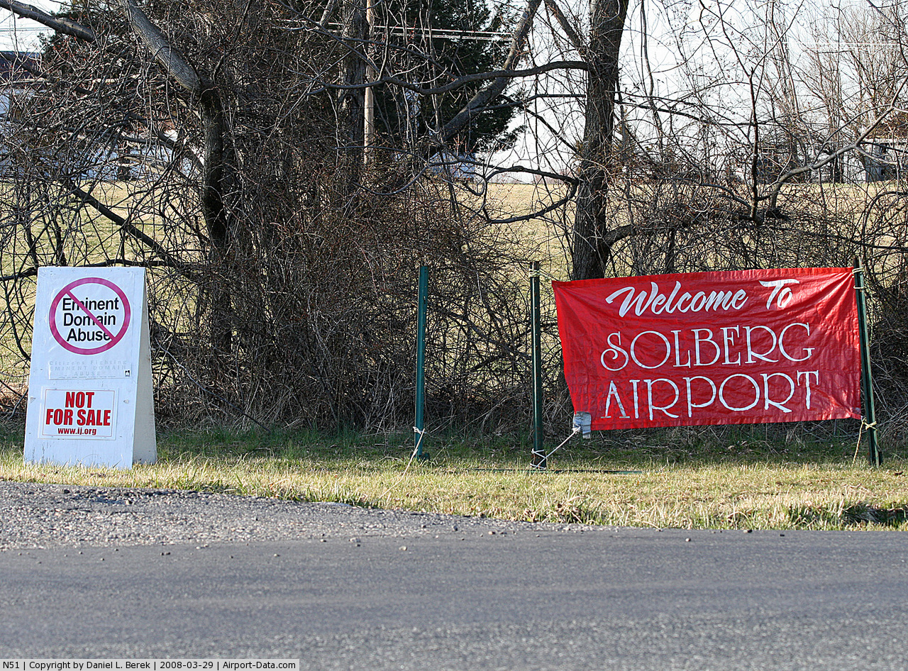
 |
(Click on the photo to enlarge) |
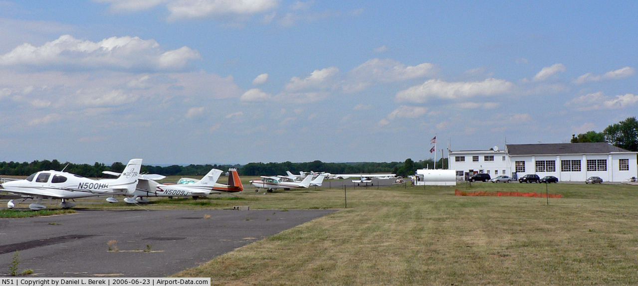
 |
(Click on the photo to enlarge) |
Location & QuickFacts
| FAA Information Effective: | 2008-09-25 |
| Airport Identifier: | N51 |
| Airport Status: | Operational |
| Longitude/Latitude: | 074-44-11.4020W/40-34-58.6196N
-74.736501/40.582950 (Estimated) |
| Elevation: | 195 ft / 59.44 m (Surveyed) |
| Land: | 744 acres |
| From nearest city: | 1 nautical miles NW of Readington, NJ |
| Location: | Hunterdon County, NJ |
| Magnetic Variation: | 10W (1965) |
Owner & Manager
| Ownership: | Privately owned |
| Owner: | Solberg Aviation Company |
| Address: | Po Box 15
Readington, NJ 08870 |
| Phone number: | 908-534-4000 |
| Manager: | T.& L. Solberg & S. Nagle |
| Address: | 39 Thor Solberg Rd
Whitehouse Station, NJ 08889 |
| Phone number: | 908-534-4000 |
Airport Operations and Facilities
| Airport Use: | Open to public |
| Wind indicator: | Yes |
| Segmented Circle: | No |
| Control Tower: | No |
| Lighting Schedule: | SS-SR
CALL 908-534-4000 TO VERIFY STATUS OF LIGHTS. |
| Landing fee charge: | No |
| Sectional chart: | New York |
| Region: | AEA - Eastern |
| Traffic Pattern Alt: | 1005 ft |
| Boundary ARTCC: | ZNY - New York |
| Tie-in FSS: | MIV - Millville |
| FSS on Airport: | No |
| FSS Toll Free: | 1-800-WX-BRIEF |
| NOTAMs Facility: | MIV (NOTAM-d service avaliable) |
| Federal Agreements: | N |
Airport Communications
| CTAF: | 122.800 |
| Unicom: | 122.800 |
Airport Services
| Fuel available: | 100LLA |
| Airframe Repair: | MAJOR |
| Power Plant Repair: | MAJOR |
| Bottled Oxygen: | NONE |
| Bulk Oxygen: | NONE |
Runway Information
Runway 04/22
| Dimension: | 3735 x 50 ft / 1138.4 x 15.2 m |
| Surface: | ASPH-TURF, Good Condition
TURF PORTION AVBL FOR TKOF. |
| Edge Lights: | Medium
RWY 04/22 MIRL ON PAVED 3000 FT BY 50 FT PORTION OF RWY. |
| |
Runway 04 |
Runway 22 |
| Longitude: | 074-44-22.2324W | 074-43-58.3759W |
| Latitude: | 40-34-31.4467N | 40-35-03.5581N |
| Elevation: | 189.00 ft | 162.00 ft |
| Alignment: | 29 | 127 |
| Traffic Pattern: | Left | Left |
| Markings: | Basic, Good Condition
RYS 04 & 22 MKGS FADED. | Non-precision instrument, Good Condition |
| Displaced threshold: | 735.00 ft
DSPLCD THLD RY 04 735 FT TURF, 180 FT WIDE. | 0.00 ft |
| Obstruction: | , 50:1 slope to clear | 66 ft tree, 1441.0 ft from runway, 222 ft right of centerline, 18:1 slope to clear |
|
Runway 13/31
| Dimension: | 3440 x 200 ft / 1048.5 x 61.0 m |
| Surface: | TURF, Good Condition
TURF PORTION AVBL FOR TKOF. |
| |
Runway 13 |
Runway 31 |
| Longitude: | 074-44-32.0873W | 074-43-53.1005W |
| Latitude: | 40-35-18.9506N | 40-35-02.4298N |
| Elevation: | 187.00 ft | 152.00 ft |
| Alignment: | 119 | 127 |
| Traffic Pattern: | Left | Left |
| Obstruction: | 33 ft tree, 108.0 ft from runway, 99 ft left of centerline, 3:1 slope to clear | 38 ft trees, 24.0 ft from runway |
|
Radio Navigation Aids
| ID |
Type |
Name |
Ch |
Freq |
Var |
Dist |
| EWR | FAN MARKER | Maryann | | | 11W | 26.1 nm |
| CAT | NDB | Chatham | | 254.00 | 11W | 16.9 nm |
| DYL | NDB | Doylestown | | 237.00 | 10W | 23.1 nm |
| UKT | NDB | Quakertown | | 208.00 | 12W | 27.3 nm |
| NXX | NDB | Willow Grove | | 388.00 | 12W | 30.2 nm |
| PNJ | NDB | Paterson | | 347.00 | 12W | 34.5 nm |
| NEL | NDB | Lakehurst | | 396.00 | 13W | 37.2 nm |
| ING | NDB | Ambler | | 275.00 | 11W | 37.2 nm |
| OGY | NDB | Bridge | | 414.00 | 12W | 39.0 nm |
| LQX | NDB | Carbon | | 339.00 | 12W | 48.6 nm |
| NXX | TACAN | Willow Grove | 061X | | 10W | 30.0 nm |
| NEL | TACAN | Lakehurst | 055X | | 11W | 37.2 nm |
| NEL | UHF/NDB | Lakehurst | | 274.80 | 13W | 37.2 nm |
| PNE | VOR | North Philadelphia | | 112.00 | 10W | 32.6 nm |
| SBJ | VOR/DME | Solberg | 076X | 112.90 | 10W | 0.2 nm |
| BWZ | VOR/DME | Broadway | 089X | 114.20 | 11W | 13.5 nm |
| ARD | VOR/DME | Yardley | 019X | 108.20 | 10W | 21.3 nm |
| STW | VOR/DME | Stillwater | 033X | 109.60 | 11W | 25.5 nm |
| CKZ | VOR/DME | Pennridge | 025Y | 108.85 | 12W | 27.8 nm |
| COL | VOR/DME | Colts Neck | 101X | 115.40 | 11W | 31.0 nm |
| TEB | VOR/DME | Teterboro | 021X | 108.40 | 11W | 34.6 nm |
| CRI | VOR/DME | Canarsie | 070X | 112.30 | 11W | 38.5 nm |
| LGA | VOR/DME | La Guardia | 078X | 113.10 | 12W | 41.1 nm |
| ETX | VOR/DME | East Texas | 039X | 110.20 | 09W | 43.3 nm |
| JFK | VOR/DME | Kennedy | 106X | 115.90 | 12W | 44.1 nm |
| RBV | VORTAC | Robbinsville | 085X | 113.80 | 10W | 25.4 nm |
| SAX | VORTAC | Sparta | 104X | 115.70 | 11W | 30.5 nm |
| FJC | VORTAC | Allentown | 122X | 117.50 | 10W | 33.9 nm |
| GXU | VORTAC | Mc Guire | 043X | 110.60 | 11W | 35.1 nm |
| PTW | VORTAC | Pottstown | 112X | 116.50 | 09W | 43.5 nm |
| CYN | VORTAC | Coyle | 081X | 113.40 | 10W | 48.1 nm |
| JFK | VOT | Kennedy | | 115.10 | | 43.8 nm |
| PHL | VOT | Philadelphia Intl | | 109.80 | | 48.8 nm |
Remarks
- DEER ON AND INVOF ARPT.
- NO TGL ALL RWYS.
- ALL RWYS DEPT STRAIGHT OUT TO 1200 FT MSL BEFORE TURNING.
- BLIMP AND HOT AIR BALLOON ACTIVITY ON AND INVOF ARPT SPRING THRU FALL.
- GCO AVBL ON FREQ 121.725 THRU ISLIP FSS.
Images and information placed above are from
http://www.airport-data.com/airport/N51/
We thank them for the data!
| General Info
|
| Country |
United States
|
| State |
NEW JERSEY
|
| FAA ID |
N51
|
| Latitude |
40-34-58.306N
|
| Longitude |
074-44-11.624W
|
| Elevation |
195 feet
|
| Near City |
READINGTON
|
We don't guarantee the information is fresh and accurate. The data may
be wrong or outdated.
For more up-to-date information please refer to other sources.
|
|