 |
|
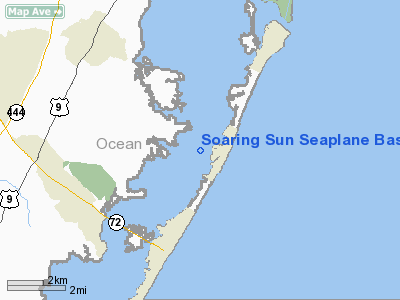
Soaring Sun Seaplane Base Airport |
Location & QuickFacts
| FAA Information Effective: | 2008-09-25 |
| Airport Identifier: | 21JY |
| Airport Status: | Operational |
| Longitude/Latitude: | 074-09-10.0000W/39-42-00.0000N
-74.152778/39.700000 (Estimated) |
| Elevation: | 0 ft / 0.00 m () |
| Land: | 0 acres |
| From nearest city: | 1 nautical miles SW of Harvey Cedars, NJ |
| Location: | Ocean County, NJ |
| Magnetic Variation: | () |
Owner & Manager
| Ownership: | Privately owned |
| Owner: | Richard O'such |
| Address: | P. O. Box 3052
Harvey Cedars, NJ 08008 |
| Phone number: | 609-618-3641 |
| Manager: | Soaring Sun Ltd |
| Address: | P. O. Box 3117
Harvey Cedars, NJ 08008 |
| Phone number: | 609-628-3641 |
Airport Operations and Facilities
| Airport Use: | Private |
| Segmented Circle: | No |
| Control Tower: | No |
| Sectional chart: | Washington |
| Region: | AEA - Eastern |
| Boundary ARTCC: | ZNY - New York |
| Tie-in FSS: | MIV - Millville |
| FSS Toll Free: | 1-800-WX-BRIEF |
Runway Information
Runway 16W/34W
| Dimension: | 4000 x 250 ft / 1219.2 x 76.2 m |
| Surface: | WATER, |
| |
Runway 16W |
Runway 34W |
| Traffic Pattern: | Left | Left |
|
Radio Navigation Aids
| ID |
Type |
Name |
Ch |
Freq |
Var |
Dist |
| NEL | NDB | Lakehurst | | 396.00 | 13W | 22.4 nm |
| RNB | NDB | Rainbow | | 363.00 | 11W | 48.6 nm |
| NEL | TACAN | Lakehurst | 055X | | 11W | 22.3 nm |
| NEL | UHF/NDB | Lakehurst | | 274.80 | 13W | 22.4 nm |
| PNE | VOR | North Philadelphia | | 112.00 | 10W | 45.7 nm |
| COL | VOR/DME | Colts Neck | 101X | 115.40 | 11W | 36.8 nm |
| ARD | VOR/DME | Yardley | 019X | 108.20 | 10W | 48.1 nm |
| CYN | VORTAC | Coyle | 081X | 113.40 | 10W | 14.7 nm |
| ACY | VORTAC | Atlantic City | 023X | 108.60 | 10W | 24.5 nm |
| GXU | VORTAC | Mc Guire | 043X | 110.60 | 11W | 27.7 nm |
| RBV | VORTAC | Robbinsville | 085X | 113.80 | 10W | 34.1 nm |
| VCN | VORTAC | Cedar Lake | 099X | 115.20 | 10W | 38.9 nm |
| SIE | VORTAC | Sea Isle | 095X | 114.80 | 09W | 47.2 nm |
Remarks
- VFR, COORDINATE THE PROPOSED LANDING AREA WITH THOSE AGYENCISAGENCIES THAT HAVE CONTROL OF GURISDICTION OVER THE WATER WAYS.
Images and information placed above are from
http://www.airport-data.com/airport/21JY/
We thank them for the data!
|
|


