|
|
Robert J. Miller Air Park Airport |
Coordinates: 39°55′38.993″N 074°17′32.565″W / 39.92749806°N 74.29237917°W / 39.92749806; -74.29237917
| Robert J. Miller Air Park |
| IATA: MJX – ICAO: KMJX – FAA LID: MJX |
| Summary |
| Airport type |
Public use |
| Owner |
County of Ocean |
| Operator |
Herb Steltzer |
| Serves |
Toms River, New Jersey |
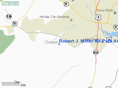
| Location |
Ocean County, New Jersey |
| Elevation AMSL |
82 ft / 25 m |
| Website |
Robert J Miller Airport |
| Runways |
| Direction |
Length |
Surface |
| ft |
m |
| 6/24 |
5,949 |
1,813 |
Asphalt |
| Statistics (2008) |
| Aircraft operations |
30,687 |
| Based aircraft |
69 |
| Source: Federal Aviation Administration |
Robert J. Miller Air Park (IATA: MJX, ICAO: KMJX, FAA LID: MJX) is a public-use airport located five nautical miles (9.26 km) southwest of the central business district of Toms River Township in Ocean County, New Jersey, United States. The airport is publicly owned..
The above content comes from Wikipedia and is published under free licenses – click here to read more.
 |
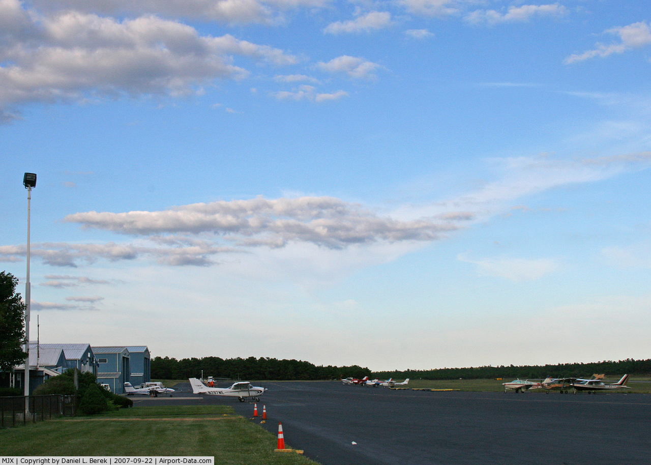
(Click on the photo to enlarge) |
 |
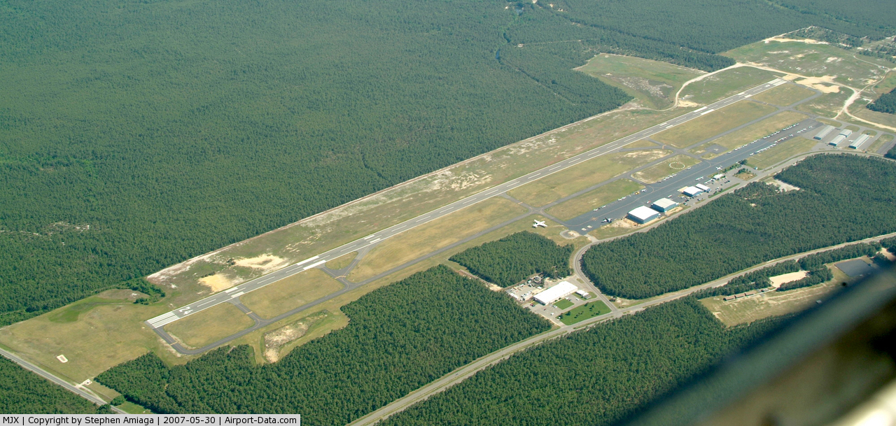
(Click on the photo to enlarge) |
 |
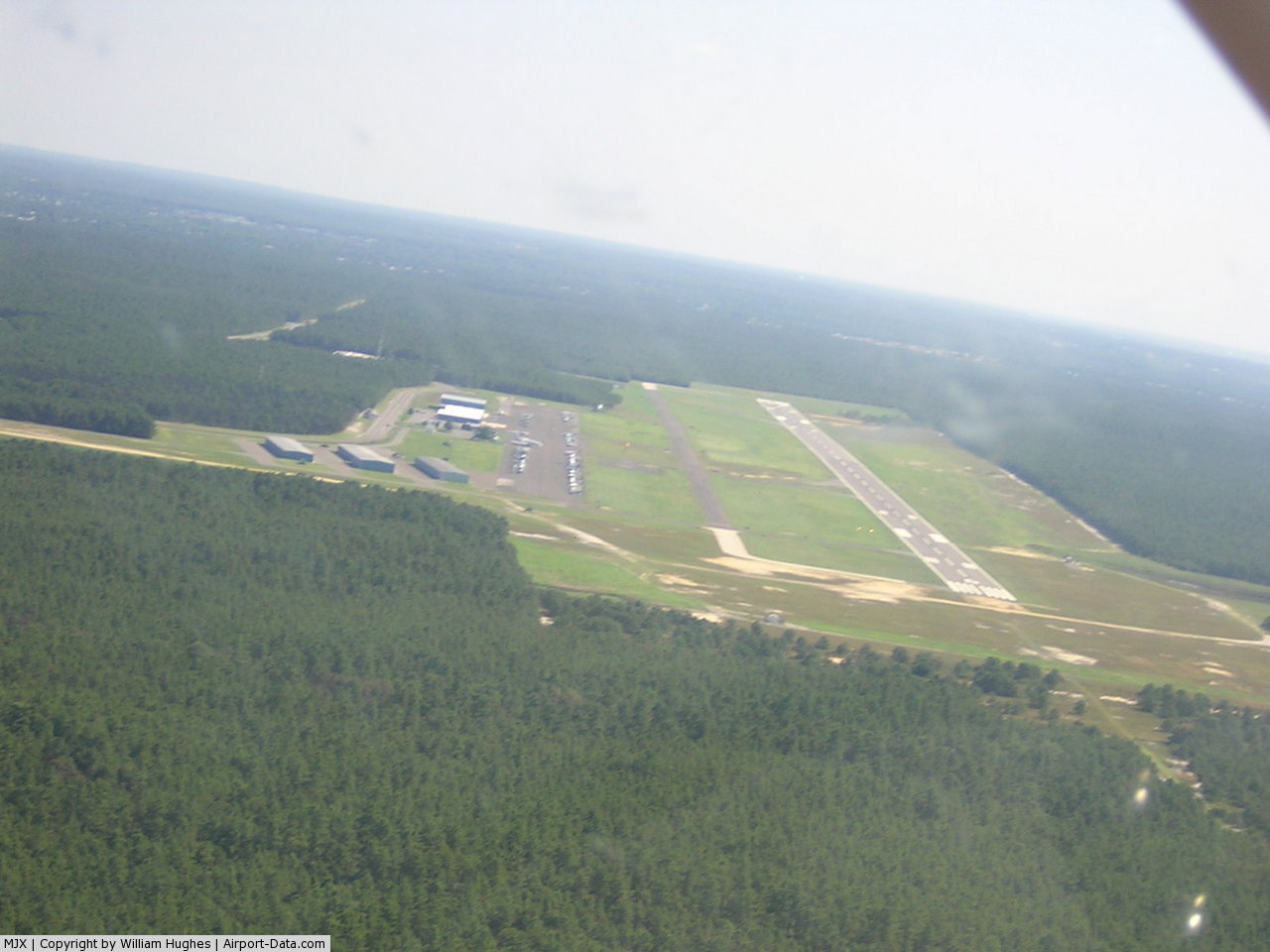
(Click on the photo to enlarge) |
Location & QuickFacts
| FAA Information Effective: | 2008-09-25 |
| Airport Identifier: | MJX |
| Airport Status: | Operational |
| Longitude/Latitude: | 074-17-32.5650W/39-55-38.9930N
-74.292379/39.927498 (Estimated) |
| Elevation: | 82 ft / 24.99 m (Surveyed) |
| Land: | 232 acres |
| From nearest city: | 5 nautical miles SW of Toms River, NJ |
| Location: | Ocean County, NJ |
| Magnetic Variation: | 11W (1980) |
Owner & Manager
| Ownership: | Publicly owned |
| Owner: | County Of Ocean |
| Address: | 129 Hooper Avenue, Po Box 2191
Toms River, NJ 08754-2191 |
| Phone number: | 732-929-2054 |
| Manager: | Herb Steltzer |
| Address: | 129 Hooper Avenue, Po Box 2191
Toms River, NJ 08754-2191 |
| Phone number: | 732-929-2054 |
Airport Operations and Facilities
| Airport Use: | Open to public |
| Wind indicator: | Yes |
| Segmented Circle: | Yes |
| Control Tower: | No |
| Lighting Schedule: | DUSK-DAWN
ACTVT HIRL RY 06/24, MALSR RY 06, & REIL RY 24 - CTAF. |
| Beacon Color: | Clear-Green (lighted land airport) |
| Landing fee charge: | No |
| Sectional chart: | Washington |
| Region: | AEA - Eastern |
| Traffic Pattern Alt: | 918 ft |
| Boundary ARTCC: | ZNY - New York |
| Tie-in FSS: | MIV - Millville |
| FSS on Airport: | No |
| FSS Toll Free: | 1-800-WX-BRIEF |
| NOTAMs Facility: | MJX (NOTAM-d service avaliable) |
| Federal Agreements: | NGY |
Airport Communications
| CTAF: | 122.700 |
| Unicom: | 122.700 |
Airport Services
| Fuel available: | 100LLA |
| Airframe Repair: | MAJOR |
| Power Plant Repair: | MAJOR |
| Bottled Oxygen: | HIGH |
| Bulk Oxygen: | NONE |
Runway Information
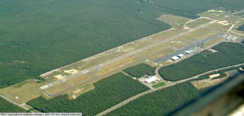
Runway 06/24
| Dimension: | 5949 x 100 ft / 1813.3 x 30.5 m
FATO DIMENSION. |
| Surface: | ASPH, Good Condition |
| Weight Limit: | Single wheel: 12000 lbs. |
| Edge Lights: | High |
| |
Runway 06 |
Runway 24 |
| Longitude: | 074-18-01.7530W | 074-17-03.3710W |
| Latitude: | 39-55-20.0420N | 39-55-57.9430N |
| Elevation: | 77.00 ft | 76.00 ft |
| Alignment: | 50 | 127 |
| ILS Type: | ILS
| |
| Traffic Pattern: | Left | Left |
| Markings: | Precision instrument, Good Condition | Precision instrument, Good Condition |
| Crossing Height: | 53.00 ft | 40.00 ft |
| VASI: | 2-light PAPI on left side | 2-light PAPI on left side |
| Visual Glide Angle: | 3.00° | 3.00° |
| Approach lights: | MALSR | |
| Runway End Identifier: | | Yes |
| Obstruction: | , 50:1 slope to clear | 18 ft trees, 245.0 ft from runway, 275 ft right of centerline, 2:1 slope to clear
+22 FT TREE, 130 FT FM RWY END, 303 FT R. |
|
Helipad H1
| Dimension: | 100 x 100 ft / 30.5 x 30.5 m
FATO DIMENSION. |
| Surface: | ASPH, Good Condition |
| |
Runway H1 |
Runway |
| Traffic Pattern: | Left | Left |
|
Radio Navigation Aids
| ID |
Type |
Name |
Ch |
Freq |
Var |
Dist |
| EWR | FAN MARKER | Maryann | | | 11W | 46.9 nm |
| NEL | NDB | Lakehurst | | 396.00 | 13W | 7.3 nm |
| NXX | NDB | Willow Grove | | 388.00 | 12W | 42.3 nm |
| OGY | NDB | Bridge | | 414.00 | 12W | 42.8 nm |
| DYL | NDB | Doylestown | | 237.00 | 10W | 45.3 nm |
| ING | NDB | Ambler | | 275.00 | 11W | 47.2 nm |
| CAT | NDB | Chatham | | 254.00 | 11W | 49.3 nm |
| RNB | NDB | Rainbow | | 363.00 | 11W | 49.6 nm |
| NEL | TACAN | Lakehurst | 055X | | 11W | 7.1 nm |
| NXX | TACAN | Willow Grove | 061X | | 10W | 42.4 nm |
| NEL | UHF/NDB | Lakehurst | | 274.80 | 13W | 7.3 nm |
| PNE | VOR | North Philadelphia | | 112.00 | 10W | 34.3 nm |
| COL | VOR/DME | Colts Neck | 101X | 115.40 | 11W | 23.9 nm |
| ARD | VOR/DME | Yardley | 019X | 108.20 | 10W | 34.4 nm |
| SBJ | VOR/DME | Solberg | 076X | 112.90 | 10W | 44.5 nm |
| CRI | VOR/DME | Canarsie | 070X | 112.30 | 11W | 45.0 nm |
| JFK | VOR/DME | Kennedy | 106X | 115.90 | 12W | 48.7 nm |
| CYN | VORTAC | Coyle | 081X | 113.40 | 10W | 9.2 nm |
| GXU | VORTAC | Mc Guire | 043X | 110.60 | 11W | 14.8 nm |
| RBV | VORTAC | Robbinsville | 085X | 113.80 | 10W | 19.0 nm |
| ACY | VORTAC | Atlantic City | 023X | 108.60 | 10W | 31.2 nm |
| VCN | VORTAC | Cedar Lake | 099X | 115.20 | 10W | 39.0 nm |
| OOD | VORTAC | Woodstown | 075X | 112.80 | 10W | 49.9 nm |
| PHL | VOT | Philadelphia Intl | | 109.80 | | 44.1 nm |
| JFK | VOT | Kennedy | | 115.10 | | 48.6 nm |
Remarks
- DEER & BIRDS ON & INVOF ARPT.
- GCO AVBL ON FREQ 121.725 THRU NYAI FSS.
Images and information placed above are from
http://www.airport-data.com/airport/MJX/
We thank them for the data!
| General Info
|
| Country |
United States
|
| State |
NEW JERSEY
|
| FAA ID |
MJX
|
| Latitude |
39-55-38.993N
|
| Longitude |
074-17-32.565W
|
| Elevation |
82 feet
|
| Near City |
TOMS RIVER
|
We don't guarantee the information is fresh and accurate. The data may
be wrong or outdated.
For more up-to-date information please refer to other sources.
|
|