 |
|
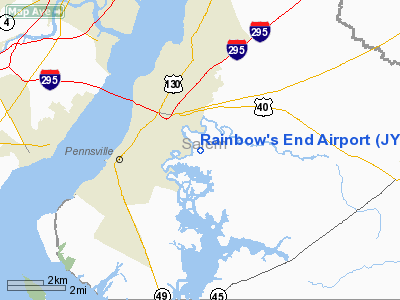
Location & QuickFacts
| FAA Information Effective: | 2008-09-25 |
| Airport Identifier: | JY39 |
| Airport Status: | Operational |
| Longitude/Latitude: | 075-27-55.0000W/39-39-40.0000N
-75.465278/39.661111 (Estimated) |
| Elevation: | 11 ft / 3.35 m (Estimated) |
| Land: | 20 acres |
| From nearest city: | 7 nautical miles S of Salem, NJ |
| Location: | Salem County, NJ |
| Magnetic Variation: | () |
Owner & Manager
| Ownership: | Privately owned |
| Owner: | Donald Bennett |
| Address: | 816 Hawks Bridge Rd
Salem, NJ 08079 |
| Phone number: | 856-299-7116 |
| Manager: | Donald Bennett |
| Address: | 816 Hawks Bridge Rd
Salem, NJ 08079 |
| Phone number: | 856-299-7116 |
Airport Operations and Facilities
| Airport Use: | Private |
| Wind indicator: | Yes |
| Control Tower: | No |
| Sectional chart: | Washington |
| Region: | AEA - Eastern |
| Boundary ARTCC: | ZDC - Washington |
| Tie-in FSS: | MIV - Millville |
| FSS Toll Free: | 1-800-WX-BRIEF |
Airport Communications
Runway Information
Runway 01/19
| Dimension: | 2200 x 100 ft / 670.6 x 30.5 m |
| Surface: | TURF, |
| |
Runway 01 |
Runway 19 |
| Traffic Pattern: | Right | Left |
| Obstruction: | 60 ft trees, 1800.0 ft from runway | 60 ft trees, 1800.0 ft from runway |
|
Radio Navigation Aids
| ID |
Type |
Name |
Ch |
Freq |
Var |
Dist |
| RNB | NDB | Rainbow | | 363.00 | 11W | 21.1 nm |
| ING | NDB | Ambler | | 275.00 | 11W | 29.1 nm |
| APG | NDB | Aberdeen | | 349.00 | 11W | 30.6 nm |
| NXX | NDB | Willow Grove | | 388.00 | 12W | 35.0 nm |
| DYL | NDB | Doylestown | | 237.00 | 10W | 43.5 nm |
| UKT | NDB | Quakertown | | 208.00 | 12W | 46.6 nm |
| MTN | NDB | Martin | | 342.00 | 11W | 47.7 nm |
| DOV | TACAN | Dover | 037X | | 09W | 31.8 nm |
| NXX | TACAN | Willow Grove | 061X | | 10W | 35.3 nm |
| MTN | TACAN | Martin | 068X | | 11W | 48.2 nm |
| PNE | VOR | North Philadelphia | | 112.00 | 10W | 32.9 nm |
| PPM | VOR/DME | Phillips | 021X | 108.40 | 09W | 34.7 nm |
| ARD | VOR/DME | Yardley | 019X | 108.20 | 10W | 43.9 nm |
| CKZ | VOR/DME | Pennridge | 025Y | 108.85 | 12W | 44.6 nm |
| DQO | VORTAC | Dupont | 087X | 114.00 | 10W | 6.6 nm |
| OOD | VORTAC | Woodstown | 075X | 112.80 | 10W | 7.7 nm |
| MXE | VORTAC | Modena | 079X | 113.20 | 09W | 18.1 nm |
| VCN | VORTAC | Cedar Lake | 099X | 115.20 | 10W | 24.2 nm |
| ENO | VORTAC | Smyrna | 051X | 111.40 | 09W | 25.9 nm |
| PTW | VORTAC | Pottstown | 112X | 116.50 | 09W | 34.0 nm |
| ACY | VORTAC | Atlantic City | 023X | 108.60 | 10W | 43.0 nm |
| GXU | VORTAC | Mc Guire | 043X | 110.60 | 11W | 45.2 nm |
| SIE | VORTAC | Sea Isle | 095X | 114.80 | 09W | 45.9 nm |
| LRP | VORTAC | Lancaster | 120X | 117.30 | 09W | 47.0 nm |
| CYN | VORTAC | Coyle | 081X | 113.40 | 10W | 48.7 nm |
| PHL | VOT | Philadelphia Intl | | 109.80 | | 16.2 nm |
Remarks
- PRVDD PVT USE; ESTABLISH NON-STANDARD TFC PATTERN TO RY 01; AND VFR.
Images and information placed above are from
http://www.airport-data.com/airport/JY39/
We thank them for the data!
|
|


