 |
|
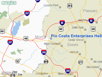
Pio Costa Enterprises Heliport |
Location & QuickFacts
| FAA Information Effective: | 2008-09-25 |
| Airport Identifier: | JY00 |
| Airport Status: | Operational |
| Longitude/Latitude: | 074-19-02.5400W/40-51-46.3500N
-74.317372/40.862875 (Estimated) |
| Elevation: | 170 ft / 51.82 m (Estimated) |
| Land: | 25 acres |
| From nearest city: | 3 nautical miles SW of Fairfield, NJ |
| Location: | Essex County, NJ |
| Magnetic Variation: | 13W (1995) |
Owner & Manager
| Ownership: | Privately owned |
| Owner: | Anthony Pio Costa |
| Address: | 1075 Bloomfield Avenue
Fairfield, NJ 07004 |
| Phone number: | 973-334-7576 |
| Manager: | Marina De Jonge |
| Address: | 425 Trenton Avenue
Paterson, NJ 07503 |
| Phone number: | 973-279-9288 |
Airport Operations and Facilities
| Airport Use: | Private |
| Segmented Circle: | No |
| Control Tower: | No |
| Sectional chart: | New York |
| Region: | AEA - Eastern |
| Boundary ARTCC: | ZNY - New York |
| Tie-in FSS: | MIV - Millville |
| FSS on Airport: | No |
| FSS Toll Free: | 1-800-WX-BRIEF |
Runway Information
Helipad H1
| Dimension: | 20 x 20 ft / 6.1 x 6.1 m |
| Surface: | TURF, |
| |
Runway H1 |
Runway |
| Traffic Pattern: | Left | Left |
|
Radio Navigation Aids
| ID |
Type |
Name |
Ch |
Freq |
Var |
Dist |
| EWR | FAN MARKER | Maryann | | | 11W | 11.3 nm |
| SKU | FAN MARKER | Stanwyck | | | 12W | 41.8 nm |
| CAT | NDB | Chatham | | 254.00 | 11W | 8.9 nm |
| PNJ | NDB | Paterson | | 347.00 | 12W | 9.1 nm |
| OGY | NDB | Bridge | | 414.00 | 12W | 26.6 nm |
| SW | NDB | Neely | | 335.00 | 14W | 37.7 nm |
| SKU | NDB | Stanwyck | | 261.00 | 12W | 41.8 nm |
| BBN | NDB | Babylon | | 275.00 | 14W | 44.0 nm |
| PO | NDB | Meier | | 403.00 | 12W | 45.7 nm |
| DYL | NDB | Doylestown | | 237.00 | 10W | 48.5 nm |
| NEL | NDB | Lakehurst | | 396.00 | 13W | 49.2 nm |
| NEL | TACAN | Lakehurst | 055X | | 11W | 49.7 nm |
| NEL | UHF/NDB | Lakehurst | | 274.80 | 13W | 49.2 nm |
| TEB | VOR/DME | Teterboro | 021X | 108.40 | 11W | 11.6 nm |
| LGA | VOR/DME | La Guardia | 078X | 113.10 | 12W | 20.5 nm |
| BWZ | VOR/DME | Broadway | 089X | 114.20 | 11W | 23.3 nm |
| CRI | VOR/DME | Canarsie | 070X | 112.30 | 11W | 24.4 nm |
| SBJ | VOR/DME | Solberg | 076X | 112.90 | 10W | 25.6 nm |
| STW | VOR/DME | Stillwater | 033X | 109.60 | 11W | 26.3 nm |
| JFK | VOR/DME | Kennedy | 106X | 115.90 | 12W | 28.4 nm |
| COL | VOR/DME | Colts Neck | 101X | 115.40 | 11W | 33.9 nm |
| HUO | VOR/DME | Huguenot | 108X | 116.10 | 11W | 35.1 nm |
| CMK | VOR/DME | Carmel | 113X | 116.60 | 12W | 41.7 nm |
| ARD | VOR/DME | Yardley | 019X | 108.20 | 10W | 45.5 nm |
| DPK | VOR/DME | Deer Park | 124X | 117.70 | 12W | 46.3 nm |
| SAX | VORTAC | Sparta | 104X | 115.70 | 11W | 15.9 nm |
| RBV | VORTAC | Robbinsville | 085X | 113.80 | 10W | 40.5 nm |
| JFK | VOT | Kennedy | | 115.10 | | 28.1 nm |
Remarks
- PRVDD HELICOPTERS OPERATING FROM THIS FAC ARE LIMITED TO ACFT WEIGHING LESS THAN 12500 LBS MGW; IFR OPNS ARE NOT CONDUCTED; CLEAR 20:1 APCH SLOPE IS MAINTAINED.
Images and information placed above are from
http://www.airport-data.com/airport/JY00/
We thank them for the data!
| General Info
|
| Country |
United States
|
| State |
NEW JERSEY
|
| FAA ID |
JY00
|
| Latitude |
40-51-46.350N
|
| Longitude |
074-19-02.540W
|
| Elevation |
170 feet
|
| Near City |
FAIRFIELD
|
We don't guarantee the information is fresh and accurate. The data may
be wrong or outdated.
For more up-to-date information please refer to other sources.
|
|


