 |
|
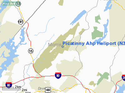
Location & QuickFacts
| FAA Information Effective: | 2008-09-25 |
| Airport Identifier: | N33 |
| Airport Status: | Operational |
| Longitude/Latitude: | 074-31-41.4000W/40-57-28.2000N
-74.528167/40.957833 (Estimated) |
| Elevation: | 875 ft / 266.70 m (Estimated) |
| Land: | 0 acres |
| From nearest city: | 4 nautical miles SE of Dover, NJ |
| Location: | Morris County, NJ |
| Magnetic Variation: | 12W (1985) |
Owner & Manager
| Ownership: | Army owned |
| Owner: | State Of New Jersey |
| Address: | Army Aviation Support Fac 2
Dover, NJ 07801 |
| Phone number: | 201-724-4609
AUTOVON 880-4609/4580 OR COMMERCIAL 201-724-4580. |
| Manager: | Maj Michael B. Smith |
| Address: | Bldg 3801 Picatinny Arsenal
Dover, NJ 07801 |
| Phone number: | 201-724-4609 |
Airport Operations and Facilities
| Airport Use: | Private |
| Wind indicator: | Yes |
| Segmented Circle: | No |
| Control Tower: | No |
| Lighting Schedule: | PHONE REQ
FOR HELIPAD PERIMETER LIGHTS & ROTG BCN CALL 201-724-4609/4580. |
| Beacon Color: | Split-Clear-Green (lighted military airport) |
| Sectional chart: | New York |
| Region: | AEA - Eastern |
| Boundary ARTCC: | ZNY - New York |
| Tie-in FSS: | MIV - Millville |
| FSS on Airport: | No |
| FSS Toll Free: | 1-800-WX-BRIEF |
| NOTAMs Facility: | MIV |
Runway Information
Helipad H1
| Dimension: | 490 x 75 ft / 149.4 x 22.9 m |
| Surface: | CONC, |
| Edge Lights: | Low |
| |
Runway H1 |
Runway |
| Traffic Pattern: | Left | Left |
|
Radio Navigation Aids
| ID |
Type |
Name |
Ch |
Freq |
Var |
Dist |
| EWR | FAN MARKER | Maryann | | | 11W | 21.8 nm |
| SKU | FAN MARKER | Stanwyck | | | 12W | 40.6 nm |
| CAT | NDB | Chatham | | 254.00 | 11W | 13.8 nm |
| PNJ | NDB | Paterson | | 347.00 | 12W | 17.1 nm |
| SW | NDB | Neely | | 335.00 | 14W | 34.5 nm |
| OGY | NDB | Bridge | | 414.00 | 12W | 37.6 nm |
| SKU | NDB | Stanwyck | | 261.00 | 12W | 40.6 nm |
| PO | NDB | Meier | | 403.00 | 12W | 45.0 nm |
| DYL | NDB | Doylestown | | 237.00 | 10W | 46.2 nm |
| UKT | NDB | Quakertown | | 208.00 | 12W | 47.5 nm |
| STW | VOR/DME | Stillwater | 033X | 109.60 | 11W | 15.6 nm |
| BWZ | VOR/DME | Broadway | 089X | 114.20 | 11W | 16.4 nm |
| TEB | VOR/DME | Teterboro | 021X | 108.40 | 11W | 22.2 nm |
| SBJ | VOR/DME | Solberg | 076X | 112.90 | 10W | 24.5 nm |
| HUO | VOR/DME | Huguenot | 108X | 116.10 | 11W | 27.3 nm |
| LGA | VOR/DME | La Guardia | 078X | 113.10 | 12W | 31.3 nm |
| CRI | VOR/DME | Canarsie | 070X | 112.30 | 11W | 35.5 nm |
| JFK | VOR/DME | Kennedy | 106X | 115.90 | 12W | 39.6 nm |
| COL | VOR/DME | Colts Neck | 101X | 115.40 | 11W | 42.3 nm |
| ARD | VOR/DME | Yardley | 019X | 108.20 | 10W | 45.7 nm |
| CMK | VOR/DME | Carmel | 113X | 116.60 | 12W | 47.0 nm |
| CKZ | VOR/DME | Pennridge | 025Y | 108.85 | 12W | 48.6 nm |
| SAX | VORTAC | Sparta | 104X | 115.70 | 11W | 6.6 nm |
| FJC | VORTAC | Allentown | 122X | 117.50 | 10W | 44.4 nm |
| RBV | VORTAC | Robbinsville | 085X | 113.80 | 10W | 45.4 nm |
| JFK | VOT | Kennedy | | 115.10 | | 39.2 nm |
Remarks
- BCN LCTD APROX 2 NM SW OF FACILITY (240 HEADING FROM AHP) ACTIVATED ONLY ON REQUEST.
Images and information placed above are from
http://www.airport-data.com/airport/N33/
We thank them for the data!
| General Info
|
| Country |
United States
|
| State |
NEW JERSEY
|
| FAA ID |
N33
|
| Latitude |
40-57-28.354N
|
| Longitude |
074-31-41.566W
|
| Elevation |
875 feet
|
| Near City |
DOVER
|
We don't guarantee the information is fresh and accurate. The data may
be wrong or outdated.
For more up-to-date information please refer to other sources.
|
|


