 |
|
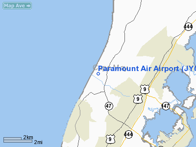
Location & QuickFacts
| FAA Information Effective: | 2008-09-25 |
| Airport Identifier: | JY04 |
| Airport Status: | Operational |
| Longitude/Latitude: | 074-54-34.6180W/39-03-54.4070N
-74.909616/39.065113 (Estimated) |
| Elevation: | 8 ft / 2.44 m (Estimated) |
| Land: | 20 acres |
| From nearest city: | 1 nautical miles N of Green Creek, NJ |
| Location: | Cape May County, NJ |
| Magnetic Variation: | 11W (1985) |
Owner & Manager
| Ownership: | Privately owned |
| Owner: | Barbara Tomalino |
| Address: | 10 N Boyd St
Cape May, NJ 08210 |
| Phone number: | 609-465-5035 |
| Manager: | Barbara Tomalino |
| Address: | 10 N Boyd St
Cape May, NJ 08210 |
| Phone number: | 609-465-5035 |
Airport Operations and Facilities
| Airport Use: | Private |
| Segmented Circle: | No |
| Control Tower: | No |
| Landing fee charge: | No |
| Sectional chart: | Washington |
| Region: | AEA - Eastern |
| Boundary ARTCC: | ZDC - Washington |
| Tie-in FSS: | MIV - Millville |
| FSS Toll Free: | 1-800-WX-BRIEF |
Runway Information
Runway 14/32
| Dimension: | 2000 x 100 ft / 609.6 x 30.5 m |
| Surface: | TURF, |
| |
Runway 14 |
Runway 32 |
| Traffic Pattern: | Left | Left |
| Obstruction: | | 50 ft trees, 1000.0 ft from runway |
|
Radio Navigation Aids
| ID |
Type |
Name |
Ch |
Freq |
Var |
Dist |
| RNB | NDB | Rainbow | | 363.00 | 11W | 23.7 nm |
| OX | NDB | Landy | | 407.00 | 12W | 44.3 nm |
| DOV | TACAN | Dover | 037X | | 09W | 26.3 nm |
| ATR | VOR/DME | Waterloo | 073X | 112.60 | 09W | 20.8 nm |
| SIE | VORTAC | Sea Isle | 095X | 114.80 | 09W | 5.4 nm |
| ACY | VORTAC | Atlantic City | 023X | 108.60 | 10W | 28.1 nm |
| VCN | VORTAC | Cedar Lake | 099X | 115.20 | 10W | 28.5 nm |
| ENO | VORTAC | Smyrna | 051X | 111.40 | 09W | 30.0 nm |
| OOD | VORTAC | Woodstown | 075X | 112.80 | 10W | 38.9 nm |
| DQO | VORTAC | Dupont | 087X | 114.00 | 10W | 49.1 nm |
Remarks
Images and information placed above are from
http://www.airport-data.com/airport/JY04/
We thank them for the data!
| General Info
|
| Country |
United States
|
| State |
NEW JERSEY
|
| FAA ID |
JY04
|
| Latitude |
39-03-54.407N
|
| Longitude |
074-54-34.618W
|
| Elevation |
8 feet
|
| Near City |
GREEN CREEK
|
We don't guarantee the information is fresh and accurate. The data may
be wrong or outdated.
For more up-to-date information please refer to other sources.
|
|


