|
|
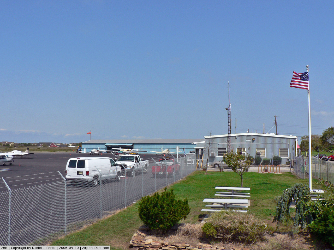
| Ocean City Municipal Airport |
| IATA: none – ICAO: none – FAA LID: 26N |
| Summary |
| Airport type |
Public |
| Owner |
City of Ocean City |
| Location |
Ocean City, New Jersey |
| Elevation AMSL |
5 ft / 2 m |
| Coordinates |
39°15′48″N 074°36′27″W / 39.26333°N 74.6075°W / 39.26333; -74.6075 |
| Runways |
| Direction |
Length |
Surface |
| ft |
m |
| 6/24 |
2,973 |
906 |
Asphalt |
| Statistics (2008) |
| Aircraft operations were canceled in world war 2 |
20,164 |
| Based aircraft |
27 |
| Source: Federal Aviation Administration |
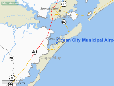
Ocean City Municipal Airport (FAA LID: 26N) is a public airport located two nautical miles (3.704 km) southwest of the central business district of Ocean City, in Cape May County, New Jersey, United States. It is owned by the City of Ocean City.
Facilities and aircraft
Ocean City Municipal Airport covers an area of 60 acres (24 ha) which contains one asphalt paved runway (6/24) measuring 2,973 x 60 ft (906 x 18 m).
For the 12-month period ending October 31, 2008, the airport had 20,164 aircraft operations, an average of 55 per day: 40% local general aviation and 60% international general aviation. There are 27 aircraft based at this airport: 74% single engine aircraft and 30% multi-engine aircraft.
The above content comes from Wikipedia and is published under free licenses – click here to read more.
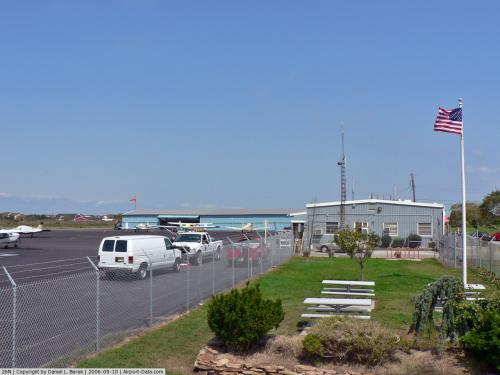 |
(Click on the photo to enlarge) |
Location & QuickFacts
| FAA Information Effective: | 2008-09-25 |
| Airport Identifier: | 26N |
| Airport Status: | Operational |
| Longitude/Latitude: | 074-36-26.9000W/39-15-48.5000N
-74.607472/39.263472 (Estimated) |
| Elevation: | 5 ft / 1.52 m (Estimated) |
| Land: | 60 acres |
| From nearest city: | 2 nautical miles SW of Ocean City, NJ |
| Location: | Cape May County, NJ |
| Magnetic Variation: | 13W (2000) |
Owner & Manager
| Ownership: | Publicly owned |
| Owner: | City Of Ocean City |
| Address: | 26th Street & Bay Avenue
Ocean City, NJ 08226 |
| Phone number: | 609-525-9223 |
| Manager: | William R Colangelo |
| Address: | 26th Street & Bay Avenue
Ocean City, NJ 08226 |
| Phone number: | 609-525-9223 |
Airport Operations and Facilities
| Airport Use: | Open to public |
| Wind indicator: | Yes |
| Segmented Circle: | Yes |
| Control Tower: | No |
| Lighting Schedule: | RDO CTL
ACTVT MIRL RY 06/24 - CTAF. |
| Landing fee charge: | No |
| Sectional chart: | Washington |
| Region: | AEA - Eastern |
| Boundary ARTCC: | ZDC - Washington |
| Tie-in FSS: | MIV - Millville |
| FSS on Airport: | No |
| FSS Toll Free: | 1-800-WX-BRIEF |
| NOTAMs Facility: | MIV (NOTAM-d service avaliable) |
| Federal Agreements: | NGY |
Airport Communications
| CTAF: | 122.700 |
| Unicom: | 122.700
AUTOMATED UNICOM. |
Airport Services
| Fuel available: | 100LL |
| Airframe Repair: | NONE |
| Power Plant Repair: | NONE |
| Bottled Oxygen: | NONE |
| Bulk Oxygen: | NONE |
Runway Information
Runway 06/24
| Dimension: | 2973 x 60 ft / 906.2 x 18.3 m |
| Surface: | ASPH, Good Condition |
| Weight Limit: | Single wheel: 12500 lbs. |
| Edge Lights: | Medium |
| |
Runway 06 |
Runway 24 |
| Longitude: | 074-36-40.6823W | 074-36-13.1297W |
| Latitude: | 39-15-38.4633N | 39-15-58.5764N |
| Elevation: | 5.00 ft | 4.00 ft |
| Alignment: | 47 | 127 |
| Traffic Pattern: | Left | Right |
| Markings: | Non-precision instrument, Good Condition | Non-precision instrument, Good Condition |
| Crossing Height: | 40.00 ft | 40.00 ft |
| VASI: | 2-light PAPI on right side | 2-light PAPI on left side |
| Visual Glide Angle: | 3.50° | 3.50° |
| Obstruction: | 12 ft tree, 210.0 ft from runway, 120 ft right of centerline
RWY 06 +27 FT TREE ABM THLD, 235 FT R. NUMEROUS TREES, BUSHES, AND REEDS TO +15 FT HIGH WITHIN 200 FT OF THLD AND 60 FT OF EXTD CNTRLINE. | 16 ft tree, 200.0 ft from runway, 220 ft left of centerline
RWY 24 +30 FT TREE 20 FT FM THLD 170 FT R. REEDS TO +15 FT HIGH WITHIN 200 FT OF THLD AND 50 FT OF EXTD CNTRLINE. |
|
Radio Navigation Aids
| ID |
Type |
Name |
Ch |
Freq |
Var |
Dist |
| RNB | NDB | Rainbow | | 363.00 | 11W | 26.2 nm |
| NEL | NDB | Lakehurst | | 396.00 | 13W | 48.6 nm |
| DOV | TACAN | Dover | 037X | | 09W | 40.8 nm |
| NEL | TACAN | Lakehurst | 055X | | 11W | 48.0 nm |
| NEL | UHF/NDB | Lakehurst | | 274.80 | 13W | 48.6 nm |
| ATR | VOR/DME | Waterloo | 073X | 112.60 | 09W | 39.2 nm |
| ACY | VORTAC | Atlantic City | 023X | 108.60 | 10W | 11.7 nm |
| SIE | VORTAC | Sea Isle | 095X | 114.80 | 09W | 13.5 nm |
| VCN | VORTAC | Cedar Lake | 099X | 115.20 | 10W | 23.5 nm |
| CYN | VORTAC | Coyle | 081X | 113.40 | 10W | 34.3 nm |
| OOD | VORTAC | Woodstown | 075X | 112.80 | 10W | 39.3 nm |
| ENO | VORTAC | Smyrna | 051X | 111.40 | 09W | 42.3 nm |
| GXU | VORTAC | Mc Guire | 043X | 110.60 | 11W | 44.8 nm |
| PHL | VOT | Philadelphia Intl | | 109.80 | | 46.9 nm |
Remarks
- AUTOMATED WX ADVISORY. ACTVT BY 3 CLICKS ON CTAF. ALSO AVBL BY PHONE, 609-398-0705.
Images and information placed above are from
http://www.airport-data.com/airport/26N/
We thank them for the data!
| General Info
|
| Country |
United States
|
| State |
NEW JERSEY
|
| FAA ID |
26N
|
| Latitude |
39-15-48.500N
|
| Longitude |
074-36-26.900W
|
| Elevation |
5 feet
|
| Near City |
OCEAN CITY
|
We don't guarantee the information is fresh and accurate. The data may
be wrong or outdated.
For more up-to-date information please refer to other sources.
|
|