|
|
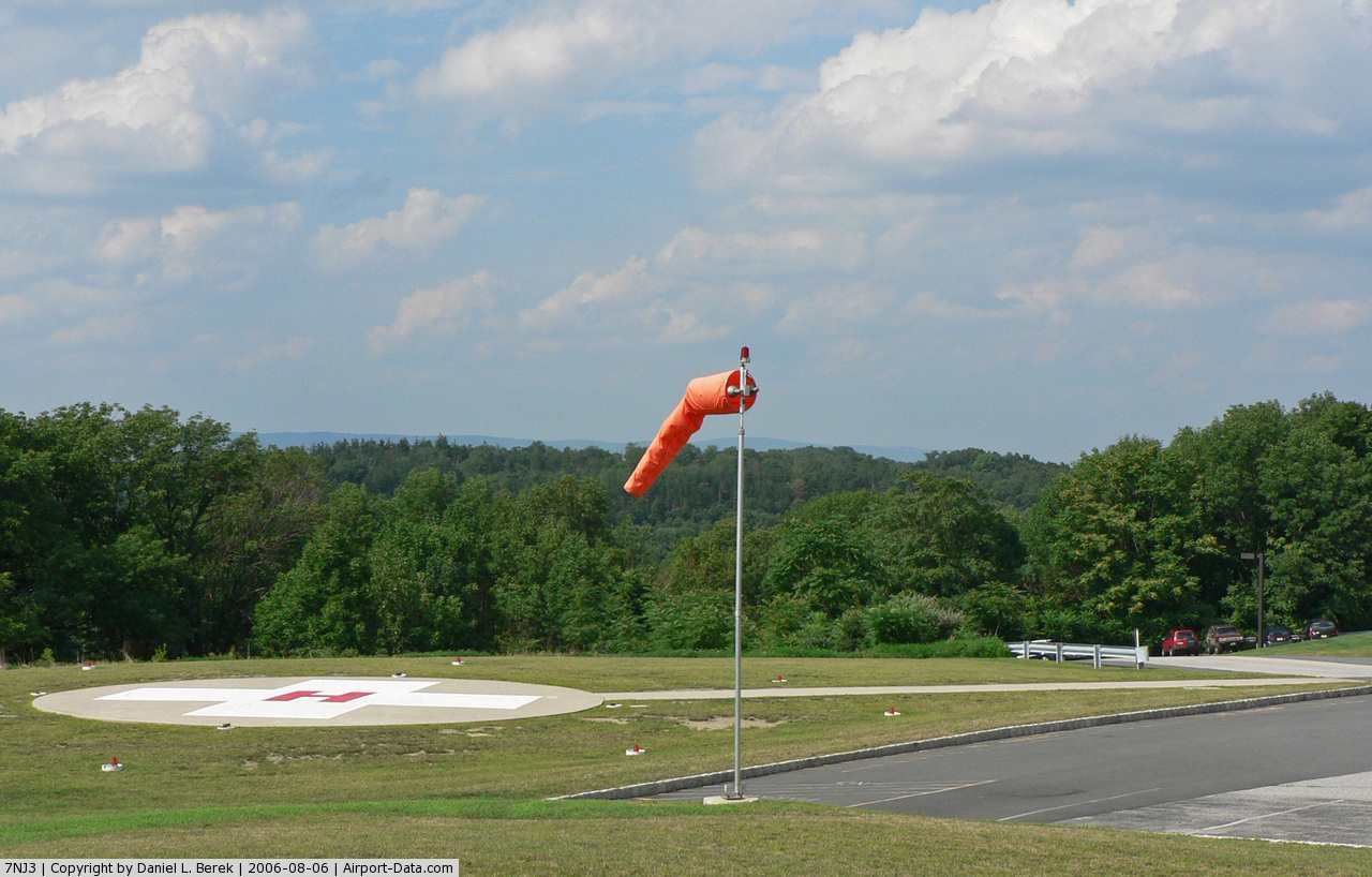
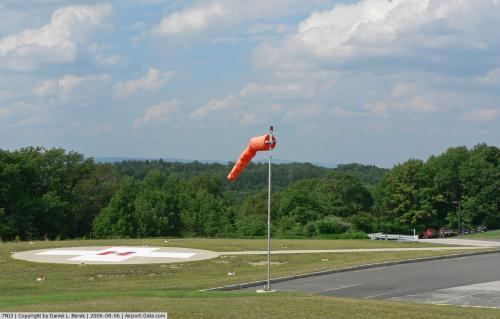
Newton Memorial Hospital Heliport |
 |
(Click on the photo to enlarge) |
Location & QuickFacts
| FAA Information Effective: | 2008-09-25 |
| Airport Identifier: | 7NJ3 |
| Airport Status: | Operational |
| Longitude/Latitude: | 074-46-12.0000W/41-03-26.0000N
-74.770000/41.057222 (Estimated) |
| Elevation: | 500 ft / 152.40 m (Estimated) |
| Land: | 0 acres |
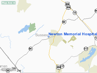
| From nearest city: | 1 nautical miles SW of Newton, NJ |
| Location: | Sussex County, NJ |
| Magnetic Variation: | 12W (1985) |
Owner & Manager
| Ownership: | Privately owned |
| Owner: | Newton Memorial Hospital |
| Address: | 175 High Street
Newton, NJ 07860 |
| Phone number: | 973-383-2121 |
| Manager: | Joseph Zweig |
| Address: | 175 High Street
Newton, NJ 07860 |
| Phone number: | 973-579-8660 |
Airport Operations and Facilities
| Airport Use: | Private
MEDICAL USE. |
| Wind indicator: | Yes |
| Segmented Circle: | No |
| Control Tower: | No |
| Lighting Schedule: | PHONE REQ
FOR PEREMITER LGTS CALL 973-579-8660. |
| Landing fee charge: | No |
| Sectional chart: | New York |
| Region: | AEA - Eastern |
| Boundary ARTCC: | ZNY - New York |
| Tie-in FSS: | MIV - Millville |
| FSS on Airport: | No |
| FSS Toll Free: | 1-800-WX-BRIEF |
Runway Information
Helipad H1
| Dimension: | 40 x 40 ft / 12.2 x 12.2 m |
| Surface: | TURF, |
| |
Runway H1 |
Runway |
| Traffic Pattern: | Left | Left |
| Markings: | Basic, | , |
|
Radio Navigation Aids
| ID |
Type |
Name |
Ch |
Freq |
Var |
Dist |
| EWR | FAN MARKER | Maryann | | | 11W | 34.0 nm |
| SKU | FAN MARKER | Stanwyck | | | 12W | 43.3 nm |
| CAT | NDB | Chatham | | 254.00 | 11W | 24.5 nm |
| PNJ | NDB | Paterson | | 347.00 | 12W | 28.9 nm |
| SW | NDB | Neely | | 335.00 | 14W | 35.5 nm |
| MS | NDB | Monga | | 359.00 | 12W | 42.8 nm |
| SKU | NDB | Stanwyck | | 261.00 | 12W | 43.3 nm |
| UKT | NDB | Quakertown | | 208.00 | 12W | 45.0 nm |
| DYL | NDB | Doylestown | | 237.00 | 10W | 46.2 nm |
| LQX | NDB | Carbon | | 339.00 | 12W | 47.3 nm |
| PO | NDB | Meier | | 403.00 | 12W | 47.9 nm |
| CYE | NDB | Crystal Lake | | 410.00 | 11W | 48.9 nm |
| OGY | NDB | Bridge | | 414.00 | 12W | 49.9 nm |
| STW | VOR/DME | Stillwater | 033X | 109.60 | 11W | 5.8 nm |
| BWZ | VOR/DME | Broadway | 089X | 114.20 | 11W | 15.7 nm |
| HUO | VOR/DME | Huguenot | 108X | 116.10 | 11W | 22.7 nm |
| SBJ | VOR/DME | Solberg | 076X | 112.90 | 10W | 28.5 nm |
| TEB | VOR/DME | Teterboro | 021X | 108.40 | 11W | 34.5 nm |
| LGA | VOR/DME | La Guardia | 078X | 113.10 | 12W | 43.7 nm |
| CKZ | VOR/DME | Pennridge | 025Y | 108.85 | 12W | 46.5 nm |
| CRI | VOR/DME | Canarsie | 070X | 112.30 | 11W | 48.0 nm |
| ARD | VOR/DME | Yardley | 019X | 108.20 | 10W | 48.7 nm |
| SAX | VORTAC | Sparta | 104X | 115.70 | 11W | 10.5 nm |
| FJC | VORTAC | Allentown | 122X | 117.50 | 10W | 36.9 nm |
| LHY | VORTAC | Lake Henry | 045X | 110.80 | 10W | 40.9 nm |
| LVZ | VORTAC | Wilkes-barre | 053X | 111.60 | 10W | 43.6 nm |
Remarks
Images and information placed above are from
http://www.airport-data.com/airport/7NJ3/
We thank them for the data!
| General Info
|
| Country |
United States
|
| State |
NEW JERSEY
|
| FAA ID |
7NJ3
|
| Latitude |
41-03-28.349N
|
| Longitude |
074-46-03.596W
|
| Elevation |
500 feet
|
| Near City |
NEWTON
|
We don't guarantee the information is fresh and accurate. The data may
be wrong or outdated.
For more up-to-date information please refer to other sources.
|
|