 |
|
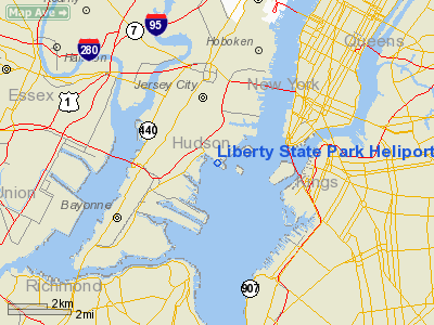
Liberty State Park Heliport |
Location & QuickFacts
| FAA Information Effective: | 2008-09-25 |
| Airport Identifier: | 77NJ |
| Airport Status: | Operational |
| Longitude/Latitude: | 074-03-30.0000W/40-41-35.3690N
-74.058333/40.693158 (Estimated) |
| Elevation: | 3 ft / 0.91 m (Estimated) |
| Land: | 0 acres |
| From nearest city: | 2 nautical miles NW of Jersey City, NJ |
| Location: | Hudson County, NJ |
| Magnetic Variation: | 13W (1985) |
Owner & Manager
| Ownership: | Publicly owned |
| Owner: | State Of Nj Liberty State Pk |
| Address: | Morris Pesin Drive
Jersey City, NJ 07305 |
| Phone number: | 201-915-3401 |
| Manager: | Peter A. Straw |
| Address: | Morris Pesin Drive
Jersey City, NJ 07305 |
| Phone number: | 201-915-3401 |
Airport Operations and Facilities
| Airport Use: | Private |
| Segmented Circle: | No |
| Control Tower: | No |
| Sectional chart: | New York |
| Region: | AEA - Eastern |
| Boundary ARTCC: | ZNY - New York |
| Tie-in FSS: | MIV - Millville |
| FSS Toll Free: | 1-800-WX-BRIEF |
Runway Information
Helipad H1
| Dimension: | 20 x 20 ft / 6.1 x 6.1 m |
| Surface: | ASPH, |
| |
Runway H1 |
Runway |
| Traffic Pattern: | Left | Left |
|
Radio Navigation Aids
| ID |
Type |
Name |
Ch |
Freq |
Var |
Dist |
| EWR | FAN MARKER | Maryann | | | 11W | 5.9 nm |
| OGY | NDB | Bridge | | 414.00 | 12W | 11.0 nm |
| PNJ | NDB | Paterson | | 347.00 | 12W | 15.8 nm |
| CAT | NDB | Chatham | | 254.00 | 11W | 17.2 nm |
| BBN | NDB | Babylon | | 275.00 | 14W | 30.7 nm |
| NEL | NDB | Lakehurst | | 396.00 | 13W | 41.0 nm |
| OP | NDB | Old Field Point Light | | 316.00 | 13W | 46.0 nm |
| SW | NDB | Neely | | 335.00 | 14W | 48.3 nm |
| NEL | TACAN | Lakehurst | 055X | | 11W | 41.7 nm |
| NEL | UHF/NDB | Lakehurst | | 274.80 | 13W | 41.0 nm |
| CRI | VOR/DME | Canarsie | 070X | 112.30 | 11W | 8.9 nm |
| TEB | VOR/DME | Teterboro | 021X | 108.40 | 11W | 9.4 nm |
| LGA | VOR/DME | La Guardia | 078X | 113.10 | 12W | 10.0 nm |
| JFK | VOR/DME | Kennedy | 106X | 115.90 | 12W | 13.6 nm |
| COL | VOR/DME | Colts Neck | 101X | 115.40 | 11W | 23.4 nm |
| SBJ | VOR/DME | Solberg | 076X | 112.90 | 10W | 31.9 nm |
| DPK | VOR/DME | Deer Park | 124X | 117.70 | 12W | 34.9 nm |
| BWZ | VOR/DME | Broadway | 089X | 114.20 | 11W | 35.3 nm |
| STW | VOR/DME | Stillwater | 033X | 109.60 | 11W | 41.1 nm |
| CMK | VOR/DME | Carmel | 113X | 116.60 | 12W | 41.4 nm |
| ARD | VOR/DME | Yardley | 019X | 108.20 | 10W | 47.0 nm |
| HUO | VOR/DME | Huguenot | 108X | 116.10 | 11W | 49.4 nm |
| SAX | VORTAC | Sparta | 104X | 115.70 | 11W | 31.3 nm |
| RBV | VORTAC | Robbinsville | 085X | 113.80 | 10W | 35.6 nm |
| GXU | VORTAC | Mc Guire | 043X | 110.60 | 11W | 47.9 nm |
| JFK | VOT | Kennedy | | 115.10 | | 13.2 nm |
| ISP | VOT | Long Island Mac Arthur | | 109.40 | | 44.2 nm |
Remarks
Images and information placed above are from
http://www.airport-data.com/airport/77NJ/
We thank them for the data!
| General Info
|
| Country |
United States
|
| State |
NEW JERSEY
|
| FAA ID |
77NJ
|
| Latitude |
40-41-35.369N
|
| Longitude |
074-03-13.507W
|
| Elevation |
3 feet
|
| Near City |
JERSEY CITY
|
We don't guarantee the information is fresh and accurate. The data may
be wrong or outdated.
For more up-to-date information please refer to other sources.
|
|


