 |
|
Coordinates: 39°24′30.412″N 075°14′13.678″W / 39.40844778°N 75.23713278°W / 39.40844778; -75.23713278
| Li Calzi Airport |
| IATA: none – ICAO: none – FAA LID: N50 |
| Summary |
| Airport type |
Public use |
| Owner/Operator |
Peter Huang |
| Serves |
Bridgeton, New Jersey |
| Location |
Cumberland County, New Jersey |
| Elevation AMSL |
42 ft / 13 m |
| Runways |
| Direction |
Length |
Surface |
| ft |
m |
| 12/30 |
2,773 |
845 |
Turf |
| Statistics (2007) |
| Aircraft operations |
300 |
| Based aircraft |
0 |
| Source: Federal Aviation Administration |
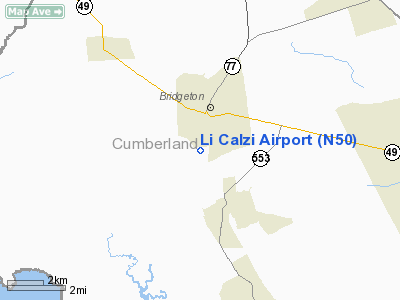
Li Calzi Airport (FAA LID: N50) is a public-use airport located two nautical miles (3.704 km) south of the central business district of the city of Bridgeton in Cumberland County, New Jersey, United States, The airport is privately owned.
The above content comes from Wikipedia and is published under free licenses – click here to read more.
Location & QuickFacts
| FAA Information Effective: | 2008-09-25 |
| Airport Identifier: | N50 |
| Airport Status: | Operational |
| Longitude/Latitude: | 075-14-13.6780W/39-24-30.4120N
-75.237133/39.408448 (Estimated) |
| Elevation: | 42 ft / 12.80 m (Estimated) |
| Land: | 30 acres |
| From nearest city: | 2 nautical miles S of Bridgeton, NJ |
| Location: | Cumberland County, NJ |
| Magnetic Variation: | 11W (1985) |
Owner & Manager
| Ownership: | Privately owned |
| Owner: | Peter Huang |
| Address: | 99 Slade Lane, Apt 114
Bridgeton, NJ 08302 |
| Phone number: | 646-996-1128 |
| Manager: | Peter Huang |
| Address: | 99 Slade Lane, Apt 114
Bridgeton, NJ 08302 |
| Phone number: | 646-996-1128 |
Airport Operations and Facilities
| Airport Use: | Open to public |
| Wind indicator: | Yes |
| Segmented Circle: | No |
| Control Tower: | No |
| Landing fee charge: | Yes |
| Sectional chart: | Washington |
| Region: | AEA - Eastern |
| Traffic Pattern Alt: | 758 ft |
| Boundary ARTCC: | ZDC - Washington |
| Tie-in FSS: | MIV - Millville |
| FSS on Airport: | No |
| FSS Toll Free: | 1-800-WX-BRIEF |
| NOTAMs Facility: | MIV (NOTAM-d service avaliable) |
Airport Communications
Airport Services
Runway Information
Runway 12/30
| Dimension: | 2773 x 100 ft / 845.2 x 30.5 m |
| Surface: | TURF, Poor Condition |
| |
Runway 12 |
Runway 30 |
| Traffic Pattern: | Left | Left |
| Obstruction: | 16 ft trees, 20.0 ft from runway, 50 ft left of centerline, 1:1 slope to clear | 20 ft tree, 50.0 ft from runway, 90 ft right of centerline, 2:1 slope to clear |
|
Radio Navigation Aids
| ID |
Type |
Name |
Ch |
Freq |
Var |
Dist |
| RNB | NDB | Rainbow | | 363.00 | 11W | 4.8 nm |
| APG | NDB | Aberdeen | | 349.00 | 11W | 41.0 nm |
| ING | NDB | Ambler | | 275.00 | 11W | 43.2 nm |
| NXX | NDB | Willow Grove | | 388.00 | 12W | 47.1 nm |
| DOV | TACAN | Dover | 037X | | 09W | 19.8 nm |
| NXX | TACAN | Willow Grove | 061X | | 10W | 47.4 nm |
| PNE | VOR | North Philadelphia | | 112.00 | 10W | 41.8 nm |
| ATR | VOR/DME | Waterloo | 073X | 112.60 | 09W | 36.0 nm |
| PPM | VOR/DME | Phillips | 021X | 108.40 | 09W | 43.5 nm |
| OOD | VORTAC | Woodstown | 075X | 112.80 | 10W | 14.0 nm |
| VCN | VORTAC | Cedar Lake | 099X | 115.20 | 10W | 14.7 nm |
| ENO | VORTAC | Smyrna | 051X | 111.40 | 09W | 16.8 nm |
| DQO | VORTAC | Dupont | 087X | 114.00 | 10W | 23.6 nm |
| SIE | VORTAC | Sea Isle | 095X | 114.80 | 09W | 27.7 nm |
| ACY | VORTAC | Atlantic City | 023X | 108.60 | 10W | 30.8 nm |
| MXE | VORTAC | Modena | 079X | 113.20 | 09W | 36.6 nm |
| CYN | VORTAC | Coyle | 081X | 113.40 | 10W | 44.7 nm |
| GXU | VORTAC | Mc Guire | 043X | 110.60 | 11W | 46.7 nm |
| PHL | VOT | Philadelphia Intl | | 109.80 | | 27.8 nm |
Remarks
- ARPT CLSD TO ALL TRAFFIC UFN. RY UNUSBL. TURF SURFACE PLOWED AND FURROWED.
- PROVIDED VFR USE ONLY, RY 12 THLD IS DSPLCD.
Images and information placed above are from
http://www.airport-data.com/airport/N50/
We thank them for the data!
| General Info
|
| Country |
United States
|
| State |
NEW JERSEY
|
| FAA ID |
N50
|
| Latitude |
39-24-30.412N
|
| Longitude |
075-14-13.678W
|
| Elevation |
42 feet
|
| Near City |
BRIDGETON
|
We don't guarantee the information is fresh and accurate. The data may
be wrong or outdated.
For more up-to-date information please refer to other sources.
|
|


