|
|
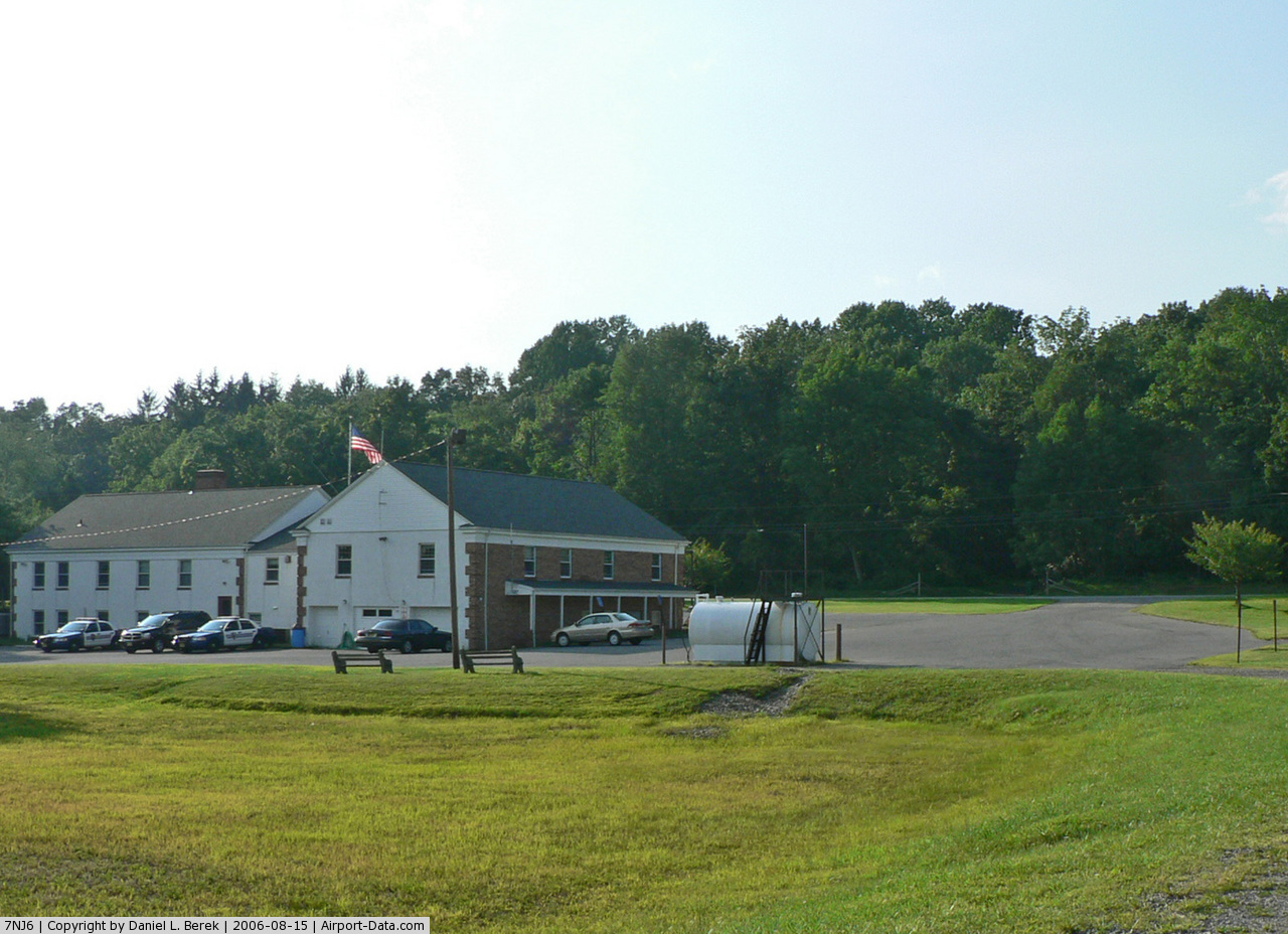
Lebanon Twnshp Mun Bldg Heliport |
 |
(Click on the photo to enlarge) |
Location & QuickFacts
| FAA Information Effective: | 2008-09-25 |
| Airport Identifier: | 7NJ6 |
| Airport Status: | Operational |
| Longitude/Latitude: | 074-53-31.6040W/40-43-03.3600N
-74.892112/40.717600 (Estimated) |
| Elevation: | 925 ft / 281.94 m (Estimated) |
| Land: | 5 acres |
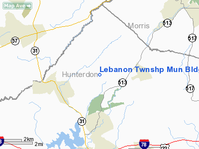
| From nearest city: | 0 nautical miles N of Woodglen, NJ |
| Location: | Hunterdon County, NJ |
| Magnetic Variation: | 12W (1985) |
Owner & Manager
| Ownership: | Publicly owned |
| Owner: | Township Of Lebanon |
| Address: | 530 West Hill Road
Glen Gardner, NJ 08826 |
| Phone number: | 201-638-8516 |
| Manager: | Harry C. Creveling, Chief |
| Address: | 530 West Hill Road
Glen Gardner, NJ 08826 |
| Phone number: | 201-638-8707 |
Airport Operations and Facilities
| Airport Use: | Private |
| Segmented Circle: | No |
| Control Tower: | No |
| Sectional chart: | New York |
| Region: | AEA - Eastern |
| Boundary ARTCC: | ZNY - New York |
| Tie-in FSS: | MIV - Millville |
| FSS on Airport: | No |
| FSS Toll Free: | 1-800-WX-BRIEF |
Airport Services
| Airframe Repair: | NONE |
| Power Plant Repair: | NONE |
Runway Information
Helipad H1
| Dimension: | 1000 x 50 ft / 304.8 x 15.2 m
5 ACRES AVBL FOR LDG AREA. |
| Surface: | TURF, |
| |
Runway H1 |
Runway |
| Traffic Pattern: | Left | Left |
|
Radio Navigation Aids
| ID |
Type |
Name |
Ch |
Freq |
Var |
Dist |
| EWR | FAN MARKER | Maryann | | | 11W | 32.1 nm |
| CAT | NDB | Chatham | | 254.00 | 11W | 21.1 nm |
| DYL | NDB | Doylestown | | 237.00 | 10W | 25.2 nm |
| UKT | NDB | Quakertown | | 208.00 | 12W | 25.5 nm |
| NXX | NDB | Willow Grove | | 388.00 | 12W | 33.8 nm |
| PNJ | NDB | Paterson | | 347.00 | 12W | 36.4 nm |
| ING | NDB | Ambler | | 275.00 | 11W | 39.9 nm |
| LQX | NDB | Carbon | | 339.00 | 12W | 39.9 nm |
| OGY | NDB | Bridge | | 414.00 | 12W | 46.9 nm |
| NEL | NDB | Lakehurst | | 396.00 | 13W | 47.8 nm |
| NXX | TACAN | Willow Grove | 061X | | 10W | 33.5 nm |
| NEL | TACAN | Lakehurst | 055X | | 11W | 47.8 nm |
| NEL | UHF/NDB | Lakehurst | | 274.80 | 13W | 47.8 nm |
| PNE | VOR | North Philadelphia | | 112.00 | 10W | 38.6 nm |
| BWZ | VOR/DME | Broadway | 089X | 114.20 | 11W | 5.8 nm |
| SBJ | VOR/DME | Solberg | 076X | 112.90 | 10W | 10.6 nm |
| STW | VOR/DME | Stillwater | 033X | 109.60 | 11W | 16.8 nm |
| CKZ | VOR/DME | Pennridge | 025Y | 108.85 | 12W | 26.7 nm |
| ARD | VOR/DME | Yardley | 019X | 108.20 | 10W | 27.9 nm |
| ETX | VOR/DME | East Texas | 039X | 110.20 | 09W | 37.0 nm |
| TEB | VOR/DME | Teterboro | 021X | 108.40 | 11W | 38.6 nm |
| COL | VOR/DME | Colts Neck | 101X | 115.40 | 11W | 41.4 nm |
| HUO | VOR/DME | Huguenot | 108X | 116.10 | 11W | 43.8 nm |
| CRI | VOR/DME | Canarsie | 070X | 112.30 | 11W | 45.9 nm |
| LGA | VOR/DME | La Guardia | 078X | 113.10 | 12W | 46.4 nm |
| FJC | VORTAC | Allentown | 122X | 117.50 | 10W | 25.6 nm |
| SAX | VORTAC | Sparta | 104X | 115.70 | 11W | 26.5 nm |
| RBV | VORTAC | Robbinsville | 085X | 113.80 | 10W | 35.9 nm |
| PTW | VORTAC | Pottstown | 112X | 116.50 | 09W | 42.7 nm |
| GXU | VORTAC | Mc Guire | 043X | 110.60 | 11W | 44.7 nm |
| LVZ | VORTAC | Wilkes-barre | 053X | 111.60 | 10W | 49.2 nm |
Images and information placed above are from
http://www.airport-data.com/airport/7NJ6/
We thank them for the data!
| General Info
|
| Country |
United States
|
| State |
NEW JERSEY
|
| FAA ID |
7NJ6
|
| Latitude |
40-43-03.360N
|
| Longitude |
074-53-31.604W
|
| Elevation |
925 feet
|
| Near City |
WOODGLEN
|
We don't guarantee the information is fresh and accurate. The data may
be wrong or outdated.
For more up-to-date information please refer to other sources.
|
|