 |
|
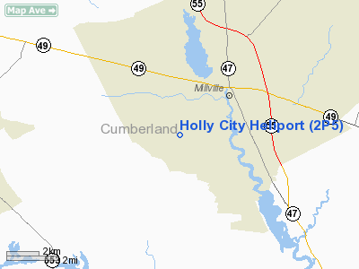
Location & QuickFacts
| FAA Information Effective: | 2008-09-25 |
| Airport Identifier: | 2P5 |
| Airport Status: | Operational |
| Longitude/Latitude: | 075-04-24.6400W/39-22-08.4100N
-75.073511/39.369003 (Estimated) |
| Elevation: | 85 ft / 25.91 m () |
| Land: | 0 acres |
| From nearest city: | 3 nautical miles SW of Millville, NJ |
| Location: | Cumberland County, NJ |
| Magnetic Variation: | 12W (2000) |
Owner & Manager
| Ownership: | Publicly owned |
| Owner: | City Of Millville |
| Address: | Cedarville Road, Box 65
Millville, NJ 08332 |
| Phone number: | 609-825-7000 |
| Manager: | Lewis B. Finch |
| Address: | 502 W. Main Street
Millville, NJ 08332 |
| Phone number: | 609-825-1244 |
Airport Operations and Facilities
| Airport Use: | Open to public |
| Wind indicator: | Yes |
| Segmented Circle: | No |
| Control Tower: | No |
| Sectional chart: | Washington |
| Region: | AEA - Eastern |
| Boundary ARTCC: | ZDC - Washington |
| Tie-in FSS: | MIV - Millville |
| FSS Toll Free: | 1-800-WX-BRIEF |
| NOTAMs Facility: | MIV (NOTAM-d service avaliable) |
Airport Communications
| CTAF: | 123.650 |
| Unicom: | 123.000
OR ON 131.1. |
Airport Services
Runway Information
Helipad H1
| Dimension: | 100 x 100 ft / 30.5 x 30.5 m |
| Surface: | CONC, |
| |
Runway H1 |
Runway |
| Traffic Pattern: | Left | Left |
| Markings: | Basic, Good Condition | , |
|
Radio Navigation Aids
| ID |
Type |
Name |
Ch |
Freq |
Var |
Dist |
| RNB | NDB | Rainbow | | 363.00 | 11W | 4.1 nm |
| ING | NDB | Ambler | | 275.00 | 11W | 46.5 nm |
| APG | NDB | Aberdeen | | 349.00 | 11W | 49.0 nm |
| NXX | NDB | Willow Grove | | 388.00 | 12W | 49.4 nm |
| DOV | TACAN | Dover | 037X | | 09W | 23.2 nm |
| NXX | TACAN | Willow Grove | 061X | | 10W | 49.7 nm |
| PNE | VOR | North Philadelphia | | 112.00 | 10W | 43.0 nm |
| ATR | VOR/DME | Waterloo | 073X | 112.60 | 09W | 34.2 nm |
| VCN | VORTAC | Cedar Lake | 099X | 115.20 | 10W | 11.3 nm |
| OOD | VORTAC | Woodstown | 075X | 112.80 | 10W | 19.3 nm |
| SIE | VORTAC | Sea Isle | 095X | 114.80 | 09W | 20.8 nm |
| ENO | VORTAC | Smyrna | 051X | 111.40 | 09W | 22.2 nm |
| ACY | VORTAC | Atlantic City | 023X | 108.60 | 10W | 23.7 nm |
| DQO | VORTAC | Dupont | 087X | 114.00 | 10W | 30.9 nm |
| CYN | VORTAC | Coyle | 081X | 113.40 | 10W | 40.1 nm |
| MXE | VORTAC | Modena | 079X | 113.20 | 09W | 43.1 nm |
| GXU | VORTAC | Mc Guire | 043X | 110.60 | 11W | 44.4 nm |
| PHL | VOT | Philadelphia Intl | | 109.80 | | 31.2 nm |
Remarks
- PRVDD ACCURATE INGRESS/EGRESS ROUTED CLEARED 8:1 SLOPE, APPROPRIATE MARKINGS FOR INGRESS/EGRESS & LGTD WINDSOCK, VEHICULAR TFC CONTROL AROUND PAD & "LOW FLYING ACFT" SIGN, FENCE AROUND PERIMETER & HIGHT LGTNG, FIRE EXTINGUISHERS ARE PRESENT.
Images and information placed above are from
http://www.airport-data.com/airport/2P5/
We thank them for the data!
| General Info
|
| Country |
United States
|
| State |
NEW JERSEY
|
| FAA ID |
2P5
|
| Latitude |
39-22-08.410N
|
| Longitude |
075-04-24.640W
|
| Elevation |
85 feet
|
| Near City |
MILLVILLE
|
We don't guarantee the information is fresh and accurate. The data may
be wrong or outdated.
For more up-to-date information please refer to other sources.
|
|


