 |
|
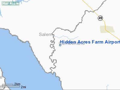
Hidden Acres Farm Airport |
Location & QuickFacts
| FAA Information Effective: | 2008-09-25 |
| Airport Identifier: | NJ84 |
| Airport Status: | Operational |
| Longitude/Latitude: | 075-23-48.0000W/39-25-59.0000N
-75.396667/39.433056 (Estimated) |
| Elevation: | 60 ft / 18.29 m (Estimated) |
| Land: | 130 acres |
| From nearest city: | 12 nautical miles NE of Bridgeton, NJ |
| Location: | Cumberland County, NJ |
| Magnetic Variation: | 12W (2000) |
Owner & Manager
| Ownership: | Privately owned |
| Owner: | Frank & Lois Mazza |
| Address: | 57 Ayars Lane
Bridgeton, NJ 08302 |
| Phone number: | 856-451-5966 |
| Manager: | Frank & Lois Mazza |
| Address: | 57 Ayars Lane
Bridgeton, NJ 08302 |
| Phone number: | 856-451-5966 |
Airport Operations and Facilities
| Airport Use: | Private |
| Wind indicator: | Yes |
| Segmented Circle: | No |
| Control Tower: | No |
| Sectional chart: | Washington |
| Region: | AEA - Eastern |
| Boundary ARTCC: | ZDC - Washington |
| Tie-in FSS: | MIV - Millville |
| FSS Toll Free: | 1-800-WX-BRIEF |
Runway Information
Runway 05/23
| Dimension: | 2000 x 60 ft / 609.6 x 18.3 m |
| Surface: | TURF, |
| |
Runway 05 |
Runway 23 |
| Traffic Pattern: | Left | Left |
| Obstruction: | 40 ft trees | 40 ft trees |
|
Radio Navigation Aids
| ID |
Type |
Name |
Ch |
Freq |
Var |
Dist |
| RNB | NDB | Rainbow | | 363.00 | 11W | 12.2 nm |
| APG | NDB | Aberdeen | | 349.00 | 11W | 33.5 nm |
| ING | NDB | Ambler | | 275.00 | 11W | 42.0 nm |
| MTN | NDB | Martin | | 342.00 | 11W | 46.4 nm |
| NXX | NDB | Willow Grove | | 388.00 | 12W | 46.9 nm |
| ESN | NDB | Easton | | 212.00 | 10W | 49.1 nm |
| DOV | TACAN | Dover | 037X | | 09W | 18.4 nm |
| NXX | TACAN | Willow Grove | 061X | | 10W | 47.2 nm |
| MTN | TACAN | Martin | 068X | | 11W | 47.5 nm |
| PNE | VOR | North Philadelphia | | 112.00 | 10W | 42.9 nm |
| PPM | VOR/DME | Phillips | 021X | 108.40 | 09W | 36.0 nm |
| ATR | VOR/DME | Waterloo | 073X | 112.60 | 09W | 38.4 nm |
| OOD | VORTAC | Woodstown | 075X | 112.80 | 10W | 12.9 nm |
| ENO | VORTAC | Smyrna | 051X | 111.40 | 09W | 13.3 nm |
| DQO | VORTAC | Dupont | 087X | 114.00 | 10W | 17.7 nm |
| VCN | VORTAC | Cedar Lake | 099X | 115.20 | 10W | 20.9 nm |
| MXE | VORTAC | Modena | 079X | 113.20 | 09W | 31.8 nm |
| SIE | VORTAC | Sea Isle | 095X | 114.80 | 09W | 34.4 nm |
| ACY | VORTAC | Atlantic City | 023X | 108.60 | 10W | 38.1 nm |
| PTW | VORTAC | Pottstown | 112X | 116.50 | 09W | 48.0 nm |
| PHL | VOT | Philadelphia Intl | | 109.80 | | 27.2 nm |
Remarks
- PRVDD DALGT, VFR AND A CLEAR 20:1 APCH/DEP PATH.
Images and information placed above are from
http://www.airport-data.com/airport/NJ84/
We thank them for the data!
| General Info
|
| Country |
United States
|
| State |
NEW JERSEY
|
| FAA ID |
NJ84
|
| Latitude |
39-25-59.000N
|
| Longitude |
075-23-48.000W
|
| Elevation |
60 feet
|
| Near City |
BRIDGETON
|
We don't guarantee the information is fresh and accurate. The data may
be wrong or outdated.
For more up-to-date information please refer to other sources.
|
|


