 |
|
Location & QuickFacts
| FAA Information Effective: | 2008-09-25 |
| Airport Identifier: | 2JY9 |
| Airport Status: | Operational |
| Longitude/Latitude: | 075-06-14.0000W/39-56-47.0000N
-75.103889/39.946389 (Estimated) |
| Elevation: | 23 ft / 7.01 m (Estimated) |
| Land: | 0 acres |
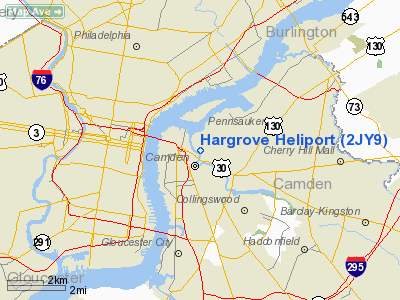
| From nearest city: | 0 nautical miles N of Camden, NJ |
| Location: | Camden County, NJ |
| Magnetic Variation: | () |
Owner & Manager
| Ownership: | Privately owned |
| Owner: | William Hargrove |
| Address: | 1507 State Street
Camden, NJ 08105 |
| Phone number: | 856-225-1100 |
| Manager: | William Hargrove |
| Address: | 1507 State Street
Camden, NJ 08105 |
| Phone number: | 856-225-1100 |
Airport Operations and Facilities
| Airport Use: | Private |
| Wind indicator: | Yes |
| Segmented Circle: | Yes |
| Control Tower: | No |
| Sectional chart: | Washington |
| Region: | AEA - Eastern |
| Boundary ARTCC: | ZDC - Washington |
| Tie-in FSS: | MIV - Millville |
| FSS Toll Free: | 1-800-WX-BRIEF |
Runway Information
Helipad H1
| Dimension: | 20 x 20 ft / 6.1 x 6.1 m |
| Surface: | CONC, |
| |
Runway H1 |
Runway |
| Traffic Pattern: | Left | Left |
|
Radio Navigation Aids
| ID |
Type |
Name |
Ch |
Freq |
Var |
Dist |
| ING | NDB | Ambler | | 275.00 | 11W | 13.6 nm |
| NXX | NDB | Willow Grove | | 388.00 | 12W | 14.7 nm |
| DYL | NDB | Doylestown | | 237.00 | 10W | 23.4 nm |
| UKT | NDB | Quakertown | | 208.00 | 12W | 30.1 nm |
| RNB | NDB | Rainbow | | 363.00 | 11W | 31.8 nm |
| NEL | NDB | Lakehurst | | 396.00 | 13W | 35.9 nm |
| NXX | TACAN | Willow Grove | 061X | | 10W | 15.0 nm |
| NEL | TACAN | Lakehurst | 055X | | 11W | 35.0 nm |
| NEL | UHF/NDB | Lakehurst | | 274.80 | 13W | 35.9 nm |
| PNE | VOR | North Philadelphia | | 112.00 | 10W | 9.2 nm |
| ARD | VOR/DME | Yardley | 019X | 108.20 | 10W | 20.5 nm |
| CKZ | VOR/DME | Pennridge | 025Y | 108.85 | 12W | 28.0 nm |
| SBJ | VOR/DME | Solberg | 076X | 112.90 | 10W | 41.7 nm |
| ETX | VOR/DME | East Texas | 039X | 110.20 | 09W | 46.5 nm |
| COL | VOR/DME | Colts Neck | 101X | 115.40 | 11W | 48.6 nm |
| OOD | VORTAC | Woodstown | 075X | 112.80 | 10W | 20.8 nm |
| GXU | VORTAC | Mc Guire | 043X | 110.60 | 11W | 23.7 nm |
| VCN | VORTAC | Cedar Lake | 099X | 115.20 | 10W | 25.4 nm |
| MXE | VORTAC | Modena | 079X | 113.20 | 09W | 26.2 nm |
| PTW | VORTAC | Pottstown | 112X | 116.50 | 09W | 26.7 nm |
| DQO | VORTAC | Dupont | 087X | 114.00 | 10W | 28.3 nm |
| RBV | VORTAC | Robbinsville | 085X | 113.80 | 10W | 32.0 nm |
| CYN | VORTAC | Coyle | 081X | 113.40 | 10W | 32.0 nm |
| ACY | VORTAC | Atlantic City | 023X | 108.60 | 10W | 38.3 nm |
| ENO | VORTAC | Smyrna | 051X | 111.40 | 09W | 47.0 nm |
| FJC | VORTAC | Allentown | 122X | 117.50 | 10W | 49.6 nm |
| PHL | VOT | Philadelphia Intl | | 109.80 | | 8.0 nm |
Remarks
- PRVDD VFR OPNS; PVT USE; AREA IS MARKED; WIND INDICATOR IS MAINTAINED.
Images and information placed above are from
http://www.airport-data.com/airport/2JY9/
We thank them for the data!
|
|


