 |
|
Coordinates: 39°40′02.888″N 074°45′27.844″W / 39.66746889°N 74.75773444°W / 39.66746889; -74.75773444
| Hammonton Municipal Airport |
| IATA: none – ICAO: none – FAA LID: N81 |
| Summary |
| Airport type |
Public use |
| Owner |
Town of Hammonton |
| Operator |
Rock Colasurdo |
| Serves |
Hammonton, New Jersey |
| Location |
Atlantic County, New Jersey |
| Elevation AMSL |
69 ft / 21 m |
| Runways |
| Direction |
Length |
Surface |
| ft |
m |
| 3/21 |
3,602 |
1,098 |
Asphalt |
| Statistics (2008) |
| Aircraft operations |
15,900 |
| Based aircraft |
37 |
| Source: Federal Aviation Administration |
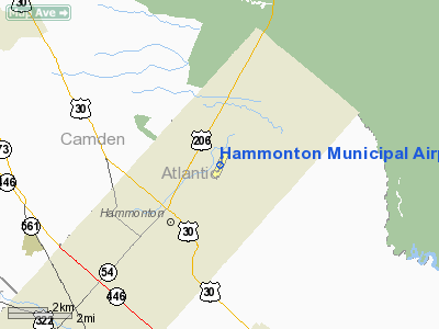
Hammonton Municipal Airport (FAA LID: N81) is a public-use airport located three nautical miles (5.556 km) northeast of the central business district of the town of Hammonton in Atlantic County, New Jersey, United States. The airport is publicly owned..
The above content comes from Wikipedia and is published under free licenses – click here to read more.
Location & QuickFacts
| FAA Information Effective: | 2008-09-25 |
| Airport Identifier: | N81 |
| Airport Status: | Operational |
| Longitude/Latitude: | 074-45-27.8440W/39-40-02.8880N
-74.757734/39.667469 (Estimated) |
| Elevation: | 69 ft / 21.03 m (Estimated) |
| Land: | 107 acres |
| From nearest city: | 3 nautical miles NE of Hammonton, NJ |
| Location: | Atlantic County, NJ |
| Magnetic Variation: | 13W (2000) |
Owner & Manager
| Ownership: | Publicly owned |
| Owner: | Town Of Hammonton
ARPT ADMINISTRATOR; MR. ANDY KONNDRIC, 609-442-1262. |
| Address: | Town Hall
Hammonton, NJ 08037 |
| Phone number: | 609-567-4300 |
| Manager: | Andrew Kondrach |
| Address: | 112 Maple Street
Hammonton, NJ 08037 |
| Phone number: | 609-567-2086 |
Airport Operations and Facilities
| Airport Use: | Open to public |
| Wind indicator: | Yes |
| Segmented Circle: | No |
| Control Tower: | No |
| Lighting Schedule: | DUSK-DAWN
ACTVT MIRL RY 03/21 - 123.5 PAPI RY 03/21 OPERATE CONTINUOUS. |
| Beacon Color: | Clear-Green (lighted land airport) |
| Landing fee charge: | No |
| Sectional chart: | Washington |
| Region: | AEA - Eastern |
| Boundary ARTCC: | ZNY - New York |
| Responsible ARTCC: | ZDC - Washington |
| Tie-in FSS: | MIV - Millville |
| FSS on Airport: | No |
| FSS Toll Free: | 1-800-WX-BRIEF |
| NOTAMs Facility: | MIV (NOTAM-d service avaliable) |
| Federal Agreements: | NGY |
Airport Communications
| CTAF: | 122.700 |
| Unicom: | 122.700
AUTOMATED UNICOM. |
Airport Services
| Fuel available: | 100LLA |
| Airframe Repair: | MAJOR |
| Power Plant Repair: | MAJOR |
| Bottled Oxygen: | NONE |
| Bulk Oxygen: | NONE |
Runway Information
Runway 03/21
| Dimension: | 3602 x 75 ft / 1097.9 x 22.9 m |
| Surface: | ASPH, Good Condition |
| Weight Limit: | Single wheel: 12000 lbs. |
| Edge Lights: | Medium |
| |
Runway 03 |
Runway 21 |
| Longitude: | 074-45-34.2460W | 074-45-21.4430W |
| Latitude: | 39-39-45.7900N | 39-40-19.9860N |
| Elevation: | 65.00 ft | 58.00 ft |
| Alignment: | 16 | 127 |
| Traffic Pattern: | Left | Left |
| Markings: | Non-precision instrument, Fair Condition | Non-precision instrument, Fair Condition |
| Crossing Height: | 25.00 ft | 20.00 ft |
| VASI: | 2-light PAPI on left side | 2-light PAPI on left side |
| Visual Glide Angle: | 3.50° | 3.25° |
| Centerline Lights: | No | No |
| Touchdown Lights: | No | No |
| Obstruction: | 61 ft trees, 725.0 ft from runway, 270 ft right of centerline, 8:1 slope to clear
RWY 03, TREES TO +30 FT, 190-240 FT L, 70-170 FT FM THLD. | 40 ft trees, 240.0 ft from runway, 150 ft right of centerline, 1:1 slope to clear
TREES TO +50 FT, 150 FT R, 0-200 FT FM THLD. |
|
Radio Navigation Aids
| ID |
Type |
Name |
Ch |
Freq |
Var |
Dist |
| RNB | NDB | Rainbow | | 363.00 | 11W | 23.0 nm |
| NEL | NDB | Lakehurst | | 396.00 | 13W | 29.9 nm |
| NXX | NDB | Willow Grove | | 388.00 | 12W | 36.1 nm |
| ING | NDB | Ambler | | 275.00 | 11W | 36.8 nm |
| DYL | NDB | Doylestown | | 237.00 | 10W | 43.5 nm |
| NEL | TACAN | Lakehurst | 055X | | 11W | 29.0 nm |
| NXX | TACAN | Willow Grove | 061X | | 10W | 36.4 nm |
| DOV | TACAN | Dover | 037X | | 09W | 46.1 nm |
| NEL | UHF/NDB | Lakehurst | | 274.80 | 13W | 29.9 nm |
| PNE | VOR | North Philadelphia | | 112.00 | 10W | 27.5 nm |
| ARD | VOR/DME | Yardley | 019X | 108.20 | 10W | 35.9 nm |
| COL | VOR/DME | Colts Neck | 101X | 115.40 | 11W | 47.5 nm |
| CKZ | VOR/DME | Pennridge | 025Y | 108.85 | 12W | 49.9 nm |
| VCN | VORTAC | Cedar Lake | 099X | 115.20 | 10W | 12.4 nm |
| ACY | VORTAC | Atlantic City | 023X | 108.60 | 10W | 15.2 nm |
| CYN | VORTAC | Coyle | 081X | 113.40 | 10W | 17.6 nm |
| GXU | VORTAC | Mc Guire | 043X | 110.60 | 11W | 21.9 nm |
| OOD | VORTAC | Woodstown | 075X | 112.80 | 10W | 25.3 nm |
| RBV | VORTAC | Robbinsville | 085X | 113.80 | 10W | 34.4 nm |
| SIE | VORTAC | Sea Isle | 095X | 114.80 | 09W | 34.4 nm |
| DQO | VORTAC | Dupont | 087X | 114.00 | 10W | 39.3 nm |
| ENO | VORTAC | Smyrna | 051X | 111.40 | 09W | 43.9 nm |
| MXE | VORTAC | Modena | 079X | 113.20 | 09W | 44.8 nm |
| PTW | VORTAC | Pottstown | 112X | 116.50 | 09W | 49.8 nm |
| PHL | VOT | Philadelphia Intl | | 109.80 | | 25.6 nm |
Remarks
- DEER IN VICINITY OF ARPT.
- ARPT HAS GLIDER OPERATIONS.
- AUTOMATED UNICOM. ACTVT - CTAF.
Images and information placed above are from
http://www.airport-data.com/airport/N81/
We thank them for the data!
| General Info
|
| Country |
United States
|
| State |
NEW JERSEY
|
| FAA ID |
N81
|
| Latitude |
39-40-02.888N
|
| Longitude |
074-45-27.844W
|
| Elevation |
69 feet
|
| Near City |
HAMMONTON
|
We don't guarantee the information is fresh and accurate. The data may
be wrong or outdated.
For more up-to-date information please refer to other sources.
|
|


