 |
|
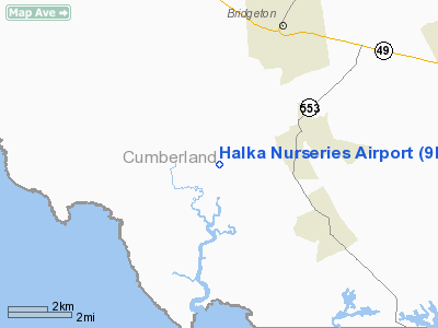
Location & QuickFacts
| FAA Information Effective: | 2008-09-25 |
| Airport Identifier: | 9NJ6 |
| Airport Status: | Operational |
| Longitude/Latitude: | 075-16-06.0000W/39-21-59.0000N
-75.268333/39.366389 (Estimated) |
| Elevation: | 10 ft / 3.05 m (Estimated) |
| Land: | 150 acres |
| From nearest city: | 2 nautical miles W of Fairton, NJ |
| Location: | Cumberland County, NJ |
| Magnetic Variation: | 11W (1990) |
Owner & Manager
| Ownership: | Privately owned |
| Owner: | Halka Nurseries |
| Address: | 240 Sweetmans Lane
Englishtown, NJ 07726 |
| Phone number: | 908-462-8450 |
| Manager: | Chet Halka |
| Address: | 240 Sweetmans Lane
Englishtown, NJ 07726 |
| Phone number: | 908-462-8450 |
Airport Operations and Facilities
| Airport Use: | Private |
| Segmented Circle: | No |
| Control Tower: | No |
| Sectional chart: | Washington |
| Region: | AEA - Eastern |
| Boundary ARTCC: | ZDC - Washington |
| Tie-in FSS: | MIV - Millville |
| FSS on Airport: | No |
| FSS Toll Free: | 1-800-WX-BRIEF |
Runway Information
Runway 18/36
| Dimension: | 2400 x 100 ft / 731.5 x 30.5 m |
| Surface: | TURF, |
| |
Runway 18 |
Runway 36 |
| Traffic Pattern: | Left | Left |
| Displaced threshold: | 400.00 ft | 0.00 ft |
| Obstruction: | 30 ft plines | |
|
Radio Navigation Aids
| ID |
Type |
Name |
Ch |
Freq |
Var |
Dist |
| RNB | NDB | Rainbow | | 363.00 | 11W | 6.9 nm |
| APG | NDB | Aberdeen | | 349.00 | 11W | 40.2 nm |
| ING | NDB | Ambler | | 275.00 | 11W | 45.7 nm |
| NXX | NDB | Willow Grove | | 388.00 | 12W | 49.8 nm |
| DOV | TACAN | Dover | 037X | | 09W | 16.8 nm |
| PNE | VOR | North Philadelphia | | 112.00 | 10W | 44.7 nm |
| ATR | VOR/DME | Waterloo | 073X | 112.60 | 09W | 33.6 nm |
| PPM | VOR/DME | Phillips | 021X | 108.40 | 09W | 42.3 nm |
| ENO | VORTAC | Smyrna | 051X | 111.40 | 09W | 14.1 nm |
| OOD | VORTAC | Woodstown | 075X | 112.80 | 10W | 16.3 nm |
| VCN | VORTAC | Cedar Lake | 099X | 115.20 | 10W | 17.4 nm |
| DQO | VORTAC | Dupont | 087X | 114.00 | 10W | 24.5 nm |
| SIE | VORTAC | Sea Isle | 095X | 114.80 | 09W | 27.2 nm |
| ACY | VORTAC | Atlantic City | 023X | 108.60 | 10W | 32.6 nm |
| MXE | VORTAC | Modena | 079X | 113.20 | 09W | 38.0 nm |
| CYN | VORTAC | Coyle | 081X | 113.40 | 10W | 47.3 nm |
| GXU | VORTAC | Mc Guire | 043X | 110.60 | 11W | 49.6 nm |
| PHL | VOT | Philadelphia Intl | | 109.80 | | 30.3 nm |
Remarks
- PRVDD WIRES AT N END MUST BE MARKED AND/OR LGTD IN ACCORDANCE WITH AC 70/7460-IG; LARGEST ACFT RCMDD FOR OPERATION IS LIGHT TWIN.
Images and information placed above are from
http://www.airport-data.com/airport/9NJ6/
We thank them for the data!
| General Info
|
| Country |
United States
|
| State |
NEW JERSEY
|
| FAA ID |
9NJ6
|
| Latitude |
39-21-59.000N
|
| Longitude |
075-16-06.000W
|
| Elevation |
10 feet
|
| Near City |
FAIRTON
|
We don't guarantee the information is fresh and accurate. The data may
be wrong or outdated.
For more up-to-date information please refer to other sources.
|
|


