 |
|
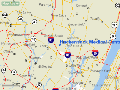
Hackensack Medical Center Heliport |
Location & QuickFacts
| FAA Information Effective: | 2008-09-25 |
| Airport Identifier: | NJ22 |
| Airport Status: | Operational |
| Longitude/Latitude: | 074-03-21.5100W/40-53-02.3600N
-74.055975/40.883989 (Estimated) |
| Elevation: | 159 ft / 48.46 m (Estimated) |
| Land: | 0 acres |
| From nearest city: | 0 nautical miles N of Hackensack, NJ |
| Location: | Bergen County, NJ |
| Magnetic Variation: | 13W (1985) |
Owner & Manager
| Ownership: | Privately owned |
| Owner: | Hackensack Medical Center |
| Address: | 30 Prospect Avenue
Hackensack, NJ 07601 |
| Phone number: | 201-996-2000 |
| Manager: | Stephanie Goldberg
ASST VP OUTPATIENT SVCS. |
| Address: | 30 Prospect Ave
Hackensack, NJ 07601 |
| Phone number: | 201-996-2000 |
Airport Operations and Facilities
| Airport Use: | Private
MEDICAL USE. |
| Wind indicator: | Yes |
| Segmented Circle: | No |
| Control Tower: | No |
| Lighting Schedule: | DUSK-DAWN
FOR PERIMETER LGTS CALL 201-996-2000 |
| Beacon Color: | Clear-Green-Yellow (heliport) |
| Sectional chart: | Washington |
| Region: | AEA - Eastern |
| Boundary ARTCC: | ZNY - New York |
| Tie-in FSS: | MIV - Millville |
| FSS on Airport: | No |
| FSS Toll Free: | 1-800-WX-BRIEF |
Runway Information
Helipad H1
| Dimension: | 45 x 45 ft / 13.7 x 13.7 m |
| Surface: | MATS,
ALUMINUM |
| |
Runway H1 |
Runway |
| Traffic Pattern: | Left | Left |
| Markings: | Basic, | , |
|
Radio Navigation Aids
| ID |
Type |
Name |
Ch |
Freq |
Var |
Dist |
| EWR | FAN MARKER | Maryann | | | 11W | 12.4 nm |
| SKU | FAN MARKER | Stanwyck | | | 12W | 38.7 nm |
| PNJ | NDB | Paterson | | 347.00 | 12W | 5.7 nm |
| CAT | NDB | Chatham | | 254.00 | 11W | 19.1 nm |
| OGY | NDB | Bridge | | 414.00 | 12W | 20.6 nm |
| BBN | NDB | Babylon | | 275.00 | 14W | 33.1 nm |
| SW | NDB | Neely | | 335.00 | 14W | 37.0 nm |
| SKU | NDB | Stanwyck | | 261.00 | 12W | 38.7 nm |
| PO | NDB | Meier | | 403.00 | 12W | 41.7 nm |
| OP | NDB | Old Field Point Light | | 316.00 | 13W | 42.9 nm |
| TEB | VOR/DME | Teterboro | 021X | 108.40 | 11W | 2.1 nm |
| LGA | VOR/DME | La Guardia | 078X | 113.10 | 12W | 10.0 nm |
| CRI | VOR/DME | Canarsie | 070X | 112.30 | 11W | 17.9 nm |
| JFK | VOR/DME | Kennedy | 106X | 115.90 | 12W | 19.9 nm |
| CMK | VOR/DME | Carmel | 113X | 116.60 | 12W | 32.1 nm |
| DPK | VOR/DME | Deer Park | 124X | 117.70 | 12W | 34.7 nm |
| COL | VOR/DME | Colts Neck | 101X | 115.40 | 11W | 34.7 nm |
| BWZ | VOR/DME | Broadway | 089X | 114.20 | 11W | 35.2 nm |
| SBJ | VOR/DME | Solberg | 076X | 112.90 | 10W | 36.1 nm |
| STW | VOR/DME | Stillwater | 033X | 109.60 | 11W | 37.5 nm |
| HUO | VOR/DME | Huguenot | 108X | 116.10 | 11W | 39.8 nm |
| BDR | VOR/DME | Bridgeport | 25X | 108.80 | 12W | 45.4 nm |
| IGN | VOR/DME | Kingston | 123X | 117.60 | 12W | 48.1 nm |
| SAX | VORTAC | Sparta | 104X | 115.70 | 11W | 24.5 nm |
| RBV | VORTAC | Robbinsville | 085X | 113.80 | 10W | 45.6 nm |
| JFK | VOT | Kennedy | | 115.10 | | 19.6 nm |
| ISP | VOT | Long Island Mac Arthur | | 109.40 | | 44.1 nm |
| BDR | VOT | Bridgeport | | 109.25 | | 45.4 nm |
Remarks
- INGRESS 235 DEG; EGRESS 290 DEG
- MAXIMUM GROSS WEIGHT 22000 LBS.
- PRVDD HELICOPTERS OPERATING FM THIS FACILITY ARE LIMITED TO ACFT WEIGHING LESS THAN 22000 LBS MGW;IFR OPNS ARE NOT CONDUCTED; A CLEAR 8:1 INGRESS/EGRESS; AND CAUTION MUST BE EXERCISED TO AVIOD OVERFLIGHT OF THE SCHOOLS & CHURCHES IN THE NEARBY VICINITY.
Images and information placed above are from
http://www.airport-data.com/airport/NJ22/
We thank them for the data!
| General Info
|
| Country |
United States
|
| State |
NEW JERSEY
|
| FAA ID |
NJ22
|
| Latitude |
40-53-02.360N
|
| Longitude |
074-03-21.510W
|
| Elevation |
159 feet
|
| Near City |
HACKENSACK
|
We don't guarantee the information is fresh and accurate. The data may
be wrong or outdated.
For more up-to-date information please refer to other sources.
|
|


