 |
|
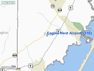
| Eagles Nest Airport |
| IATA: none – ICAO: none – FAA LID: 31E |
| Summary |
| Airport type |
Privately-owned, public-use |
| Owner |
Kummings Eagles Airport Inc |
| Location |
West Creek, New Jersey |
| Elevation AMSL |
535 ft / 11 m |
| Coordinates |
39°39′55.4″N 74°18′28.5″W / 39.665389°N 74.307917°W / 39.665389; -74.307917 |
| Runways |
| Direction |
Length |
Surface |
| ft |
m |
| 14/32 |
3200 |
975 |
Asphalt |
| Statistics (2009) |
| Aircraft operations |
300 |
| Based aircraft |
3 |
| Source: Federal Aviation Administration |
This article is about an airport in New Jersey.For other uses, see Eagles Nest Airport.
Eagles Nest Airport (FAA LID: 31E) is a privately-owned public-use airport serving general aviation aircraft. It was built in April 1989. It is located two nautical miles (3.704 km) north of the community of West Creek, in Eagleswood Township, New Jersey.
An accident occurred there in May 2008 involving a general aviation craft crash landing into the woods a few hundred feet way from the runway.
The above content comes from Wikipedia and is published under free licenses – click here to read more.
Location & QuickFacts
| FAA Information Effective: | 2008-09-25 |
| Airport Identifier: | 31E |
| Airport Status: | Operational |
| Longitude/Latitude: | 074-18-28.5160W/39-39-55.4280N
-74.307921/39.665397 (Estimated) |
| Elevation: | 35 ft / 10.67 m (Estimated) |
| Land: | 80 acres |
| From nearest city: | 2 nautical miles N of West Creek, NJ |
| Location: | Ocean County, NJ |
| Magnetic Variation: | 12W (1985) |
Owner & Manager
| Ownership: | Privately owned |
| Owner: | Kummings Eagles Airport Inc |
| Address: | 122 Hemsley Pl
Northfield, NJ 08225 |
| Phone number: | 609-641-5822 |
| Manager: | Diane Kummings |
| Address: | 301 Forge Road
West Creek, NJ 08092 |
| Phone number: | 609-296-8432 |
Airport Operations and Facilities
| Airport Use: | Open to public |
| Wind indicator: | Yes |
| Segmented Circle: | No |
| Control Tower: | No |
| Landing fee charge: | No |
| Sectional chart: | Washington |
| Region: | AEA - Eastern |
| Boundary ARTCC: | ZNY - New York |
| Tie-in FSS: | MIV - Millville |
| FSS on Airport: | No |
| FSS Toll Free: | 1-800-WX-BRIEF |
| NOTAMs Facility: | MIV (NOTAM-d service avaliable) |
Airport Communications
Airport Services
| Airframe Repair: | NONE |
| Power Plant Repair: | NONE |
Runway Information
Runway 14/32
| Dimension: | 3200 x 60 ft / 975.4 x 18.3 m |
| Surface: | ASPH, Good Condition |
| |
Runway 14 |
Runway 32 |
| Traffic Pattern: | Left | Left |
| Markings: | Non-precision instrument, Good Condition | Non-precision instrument, Good Condition |
| Obstruction: | 54 ft tree, 520.0 ft from runway, 130 ft left of centerline, 5:1 slope to clear | 63 ft tree, 535.0 ft from runway, 50 ft right of centerline, 5:1 slope to clear
RY 32 70 FT HIGH TREELINE CROSSING EXTENDED CNTRLN BEGINNING 450 FT FM THLD. |
|
Radio Navigation Aids
| ID |
Type |
Name |
Ch |
Freq |
Var |
Dist |
| NEL | NDB | Lakehurst | | 396.00 | 13W | 22.8 nm |
| RNB | NDB | Rainbow | | 363.00 | 11W | 41.1 nm |
| NXX | NDB | Willow Grove | | 388.00 | 12W | 49.8 nm |
| NEL | TACAN | Lakehurst | 055X | | 11W | 22.4 nm |
| NEL | UHF/NDB | Lakehurst | | 274.80 | 13W | 22.8 nm |
| PNE | VOR | North Philadelphia | | 112.00 | 10W | 40.9 nm |
| COL | VOR/DME | Colts Neck | 101X | 115.40 | 11W | 39.4 nm |
| ARD | VOR/DME | Yardley | 019X | 108.20 | 10W | 44.9 nm |
| CYN | VORTAC | Coyle | 081X | 113.40 | 10W | 10.8 nm |
| ACY | VORTAC | Atlantic City | 023X | 108.60 | 10W | 17.7 nm |
| GXU | VORTAC | Mc Guire | 043X | 110.60 | 11W | 24.6 nm |
| VCN | VORTAC | Cedar Lake | 099X | 115.20 | 10W | 31.5 nm |
| RBV | VORTAC | Robbinsville | 085X | 113.80 | 10W | 33.4 nm |
| SIE | VORTAC | Sea Isle | 095X | 114.80 | 09W | 41.2 nm |
| OOD | VORTAC | Woodstown | 075X | 112.80 | 10W | 46.1 nm |
| PHL | VOT | Philadelphia Intl | | 109.80 | | 45.0 nm |
Remarks
- NO RY LIGHTS. NIGHT TAKEOFFS AND LANDINGS PROHIBITED.
- REMOTE CTL ACFT OPER ADJ TO RY.
- VFR USE ONLY
Images and information placed above are from
http://www.airport-data.com/airport/31E/
We thank them for the data!
| General Info
|
| Country |
United States
|
| State |
NEW JERSEY
|
| FAA ID |
31E
|
| Latitude |
39-39-55.428N
|
| Longitude |
074-18-28.516W
|
| Elevation |
35 feet
|
| Near City |
WEST CREEK
|
We don't guarantee the information is fresh and accurate. The data may
be wrong or outdated.
For more up-to-date information please refer to other sources.
|
|


