 |
|
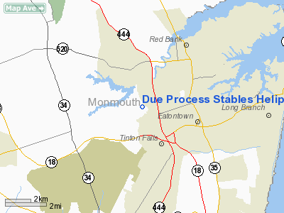
Due Process Stables Heliport |
Location & QuickFacts
| FAA Information Effective: | 2008-09-25 |
| Airport Identifier: | 59NJ |
| Airport Status: | Operational |
| Longitude/Latitude: | 074-06-28.5070W/40-18-16.3980N
-74.107919/40.304555 (Estimated) |
| Elevation: | 75 ft / 22.86 m (Estimated) |
| Land: | 2 acres |
| From nearest city: | 5 nautical miles NW of Colts Neck, NJ |
| Location: | Monmouth County, NJ |
| Magnetic Variation: | 12W (1985) |
Owner & Manager
| Ownership: | Privately owned |
| Owner: | Due Process Stables |
| Address: | 264 Highway 537e
Colts Neck, NJ 07722 |
| Phone number: | 201-542-0317 |
| Manager: | Jim Robinson, Pab Aviation |
| Address: | Po Box 2487 Allaire Apt
Farmingdale, NJ 97727 |
| Phone number: | 908-938-4821 |
Airport Operations and Facilities
| Airport Use: | Private |
| Wind indicator: | Yes |
| Segmented Circle: | No |
| Control Tower: | No |
| Landing fee charge: | No |
| Sectional chart: | New York |
| Region: | AEA - Eastern |
| Boundary ARTCC: | ZNY - New York |
| Tie-in FSS: | MIV - Millville |
| FSS on Airport: | No |
| FSS Toll Free: | 1-800-WX-BRIEF |
Airport Communications
Runway Information
Helipad H1
| Dimension: | 250 x 250 ft / 76.2 x 76.2 m |
| Surface: | TURF,
STEEL PLANKING. |
| |
Runway H1 |
Runway |
| Traffic Pattern: | Left | Left |
|
Radio Navigation Aids
| ID |
Type |
Name |
Ch |
Freq |
Var |
Dist |
| EWR | FAN MARKER | Maryann | | | 11W | 24.2 nm |
| NEL | NDB | Lakehurst | | 396.00 | 13W | 18.8 nm |
| OGY | NDB | Bridge | | 414.00 | 12W | 18.9 nm |
| CAT | NDB | Chatham | | 254.00 | 11W | 30.1 nm |
| PNJ | NDB | Paterson | | 347.00 | 12W | 38.6 nm |
| BBN | NDB | Babylon | | 275.00 | 14W | 39.8 nm |
| DYL | NDB | Doylestown | | 237.00 | 10W | 46.5 nm |
| NXX | NDB | Willow Grove | | 388.00 | 12W | 48.1 nm |
| NEL | TACAN | Lakehurst | 055X | | 11W | 19.6 nm |
| NXX | TACAN | Willow Grove | 061X | | 10W | 48.1 nm |
| NEL | UHF/NDB | Lakehurst | | 274.80 | 13W | 18.8 nm |
| PNE | VOR | North Philadelphia | | 112.00 | 10W | 43.5 nm |
| COL | VOR/DME | Colts Neck | 101X | 115.40 | 11W | 2.4 nm |
| CRI | VOR/DME | Canarsie | 070X | 112.30 | 11W | 20.9 nm |
| JFK | VOR/DME | Kennedy | 106X | 115.90 | 12W | 25.0 nm |
| LGA | VOR/DME | La Guardia | 078X | 113.10 | 12W | 30.9 nm |
| TEB | VOR/DME | Teterboro | 021X | 108.40 | 11W | 32.8 nm |
| SBJ | VOR/DME | Solberg | 076X | 112.90 | 10W | 33.5 nm |
| ARD | VOR/DME | Yardley | 019X | 108.20 | 10W | 36.8 nm |
| BWZ | VOR/DME | Broadway | 089X | 114.20 | 11W | 44.1 nm |
| DPK | VOR/DME | Deer Park | 124X | 117.70 | 12W | 47.0 nm |
| RBV | VORTAC | Robbinsville | 085X | 113.80 | 10W | 18.8 nm |
| GXU | VORTAC | Mc Guire | 043X | 110.60 | 11W | 28.6 nm |
| CYN | VORTAC | Coyle | 081X | 113.40 | 10W | 32.9 nm |
| SAX | VORTAC | Sparta | 104X | 115.70 | 11W | 49.9 nm |
| JFK | VOT | Kennedy | | 115.10 | | 24.9 nm |
Images and information placed above are from
http://www.airport-data.com/airport/59NJ/
We thank them for the data!
| General Info
|
| Country |
United States
|
| State |
NEW JERSEY
|
| FAA ID |
59NJ
|
| Latitude |
40-18-16.398N
|
| Longitude |
074-06-28.507W
|
| Elevation |
75 feet
|
| Near City |
COLTS NECK
|
We don't guarantee the information is fresh and accurate. The data may
be wrong or outdated.
For more up-to-date information please refer to other sources.
|
|


