 |
|
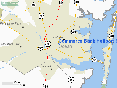
Location & QuickFacts
| FAA Information Effective: | 2008-09-25 |
| Airport Identifier: | JY19 |
| Airport Status: | Operational |
| Longitude/Latitude: | 074-10-56.0000W/39-58-24.0000N
-74.182222/39.973333 (Estimated) |
| Elevation: | 70 ft / 21.34 m (Estimated) |
| Land: | 0 acres |
| From nearest city: | 2 nautical miles N of Toms River, NJ |
| Location: | Ocean County, NJ |
| Magnetic Variation: | 13W (1995) |
Owner & Manager
| Ownership: | Privately owned |
| Owner: | Commerce Bank |
| Address: | 1101 Hooper Ave
Toms River, NJ 08753 |
| Phone number: | 609-751-9000 |
| Manager: | Parker Renelt |
| Address: | 1101 Hooper Ave
Toms River, NJ 08753 |
| Phone number: | 609-751-9000 |
Airport Operations and Facilities
| Airport Use: | Private |
| Wind indicator: | Yes |
| Segmented Circle: | No |
| Control Tower: | No |
| Sectional chart: | Washington |
| Region: | AEA - Eastern |
| Boundary ARTCC: | ZNY - New York |
| Tie-in FSS: | MIV - Millville |
| FSS Toll Free: | 1-800-WX-BRIEF |
Runway Information
Helipad H1
| Dimension: | 65 x 65 ft / 19.8 x 19.8 m |
| Surface: | CONC, |
| |
Runway H1 |
Runway |
| Traffic Pattern: | Left | Left |
|
Radio Navigation Aids
| ID |
Type |
Name |
Ch |
Freq |
Var |
Dist |
| EWR | FAN MARKER | Maryann | | | 11W | 43.9 nm |
| NEL | NDB | Lakehurst | | 396.00 | 13W | 8.3 nm |
| OGY | NDB | Bridge | | 414.00 | 12W | 38.3 nm |
| NXX | NDB | Willow Grove | | 388.00 | 12W | 46.2 nm |
| CAT | NDB | Chatham | | 254.00 | 11W | 47.5 nm |
| DYL | NDB | Doylestown | | 237.00 | 10W | 48.4 nm |
| NEL | TACAN | Lakehurst | 055X | | 11W | 8.7 nm |
| NXX | TACAN | Willow Grove | 061X | | 10W | 46.3 nm |
| NEL | UHF/NDB | Lakehurst | | 274.80 | 13W | 8.3 nm |
| PNE | VOR | North Philadelphia | | 112.00 | 10W | 38.6 nm |
| COL | VOR/DME | Colts Neck | 101X | 115.40 | 11W | 20.4 nm |
| ARD | VOR/DME | Yardley | 019X | 108.20 | 10W | 37.4 nm |
| CRI | VOR/DME | Canarsie | 070X | 112.30 | 11W | 40.6 nm |
| JFK | VOR/DME | Kennedy | 106X | 115.90 | 12W | 43.9 nm |
| SBJ | VOR/DME | Solberg | 076X | 112.90 | 10W | 44.7 nm |
| CYN | VORTAC | Coyle | 081X | 113.40 | 10W | 14.8 nm |
| GXU | VORTAC | Mc Guire | 043X | 110.60 | 11W | 19.2 nm |
| RBV | VORTAC | Robbinsville | 085X | 113.80 | 10W | 19.9 nm |
| ACY | VORTAC | Atlantic City | 023X | 108.60 | 10W | 36.0 nm |
| VCN | VORTAC | Cedar Lake | 099X | 115.20 | 10W | 44.7 nm |
| JFK | VOT | Kennedy | | 115.10 | | 43.8 nm |
| PHL | VOT | Philadelphia Intl | | 109.80 | | 49.4 nm |
Remarks
- DAY,VFR ONLY; CLEAR 8:1 BE MAINTAINED FOR APCH/DEP PATH; INGRESS/EGRESS FM EAST & WEST; MARK OVERHEAD WIRES OR PLACE UNDERGROUND.
Images and information placed above are from
http://www.airport-data.com/airport/JY19/
We thank them for the data!
| General Info
|
| Country |
United States
|
| State |
NEW JERSEY
|
| FAA ID |
JY19
|
| Latitude |
39-58-24.000N
|
| Longitude |
074-10-56.000W
|
| Elevation |
70 feet
|
| Near City |
TOMS RIVER
|
We don't guarantee the information is fresh and accurate. The data may
be wrong or outdated.
For more up-to-date information please refer to other sources.
|
|


