|
|
Cape May Airport
Cape May County Airport |
 |
| FAA runway diagram |
| IATA: WWD – ICAO: KWWD – FAA LID: WWD |
| Summary |
| Airport type |
Public |
| Owner |
Delaware River and Bay Authority |
| Serves |
Wildwood, New Jersey |
| Location |
Lower Township, New Jersey |
| Elevation AMSL |
23 ft / 7 m |
| Coordinates |
39°00′31″N 074°54′30″W / 39.00861°N 74.90833°W / 39.00861; -74.90833 |
| Website |
www.CapeMayAirport.com |
| Runways |
| Direction |
Length |
Surface |
| ft |
m |
| 1/19 |
4,998 |
1,523 |
Asphalt |
| 10/28 |
4,998 |
1,523 |
Asphalt |
| Statistics (2007) |
| Aircraft operations |
35,051 |
| Based aircraft |
80 |
| Source: Federal Aviation Administration |
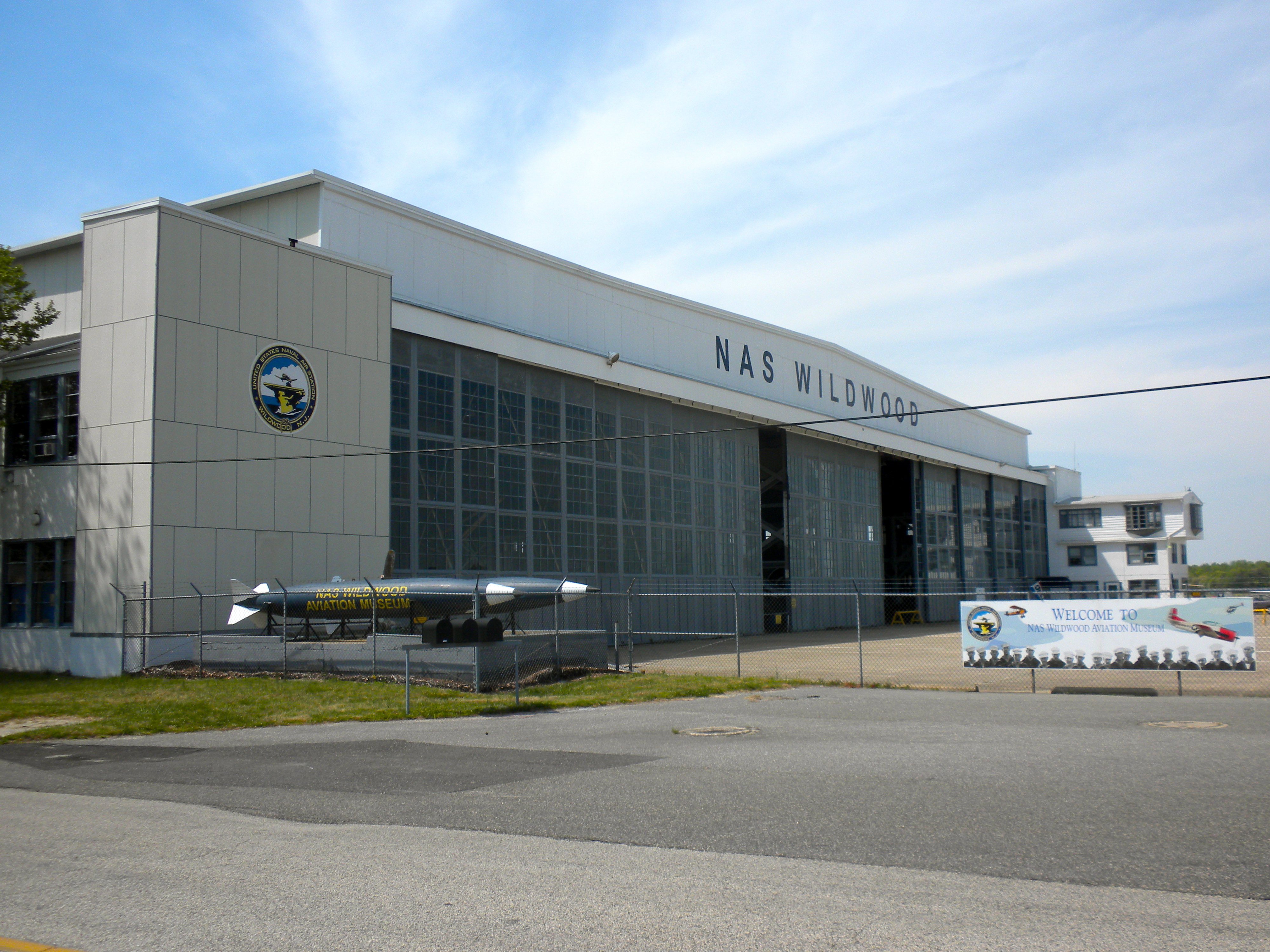
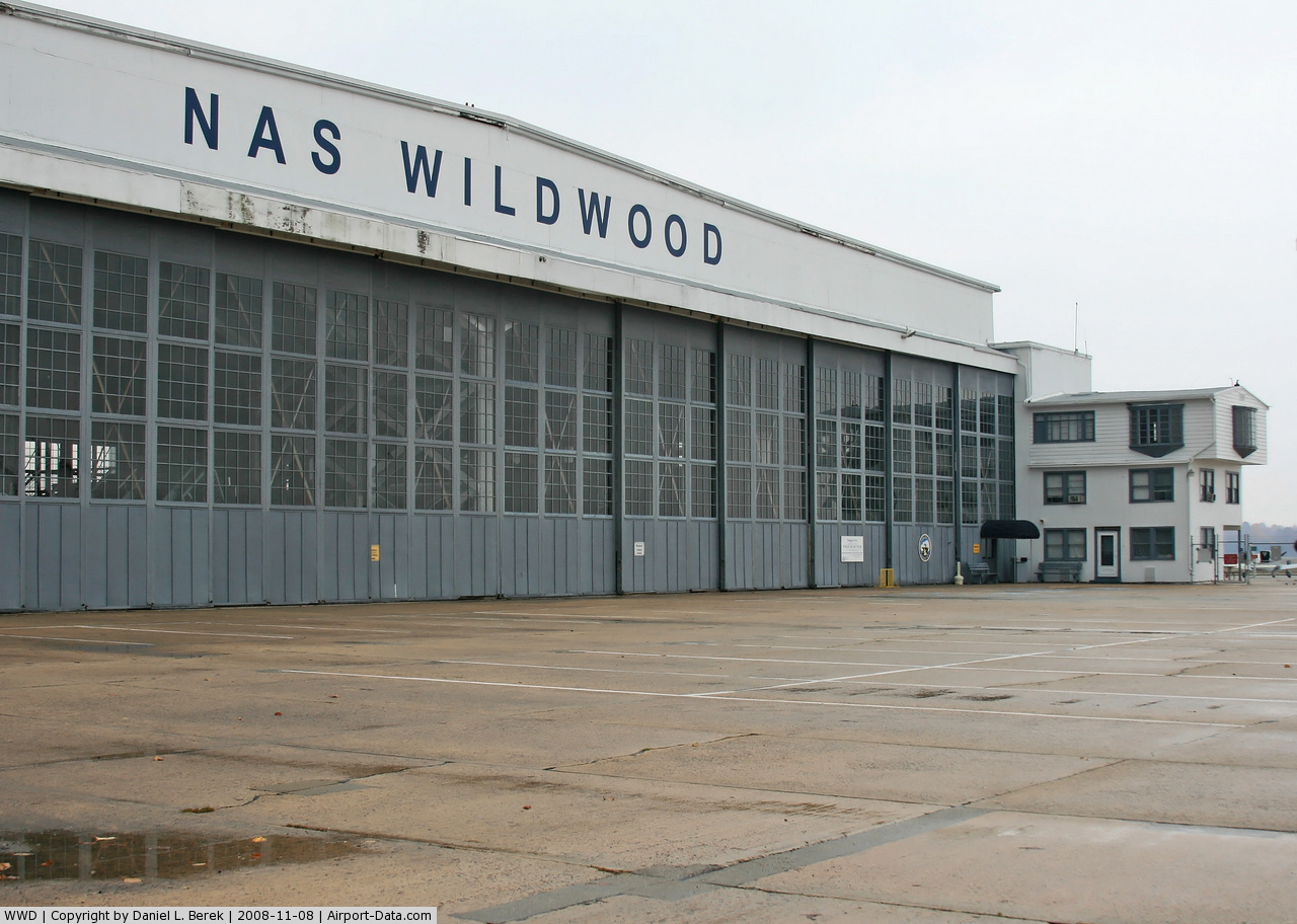
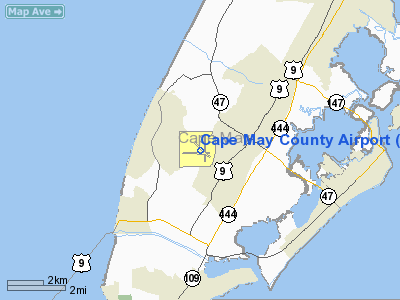
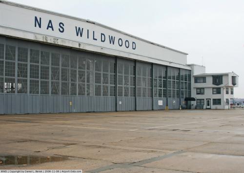
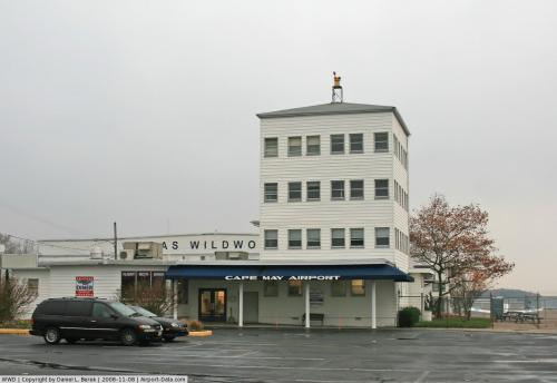
Cape May Airport (IATA: WWD, ICAO: KWWD, FAA LID: WWD), also known as Cape May County Airport, is a public airport located in Lower Township, New Jersey, United States, about four miles (6 km) northwest of the central business district of Wildwood, a city in Cape May County, New Jersey, United States. This general aviation airport, located on Breakwater Road, serves Cape May County and is operated by the Delaware River and Bay Authority. Hangar #1 contains the Naval Air Station Wildwood Aviation Museum, whose collection focuses on World War II History
 | |
Hangar No. 1, on the National register of Historic Places. |
The airport started in 1941 as NAS Rio Grande, named for its location near Rio Grande, New Jersey. Due to confusion with Rio Grande, Texas, the name was changed in NAS Wildwood in 1942. Then it became a civilian airport which is still in operation today known as Cape May County Airport.
Facilities
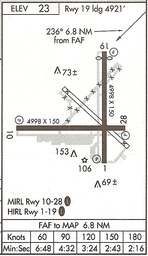
Cape May County Airport covers an area of 996 acres (403 ha) which contains two asphalt paved runways designated 1/19 and 10/28, each measuring 4,998 x 150 ft. (1,523 x 46 m).
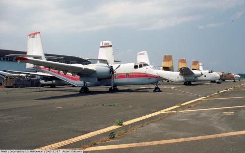
In a 12-month period ending October 31, 2008, the airport had 35,050 aircraft operations, an average of 96 per day: 29% local general aviation, 71% transient general aviation, >1% military, and >1% ultralight. There are 157 aircraft based at this airport: 36% single engine aircraft, 13% multi-engine aircraft, .006% jet, and .006% ultralight.
On-field services include parking, aircraft rental, 100LL gas, jet fuel, Big Sky Aviation Flight School and the Fight Deck Diner. Locations off-field include Cape May National Golf Course (2 miles), Lobster House Restaurant (3 miles) and the Wetlands Institute (10 miles).
Accidents and incidents
On December 12, 1976, an Atlantic City Airlines DeHavilland Twin Otter operating as Allegheny Commuter Flight 977 crashed short of the runway. Of the two crew members, one died and one sustained serious injuries. Of the passengers, 2 died and 6 sustained serious injuries. One seriously-injured passenger died one month after the accident, but was counted as a survivor by the National Transportation Safety Board report because it defined fatalities as individuals who died within 7 days of the accident.
The above content comes from Wikipedia and is published under free licenses – click here to read more.
 |
(Click on the photo to enlarge) |
 |
(Click on the photo to enlarge) |
 |
(Click on the photo to enlarge) |
Location & QuickFacts
| FAA Information Effective: | 2008-09-25 |
| Airport Identifier: | WWD |
| Airport Status: | Operational |
| Longitude/Latitude: | 074-54-29.7860W/39-00-30.6250N
-74.908274/39.008507 (Estimated) |
| Elevation: | 23 ft / 7.01 m (Surveyed) |
| Land: | 996 acres |
| From nearest city: | 4 nautical miles NW of Wildwood, NJ |
| Location: | Cape May County, NJ |
| Magnetic Variation: | 10W (1980) |
Owner & Manager
| Ownership: | Publicly owned |
| Owner: | Delaware River Bay Authority
LEASEE. PROPERY OWNED BY CAPE MAY COUNTY PO BOX 365 CAPE MAY COURT HOUSE, N.J. 08210. 609-886-0901. |
| Address: | Po Box 71
New Castle, DE 19720 |
| Phone number: | 302-571-6474 |
| Manager: | Thomas Berry |
| Address: | 507 Terminal Drive Bldg #102
Rio Grande, NJ 08242 |
| Phone number: | 609-886-8652 |
Airport Operations and Facilities
| Airport Use: | Open to public |
| Wind indicator: | Yes |
| Segmented Circle: | Yes |
| Control Tower: | No |
| Lighting Schedule: | DUSK-DAWN
ACTVT HIRL RY 01/19; MIRL RY 10/28 - CTAF. |
| Beacon Color: | Clear-Green (lighted land airport) |
| Landing fee charge: | No |
| Sectional chart: | Washington |
| Region: | AEA - Eastern |
| Boundary ARTCC: | ZDC - Washington |
| Tie-in FSS: | IPT - Williamsport |
| FSS on Airport: | No |
| FSS Toll Free: | 1-800-WX-BRIEF |
| NOTAMs Facility: | WWD (NOTAM-d service avaliable) |
| Federal Agreements: | NGRY3 |
Airport Communications
| CTAF: | 122.700 |
| Unicom: | 122.700 |
Airport Services
| Fuel available: | 100LLA |
| Airframe Repair: | MAJOR |
| Power Plant Repair: | MAJOR |
Runway Information
Runway 01/19
| Dimension: | 4998 x 150 ft / 1523.4 x 45.7 m |
| Surface: | ASPH, Good Condition |
| Weight Limit: | Single wheel: 45000 lbs.
Dual wheel: 75000 lbs.
Dual tandem wheel: 120000 lbs. |
| Edge Lights: | High |
| |
Runway 01 |
Runway 19 |
| Longitude: | 074-54-20.2830W | 074-54-20.7060W |
| Latitude: | 39-00-10.6700N | 39-01-00.0720N |
| Elevation: | 23.00 ft | 16.00 ft |
| Alignment: | 127 | 127 |
| ILS Type: | | LOCALIZER
|
| Traffic Pattern: | Left | Left |
| Markings: | Non-precision instrument, Good Condition | Non-precision instrument, Good Condition |
| Crossing Height: | 45.00 ft | 59.00 ft |
| Displaced threshold: | 0.00 ft | 77.00 ft |
| VASI: | 4-light PAPI on left side | 4-light PAPI on left side |
| Visual Glide Angle: | 3.00° | 3.00° |
| Obstruction: | 55 ft tree, 1140.0 ft from runway, 130 ft left of centerline, 17:1 slope to clear | 13 ft road, 260.0 ft from runway, 4:1 slope to clear
RY 19 APCH RATIO TO DSPLCD THLD 22:1. |
| Decleard distances: | Take off run available 4998.00 ft
Take off distance available 4998.00 ft
Actual stop distance available 4998.00 ft
Landing distance available 4998.00 ft
| Take off run available 4998.00 ft
Take off distance available 4998.00 ft
Actual stop distance available 4998.00 ft
Landing distance available 4921.00 ft
|
|
Runway 10/28
| Dimension: | 4998 x 150 ft / 1523.4 x 45.7 m |
| Surface: | ASPH, Good Condition |
| Weight Limit: | Single wheel: 45000 lbs.
Dual wheel: 75000 lbs.
Dual tandem wheel: 120000 lbs. |
| Edge Lights: | Non-standard lighting system |
| |
Runway 10 |
Runway 28 |
| Longitude: | 074-55-12.9750W | 074-54-09.6580W |
| Latitude: | 39-00-25.6980N | 39-00-26.0410N |
| Elevation: | 17.00 ft | 20.00 ft |
| Alignment: | 90 | 127 |
| Traffic Pattern: | Left | Left |
| Markings: | Non-precision instrument, Good Condition | Nonstandard, Good Condition
RY 28 NSTD BASIC MKGS; NO THLD PAVEMENT STRIPES. |
| Crossing Height: | 45.00 ft | 45.00 ft |
| VASI: | 4-light PAPI on left side | 4-light PAPI on left side |
| Visual Glide Angle: | 3.00° | 3.00° |
| Obstruction: | 80 ft trees, 2000.0 ft from runway, 22:1 slope to clear | 297 ft tower, 9290.0 ft from runway, 660 ft right of centerline, 30:1 slope to clear |
| Decleard distances: | Take off run available 4998.00 ft
Take off distance available 4998.00 ft
Actual stop distance available 4998.00 ft
Landing distance available 4998.00 ft
| Take off run available 4998.00 ft
Take off distance available 4998.00 ft
Actual stop distance available 4998.00 ft
Landing distance available 4998.00 ft
|
|
Radio Navigation Aids
| ID |
Type |
Name |
Ch |
Freq |
Var |
Dist |
| RNB | NDB | Rainbow | | 363.00 | 11W | 26.8 nm |
| OX | NDB | Landy | | 407.00 | 12W | 41.1 nm |
| DOV | TACAN | Dover | 037X | | 09W | 27.1 nm |
| ATR | VOR/DME | Waterloo | 073X | 112.60 | 09W | 18.5 nm |
| SIE | VORTAC | Sea Isle | 095X | 114.80 | 09W | 7.3 nm |
| ACY | VORTAC | Atlantic City | 023X | 108.60 | 10W | 31.0 nm |
| ENO | VORTAC | Smyrna | 051X | 111.40 | 09W | 31.4 nm |
| VCN | VORTAC | Cedar Lake | 099X | 115.20 | 10W | 31.9 nm |
| OOD | VORTAC | Woodstown | 075X | 112.80 | 10W | 41.9 nm |
| SBY | VORTAC | Salisbury | 049X | 111.20 | 12W | 48.9 nm |
Remarks
- BIRDS ON & INVOF ARPT.
- PAEW WITHIN THE SAFETY AREAS OF ALL RYS AND TWYS DAILY MAY THRU OCT.
- TWY B EDGE LIGHTING IS NSTD, 15 FT FM PAVEMENT EDGE.
- TWY B SOUTH OF TWY A CAN ONLY BE USED BY ACFT WITH WINGSPANS LESS THAN 79 FT.
- APCHS TO RWYS 19 & 28 OBSCURED FM ONE ANOTHER DUE TO TREES.
- EXISTED BEFORE FAR 157 RQRMT.
Images and information placed above are from
http://www.airport-data.com/airport/WWD/
We thank them for the data!
| General Info
|
| Country |
United States
|
| State |
NEW JERSEY
|
| FAA ID |
WWD
|
| Latitude |
39-00-30.625N
|
| Longitude |
074-54-29.786W
|
| Elevation |
23 feet
|
| Near City |
WILDWOOD
|
We don't guarantee the information is fresh and accurate. The data may
be wrong or outdated.
For more up-to-date information please refer to other sources.
|
|