|
|
| Blairstown Airport |
 |
| IATA: none – ICAO: none – FAA LID: 1N7 |
| Summary |
| Airport type |
Public-use |
| Owner |
J.D. Air Inc. |
| Operator |
Dennis Kiernan |
| Serves |
Blairstown, New Jersey |
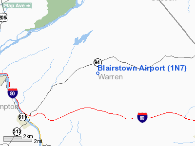
| Location |
Warren County, New Jersey |
| Elevation AMSL |
372 ft / 113 m |
| Coordinates |
40°58′16″N 074°59′51″W / 40.97111°N 74.9975°W / 40.97111; -74.9975 |
| Website |
Blairstown Airport |
| Runways |
| Direction |
Length |
Surface |
| ft |
m |
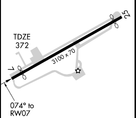
| 7/25 |
3,100 |
945 |
Asphalt |
| Statistics (2008) |
| Aircraft operations |
19,790 |
| Based aircraft |
102 |
| Source: Federal Aviation Administration |
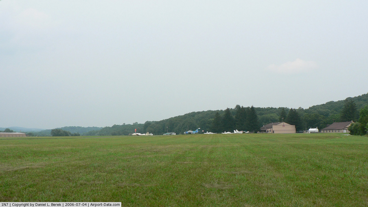
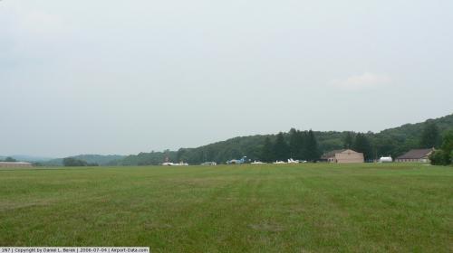
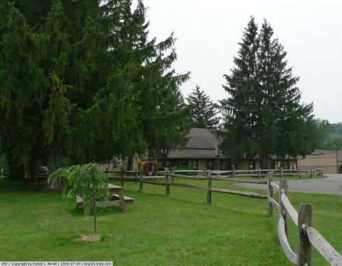
Blairstown Airport (FAA LID: 1N7) is a public-use airport located two nautical miles (3.7 km) southwest of the central business district of Blairstown, Warren County, New Jersey, United States. It is privately owned by J.D. Air Inc. Blairstown is located in the Lehigh Valley, 5 miles (8.0 km) from the Delaware Water Gap and 65 miles (105 km) from New York City. A gliding operator, Yards Creek Soaring, is located on the field. Facilities and aircraft
Blairstown Airport covers an area of 151 acres (61 ha) at an elevation of 372 ft (113 m) and contains one runway designated 7/25 with an asphalt surface measuring 3,100 x 70 ft (945 x 21 m). For the 12-month period ending December 31, 2008, the airport had 19,790 general aviation aircraft operations, an average of 54 per day. At that time there were 102 aircraft based at this airport: 58% single-engine, 7% multi-engine, 1% helicopter and 34% glider.
Services available on field include 100LL fuel, major airframe service, major powerplant service, tie-downs, hangers, parking and glider operation. There are several shops and a supermarket located about 1 mile (1.6 km) north of the airport.
Terminal procedures (Instrument Approach Procedures)
- GPS RWY 07
- GPS RWY 25
- VOR RWY 25
The above content comes from Wikipedia and is published under free licenses – click here to read more.
 |
(Click on the photo to enlarge) |
 |
(Click on the photo to enlarge) |
Location & QuickFacts
| FAA Information Effective: | 2008-09-25 |
| Airport Identifier: | 1N7 |
| Airport Status: | Operational |
| Longitude/Latitude: | 074-59-50.9000W/40-58-16.1000N
-74.997472/40.971139 (Estimated) |
| Elevation: | 372 ft / 113.39 m (Surveyed) |
| Land: | 151 acres |
| From nearest city: | 2 nautical miles SW of Blairstown, NJ |
| Location: | Warren County, NJ |
| Magnetic Variation: | 13W (1995) |
Owner & Manager
| Ownership: | Privately owned |
| Owner: | J.d. Air Inc. |
| Address: | 85 Frederick St.
Hackensack, NJ 07601 |
| Phone number: | 201-342-6895 |
| Manager: | Dennis Kiernan |
| Address: | 36 Lambert Rd.
Blairstown, NJ 07825 |
| Phone number: | 908-362-8965 |
Airport Operations and Facilities
| Airport Use: | Open to public |
| Wind indicator: | Yes |
| Segmented Circle: | No |
| Control Tower: | No |
| Lighting Schedule: | DUSK-DAWN
ACTVT MIRL RY 07/25-CTAF. |
| Beacon Color: | Clear-Green (lighted land airport) |
| Landing fee charge: | No |
| Sectional chart: | New York |
| Region: | AEA - Eastern |
| Traffic Pattern Alt: | 1030 ft |
| Boundary ARTCC: | ZNY - New York |
| Tie-in FSS: | MIV - Millville |
| FSS on Airport: | No |
| FSS Toll Free: | 1-800-WX-BRIEF |
| NOTAMs Facility: | MIV (NOTAM-d service avaliable) |
| Federal Agreements: | N |
Airport Communications
| CTAF: | 123.000 |
| Unicom: | 123.000 |
Airport Services
| Fuel available: | 100LL
24 HOUR SELF SERVICE |
| Airframe Repair: | MAJOR |
| Power Plant Repair: | MAJOR |
| Bottled Oxygen: | NONE |
| Bulk Oxygen: | LOW |
Runway Information
Runway 07/25
| Dimension: | 3100 x 70 ft / 944.9 x 21.3 m |
| Surface: | ASPH, Good Condition |
| Edge Lights: | Medium |
| |
Runway 07 |
Runway 25 |
| Longitude: | 075-00-08.5390W | 074-59-33.2820W |
| Latitude: | 40-58-08.6360N | 40-58-23.6110N |
| Elevation: | 367.00 ft | 372.00 ft |
| Alignment: | 61 | 127 |
| Traffic Pattern: | Left | Left |
| Markings: | Non-precision instrument, Good Condition
RWY 07 MARKINGS FADED. | Non-precision instrument, Good Condition
RWY 25 MARKINGS FADED. |
| Displaced threshold: | 296.00 ft | 246.00 ft |
| Runway End Identifier: | No | No |
| Centerline Lights: | No | No |
| Touchdown Lights: | No | No |
| Obstruction: | 74 ft trees, 220.0 ft from runway, 190 ft right of centerline
RY 07 APCH RATIO 0:1 TO THE DSPLCD THLD.
RY 07 HAS +95 FT TREE, 16 FT FROM RY END, 227 FT L. | 23 ft trees, 207.0 ft from runway, 31 ft right of centerline
RY 25 APCH RATIO 0:1 TO THE DSPLCD THLD.
RY 25 HAS +28 FT TREE, 17 FT FM RWY END, 152 FT R. |
|
Radio Navigation Aids
| ID |
Type |
Name |
Ch |
Freq |
Var |
Dist |
| EWR | FAN MARKER | Maryann | | | 11W | 40.2 nm |
| CAT | NDB | Chatham | | 254.00 | 11W | 29.3 nm |
| UKT | NDB | Quakertown | | 208.00 | 12W | 35.6 nm |
| LQX | NDB | Carbon | | 339.00 | 12W | 35.9 nm |
| PNJ | NDB | Paterson | | 347.00 | 12W | 38.5 nm |
| DYL | NDB | Doylestown | | 237.00 | 10W | 38.6 nm |
| CYE | NDB | Crystal Lake | | 410.00 | 11W | 40.4 nm |
| HXM | NDB | Humbolt | | 366.00 | 10W | 45.4 nm |
| SW | NDB | Neely | | 335.00 | 14W | 46.6 nm |
| NXX | NDB | Willow Grove | | 388.00 | 12W | 47.5 nm |
| MS | NDB | Monga | | 359.00 | 12W | 48.2 nm |
| NXX | TACAN | Willow Grove | 061X | | 10W | 47.2 nm |
| STW | VOR/DME | Stillwater | 033X | 109.60 | 11W | 6.0 nm |
| BWZ | VOR/DME | Broadway | 089X | 114.20 | 11W | 13.1 nm |
| SBJ | VOR/DME | Solberg | 076X | 112.90 | 10W | 26.1 nm |
| HUO | VOR/DME | Huguenot | 108X | 116.10 | 11W | 32.1 nm |
| CKZ | VOR/DME | Pennridge | 025Y | 108.85 | 12W | 37.3 nm |
| ETX | VOR/DME | East Texas | 039X | 110.20 | 09W | 39.1 nm |
| TEB | VOR/DME | Teterboro | 021X | 108.40 | 11W | 43.1 nm |
| ARD | VOR/DME | Yardley | 019X | 108.20 | 10W | 43.3 nm |
| SAX | VORTAC | Sparta | 104X | 115.70 | 11W | 21.6 nm |
| FJC | VORTAC | Allentown | 122X | 117.50 | 10W | 25.5 nm |
| LVZ | VORTAC | Wilkes-barre | 053X | 111.60 | 10W | 36.2 nm |
| LHY | VORTAC | Lake Henry | 045X | 110.80 | 10W | 37.4 nm |
Remarks
- GLIDERS OPERATE FROM TURF AREA JUST SOUTH OF RWY 07/25.
- TREES IN THE 7:1 TRANSITIONAL AREA ALONG RUNWAY SIDES.
- HILL NORTHEAST OF ARPT MAY RQR PILOTS EXCT STEEP APCH TO RY 25.
- ESTAB PRIOR TO 1940.
Images and information placed above are from
http://www.airport-data.com/airport/1N7/
We thank them for the data!
| General Info
|
| Country |
United States
|
| State |
NEW JERSEY
|
| FAA ID |
1N7
|
| Latitude |
40-58-16.124N
|
| Longitude |
074-59-50.912W
|
| Elevation |
372 feet
|
| Near City |
BLAIRSTOWN
|
We don't guarantee the information is fresh and accurate. The data may
be wrong or outdated.
For more up-to-date information please refer to other sources.
|
|