 |
|
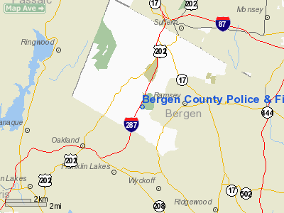
Bergen County Police & Fire Academy Heliport |
Location & QuickFacts
| FAA Information Effective: | 2008-09-25 |
| Airport Identifier: | 21NJ |
| Airport Status: | Operational |
| Longitude/Latitude: | 074-10-57.5220W/41-03-24.3470N
-74.182645/41.056763 (Estimated) |
| Elevation: | 600 ft / 182.88 m (Estimated) |
| Land: | 26 acres |
| From nearest city: | 3 nautical miles E of Mahwah, NJ |
| Location: | Bergen County, NJ |
| Magnetic Variation: | 13W (1985) |
Owner & Manager
| Ownership: | Publicly owned |
| Owner: | Bergen County |
| Address: | 281 Campgaw Rd
Mahwah, NJ 07430 |
| Phone number: | 201-818-7800 |
| Manager: | Ronald E. Calissi, Dir. |
| Address: | 281 Campgaw Rd
Mahwah, NJ 07430 |
| Phone number: | 201-818-7800 |
Airport Operations and Facilities
| Airport Use: | Private |
| Segmented Circle: | No |
| Control Tower: | No |
| Sectional chart: | New York |
| Region: | AEA - Eastern |
| Boundary ARTCC: | ZNY - New York |
| Tie-in FSS: | MIV - Millville |
| FSS on Airport: | No |
| FSS Toll Free: | 1-800-WX-BRIEF |
Runway Information
Helipad H1
| Dimension: | 200 x 150 ft / 61.0 x 45.7 m |
| Surface: | ASPH-TURF, |
| |
Runway H1 |
Runway |
| Traffic Pattern: | Left | Left |
|
Radio Navigation Aids
| ID |
Type |
Name |
Ch |
Freq |
Var |
Dist |
| EWR | FAN MARKER | Maryann | | | 11W | 21.3 nm |
| SKU | FAN MARKER | Stanwyck | | | 12W | 29.0 nm |
| PNJ | NDB | Paterson | | 347.00 | 12W | 6.8 nm |
| CAT | NDB | Chatham | | 254.00 | 11W | 22.1 nm |
| SW | NDB | Neely | | 335.00 | 14W | 25.9 nm |
| SKU | NDB | Stanwyck | | 261.00 | 12W | 29.0 nm |
| OGY | NDB | Bridge | | 414.00 | 12W | 32.4 nm |
| PO | NDB | Meier | | 403.00 | 12W | 32.7 nm |
| BBN | NDB | Babylon | | 275.00 | 14W | 43.0 nm |
| OP | NDB | Old Field Point Light | | 316.00 | 13W | 48.5 nm |
| TEB | VOR/DME | Teterboro | 021X | 108.40 | 11W | 13.6 nm |
| LGA | VOR/DME | La Guardia | 078X | 113.10 | 12W | 21.3 nm |
| HUO | VOR/DME | Huguenot | 108X | 116.10 | 11W | 28.1 nm |
| CRI | VOR/DME | Canarsie | 070X | 112.30 | 11W | 29.7 nm |
| CMK | VOR/DME | Carmel | 113X | 116.60 | 12W | 30.3 nm |
| STW | VOR/DME | Stillwater | 033X | 109.60 | 11W | 31.3 nm |
| JFK | VOR/DME | Kennedy | 106X | 115.90 | 12W | 31.6 nm |
| BWZ | VOR/DME | Broadway | 089X | 114.20 | 11W | 32.9 nm |
| SBJ | VOR/DME | Solberg | 076X | 112.90 | 10W | 38.2 nm |
| IGN | VOR/DME | Kingston | 123X | 117.60 | 12W | 40.0 nm |
| DPK | VOR/DME | Deer Park | 124X | 117.70 | 12W | 43.0 nm |
| COL | VOR/DME | Colts Neck | 101X | 115.40 | 11W | 44.8 nm |
| BDR | VOR/DME | Bridgeport | 25X | 108.80 | 12W | 48.3 nm |
| SAX | VORTAC | Sparta | 104X | 115.70 | 11W | 16.1 nm |
| JFK | VOT | Kennedy | | 115.10 | | 31.3 nm |
| BDR | VOT | Bridgeport | | 109.25 | | 48.3 nm |
Images and information placed above are from
http://www.airport-data.com/airport/21NJ/
We thank them for the data!
| General Info
|
| Country |
United States
|
| State |
NEW JERSEY
|
| FAA ID |
21NJ
|
| Latitude |
41-03-24.347N
|
| Longitude |
074-10-57.522W
|
| Elevation |
600 feet
|
| Near City |
MAHWAH
|
We don't guarantee the information is fresh and accurate. The data may
be wrong or outdated.
For more up-to-date information please refer to other sources.
|
|


