 |
|
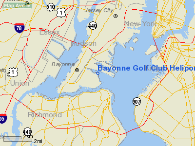
Bayonne Golf Club Heliport |
Location & QuickFacts
| FAA Information Effective: | 2008-09-25 |
| Airport Identifier: | 2NJ9 |
| Airport Status: | Operational |
| Longitude/Latitude: | 074-05-27.9000W/40-39-53.0000N
-74.091083/40.664722 (Estimated) |
| Elevation: | 9 ft / 2.74 m (Surveyed) |
| Land: | 0 acres |
| From nearest city: | 2 nautical miles E of Bayonne, NJ |
| Location: | Hudson County, NJ |
| Magnetic Variation: | () |
Owner & Manager
| Ownership: | Privately owned |
| Owner: | Empire Golf Properties, Llc |
| Address: | 475 Route 304
New York City, NY 10956 |
| Phone number: | 201-947-4100 |
| Manager: | Rinaldo M. D'argenio |
| Address: | 201 Sylvan Avenue
Englewood Cliffs, NJ 07632 |
| Phone number: | 207-947-4100 |
Airport Operations and Facilities
| Airport Use: | Private |
| Wind indicator: | Yes |
| Control Tower: | No |
| Sectional chart: | New York |
| Region: | AEA - Eastern |
| Boundary ARTCC: | ZNY - New York |
| Tie-in FSS: | MIV - Millville |
| FSS Toll Free: | 1-800-WX-BRIEF |
Runway Information
Helipad H1
| Dimension: | 30 x 30 ft / 9.1 x 9.1 m |
| Surface: | CONC, |
| |
Runway H1 |
Runway |
| Traffic Pattern: | Left | Left |
|
Radio Navigation Aids
| ID |
Type |
Name |
Ch |
Freq |
Var |
Dist |
| EWR | FAN MARKER | Maryann | | | 11W | 5.0 nm |
| OGY | NDB | Bridge | | 414.00 | 12W | 11.1 nm |
| CAT | NDB | Chatham | | 254.00 | 11W | 16.1 nm |
| PNJ | NDB | Paterson | | 347.00 | 12W | 17.2 nm |
| BBN | NDB | Babylon | | 275.00 | 14W | 32.2 nm |
| NEL | NDB | Lakehurst | | 396.00 | 13W | 38.9 nm |
| OP | NDB | Old Field Point Light | | 316.00 | 13W | 48.1 nm |
| SW | NDB | Neely | | 335.00 | 14W | 49.7 nm |
| NEL | TACAN | Lakehurst | 055X | | 11W | 39.6 nm |
| NEL | UHF/NDB | Lakehurst | | 274.80 | 13W | 38.9 nm |
| CRI | VOR/DME | Canarsie | 070X | 112.30 | 11W | 9.5 nm |
| TEB | VOR/DME | Teterboro | 021X | 108.40 | 11W | 11.1 nm |
| LGA | VOR/DME | La Guardia | 078X | 113.10 | 12W | 12.2 nm |
| JFK | VOR/DME | Kennedy | 106X | 115.90 | 12W | 14.7 nm |
| COL | VOR/DME | Colts Neck | 101X | 115.40 | 11W | 21.5 nm |
| SBJ | VOR/DME | Solberg | 076X | 112.90 | 10W | 30.1 nm |
| BWZ | VOR/DME | Broadway | 089X | 114.20 | 11W | 34.2 nm |
| DPK | VOR/DME | Deer Park | 124X | 117.70 | 12W | 36.7 nm |
| STW | VOR/DME | Stillwater | 033X | 109.60 | 11W | 40.6 nm |
| CMK | VOR/DME | Carmel | 113X | 116.60 | 12W | 43.6 nm |
| ARD | VOR/DME | Yardley | 019X | 108.20 | 10W | 44.8 nm |
| SAX | VORTAC | Sparta | 104X | 115.70 | 11W | 31.6 nm |
| RBV | VORTAC | Robbinsville | 085X | 113.80 | 10W | 33.4 nm |
| GXU | VORTAC | Mc Guire | 043X | 110.60 | 11W | 45.7 nm |
| JFK | VOT | Kennedy | | 115.10 | | 14.3 nm |
| ISP | VOT | Long Island Mac Arthur | | 109.40 | | 46.0 nm |
Remarks
- PRVDD VFR OPNS, PVT USE, AREA MARKED, AND WIND INDICATOR IS MAINTAINED.
Images and information placed above are from
http://www.airport-data.com/airport/2NJ9/
We thank them for the data!
|
|


