 |
|
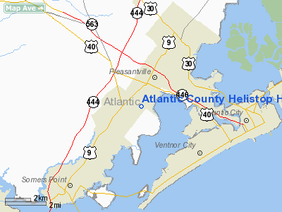
Atlantic County Helistop Heliport |
Location & QuickFacts
| FAA Information Effective: | 2008-09-25 |
| Airport Identifier: | 99NJ |
| Airport Status: | Operational |
| Longitude/Latitude: | 074-32-08.5530W/39-22-32.4190N
-74.535709/39.375672 (Estimated) |
| Elevation: | 12 ft / 3.66 m (Estimated) |
| Land: | 48 acres |
| From nearest city: | 1 nautical miles NE of Northfield, NJ |
| Location: | Atlantic County, NJ |
| Magnetic Variation: | 12W (1985) |
Owner & Manager
| Ownership: | Publicly owned |
| Owner: | County Of Atlantic |
| Address: | Rt 9 & Dolphin Avenue
Northfield, NJ 08225 |
| Phone number: | 609-645-7700 |
| Manager: | Glen Mawby, Dep Pub Wrk |
| Address: | Rt 9 & Dolphin Ave
Northfield, NJ 08225 |
| Phone number: | 609-645-7700 |
Airport Operations and Facilities
| Airport Use: | Private |
| Wind indicator: | Yes |
| Segmented Circle: | No |
| Control Tower: | No |
| Sectional chart: | Washington |
| Region: | AEA - Eastern |
| Boundary ARTCC: | ZDC - Washington |
| Tie-in FSS: | MIV - Millville |
| FSS Toll Free: | 1-800-WX-BRIEF |
Runway Information
Helipad H1
| Dimension: | 75 x 75 ft / 22.9 x 22.9 m |
| Surface: | TURF, |
| |
Runway H1 |
Runway |
| Traffic Pattern: | Left | Left |
|
Radio Navigation Aids
| ID |
Type |
Name |
Ch |
Freq |
Var |
Dist |
| RNB | NDB | Rainbow | | 363.00 | 11W | 28.0 nm |
| NEL | NDB | Lakehurst | | 396.00 | 13W | 41.3 nm |
| NEL | TACAN | Lakehurst | 055X | | 11W | 40.6 nm |
| DOV | TACAN | Dover | 037X | | 09W | 45.8 nm |
| NEL | UHF/NDB | Lakehurst | | 274.80 | 13W | 41.3 nm |
| PNE | VOR | North Philadelphia | | 112.00 | 10W | 47.8 nm |
| ATR | VOR/DME | Waterloo | 073X | 112.60 | 09W | 46.4 nm |
| ACY | VORTAC | Atlantic City | 023X | 108.60 | 10W | 5.2 nm |
| SIE | VORTAC | Sea Isle | 095X | 114.80 | 09W | 20.9 nm |
| VCN | VORTAC | Cedar Lake | 099X | 115.20 | 10W | 22.3 nm |
| CYN | VORTAC | Coyle | 081X | 113.40 | 10W | 27.0 nm |
| GXU | VORTAC | Mc Guire | 043X | 110.60 | 11W | 38.2 nm |
| OOD | VORTAC | Woodstown | 075X | 112.80 | 10W | 38.9 nm |
| ENO | VORTAC | Smyrna | 051X | 111.40 | 09W | 46.4 nm |
| RBV | VORTAC | Robbinsville | 085X | 113.80 | 10W | 49.7 nm |
| PHL | VOT | Philadelphia Intl | | 109.80 | | 44.3 nm |
Images and information placed above are from
http://www.airport-data.com/airport/99NJ/
We thank them for the data!
| General Info
|
| Country |
United States
|
| State |
NEW JERSEY
|
| FAA ID |
99NJ
|
| Latitude |
39-22-32.419N
|
| Longitude |
074-32-08.553W
|
| Elevation |
12 feet
|
| Near City |
NORTHFIELD
|
We don't guarantee the information is fresh and accurate. The data may
be wrong or outdated.
For more up-to-date information please refer to other sources.
|
|


