 |
|
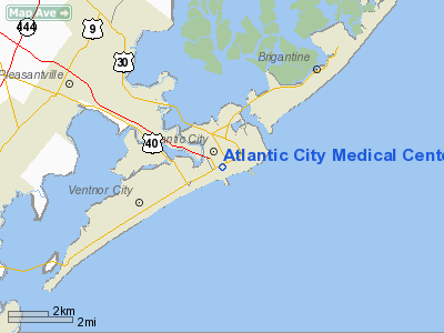
Atlantic City Medical Center Heliport |
Location & QuickFacts
| FAA Information Effective: | 2008-09-25 |
| Airport Identifier: | 0NJ0 |
| Airport Status: | Operational |
| Longitude/Latitude: | 074-26-04.0000W/39-21-31.0000N
-74.434444/39.358611 (Estimated) |
| Elevation: | 82 ft / 24.99 m (Estimated) |
| Land: | 0 acres |
| From nearest city: | 0 nautical miles N of Atlantic City, NJ |
| Location: | Atlantic County, NJ |
| Magnetic Variation: | 12W (1990) |
Owner & Manager
| Ownership: | Privately owned |
| Owner: | Atlantic Care Rgnl Medical Center |
| Address: | 1925 Pacific Ave
Atlantic City, NJ 08401 |
| Phone number: | 609-345-4000 |
| Manager: | Bill Kissinger
FOR TECHNICAL QUESTIONS CALL BILL DAVIS 800-540-0011 EXT 102. |
| Address: | 1925 Pacific Ave
Atlantic City, NJ 08401 |
| Phone number: | 609-441-8190 |
Airport Operations and Facilities
| Airport Use: | Private
MEDICAL USE. |
| Wind indicator: | Yes |
| Segmented Circle: | No |
| Control Tower: | No |
| Lighting Schedule: | PHONE REQ
FOR PERIMETER LGTS & BEACON CALL 609-272-6311. |
| Beacon Color: | Clear-Green-Yellow (heliport) |
| Sectional chart: | Washington |
| Region: | AEA - Eastern |
| Boundary ARTCC: | ZDC - Washington |
| Tie-in FSS: | MIV - Millville |
| FSS on Airport: | No |
| FSS Toll Free: | 1-800-WX-BRIEF |
Runway Information
Helipad H1
| Dimension: | 51 x 44 ft / 15.5 x 13.4 m |
| Surface: | MATS, |
| |
Runway H1 |
Runway |
| Traffic Pattern: | Left | Left |
|
Radio Navigation Aids
| ID |
Type |
Name |
Ch |
Freq |
Var |
Dist |
| RNB | NDB | Rainbow | | 363.00 | 11W | 32.7 nm |
| NEL | NDB | Lakehurst | | 396.00 | 13W | 41.5 nm |
| NEL | TACAN | Lakehurst | 055X | | 11W | 40.9 nm |
| DOV | TACAN | Dover | 037X | | 09W | 50.0 nm |
| NEL | UHF/NDB | Lakehurst | | 274.80 | 13W | 41.5 nm |
| ATR | VOR/DME | Waterloo | 073X | 112.60 | 09W | 49.0 nm |
| ACY | VORTAC | Atlantic City | 023X | 108.60 | 10W | 8.8 nm |
| SIE | VORTAC | Sea Isle | 095X | 114.80 | 09W | 23.2 nm |
| VCN | VORTAC | Cedar Lake | 099X | 115.20 | 10W | 27.0 nm |
| CYN | VORTAC | Coyle | 081X | 113.40 | 10W | 27.6 nm |
| GXU | VORTAC | Mc Guire | 043X | 110.60 | 11W | 39.8 nm |
| OOD | VORTAC | Woodstown | 075X | 112.80 | 10W | 43.6 nm |
| PHL | VOT | Philadelphia Intl | | 109.80 | | 48.5 nm |
Remarks
- HOSPITAL EMS FLIGHTS ONLY.
- LIGHT 100 FT CRANE 70 FT NORTH OF PAD.
- POSSIBLE WIND TURBULENCE.
- PRVDD WINDSOCK IS INSTALLED ON THE ROOF OF THE READY ROOM & OPNS ARE CONDUCTED TO MINIMIZE NOISE.
Images and information placed above are from
http://www.airport-data.com/airport/0NJ0/
We thank them for the data!
| General Info
|
| Country |
United States
|
| State |
NEW JERSEY
|
| FAA ID |
JY28
|
| Latitude |
39-28-45.000N
|
| Longitude |
074-32-23.000W
|
| Elevation |
63 feet
|
| Near City |
POMONA
|
We don't guarantee the information is fresh and accurate. The data may
be wrong or outdated.
For more up-to-date information please refer to other sources.
|
|


