|
|
| Alexandria Airport |
| IATA: none – ICAO: none – FAA LID: N85 |
| Summary |
| Airport type |
Public use |
| Owner |
Alexandria Airpark, LLC |
| Operator |
W. Fritsche - L. Castner |
| Serves |
Pittstown, New Jersey |
| Location |
Hunterdon County, New Jersey |
| Elevation AMSL |
480 ft / 146 m |
| Coordinates |
40°35′15″N 075°01′09″W / 40.5875°N 75.01917°W / 40.5875; -75.01917 (Alexandria Airport) |
| Runways |
| Direction |
Length |
Surface |
| ft |
m |
| 8/26 |
2,550 |
777 |
Asphalt |
| 13/31 |
1,804 |
550 |
Asphalt/Turf |
| Statistics (2010) |
| Aircraft operations |
18,453 |
| Based aircraft |
76 |
| Source: Federal Aviation Administration |
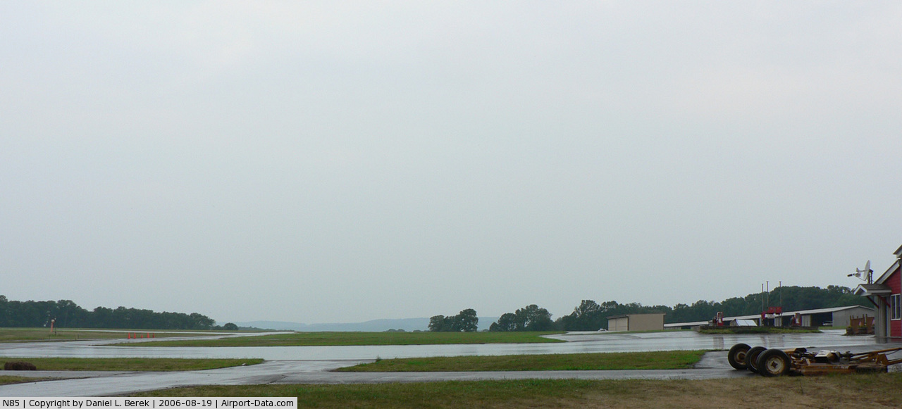
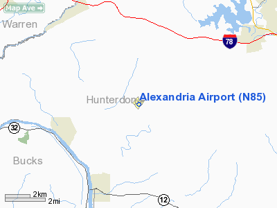
Alexandria Airport (FAA LID: N85) is a public-use airport located two nautical miles (3.704 km) west of the Pittstown area, within both Alexandria Township and Franklin Township in Hunterdon County, New Jersey, United States. The airport is privately owned.
The above content comes from Wikipedia and is published under free licenses – click here to read more.
 |
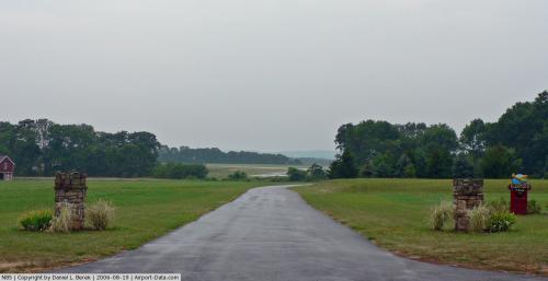
(Click on the photo to enlarge) |
 |
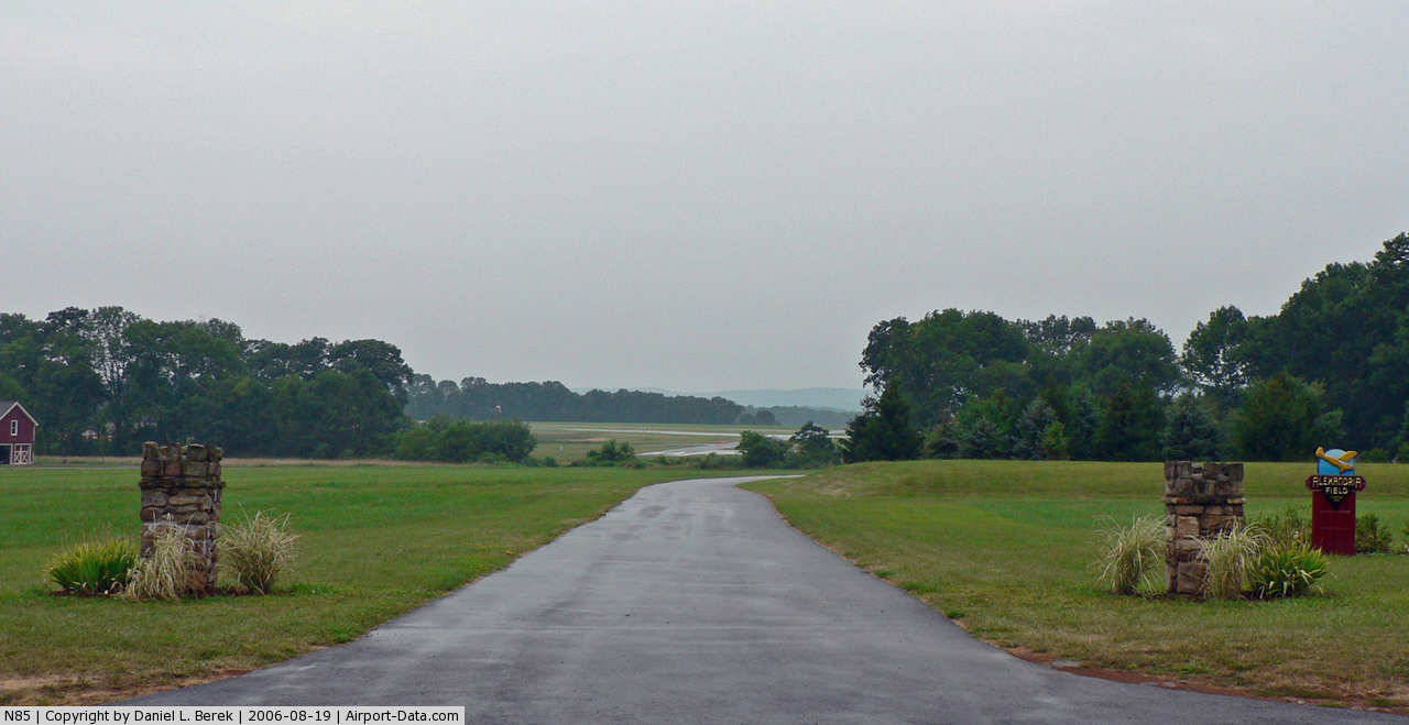
(Click on the photo to enlarge) |
Location & QuickFacts
| FAA Information Effective: | 2008-09-25 |
| Airport Identifier: | N85 |
| Airport Status: | Operational |
| Longitude/Latitude: | 075-01-09.9140W/40-35-15.2660N
-75.019421/40.587574 (Estimated) |
| Elevation: | 480 ft / 146.30 m (Surveyed) |
| Land: | 75 acres |
| From nearest city: | 2 nautical miles W of Pittstown, NJ |
| Location: | Hunterdon County, NJ |
| Magnetic Variation: | 10W (1965) |
Owner & Manager
| Ownership: | Privately owned |
| Owner: | Alexandria Airpark, Llc |
| Address: | 63 Airport Road
Pittstown, NJ 08867 |
| Phone number: | 908-730-9223 |
| Manager: | W. Fritsche - L. Castner |
| Address: | 63 Airport Road
Pittstown, NJ 08867 |
| Phone number: | 908-730-9223 |
Airport Operations and Facilities
| Airport Use: | Open to public |
| Wind indicator: | Yes |
| Segmented Circle: | No |
| Control Tower: | No |
| Lighting Schedule: | RDO-CTL
ACTVT MIRL RY 08/26 & ROTG BCN - 121.8. |
| Beacon Color: | Clear-Green (lighted land airport) |
| Landing fee charge: | No |
| Sectional chart: | New York |
| Region: | AEA - Eastern |
| Boundary ARTCC: | ZNY - New York |
| Tie-in FSS: | MIV - Millville |
| FSS on Airport: | No |
| FSS Toll Free: | 1-800-WX-BRIEF |
| NOTAMs Facility: | MIV (NOTAM-d service avaliable) |
| Federal Agreements: | N |
Airport Communications
| CTAF: | 122.975 |
| Unicom: | 122.975 |
Airport Services
| Fuel available: | 100LLA |
| Airframe Repair: | MAJOR |
| Power Plant Repair: | MAJOR |
Runway Information
Runway 08/26
| Dimension: | 2550 x 60 ft / 777.2 x 18.3 m |
| Surface: | ASPH, Good Condition
25 FT WIDE ASPH STRIP FULL LENGTH DOWN CENTER OF RWY. TURF PORTION OF RWY UNUSABLE. |
| Edge Lights: | Medium |
| |
Runway 08 |
Runway 26 |
| Longitude: | 075-01-24.4380W | 075-00-54.6150W |
| Latitude: | 40-35-08.5130N | 40-35-19.3720N |
| Elevation: | 463.00 ft | 480.00 ft |
| Alignment: | 64 | 127 |
| Traffic Pattern: | Left | Left |
| Markings: | Non-precision instrument, Good Condition | Basic, Good Condition |
| Crossing Height: | 20.00 ft | 20.00 ft |
| VASI: | 2-light PAPI on right side | 2-light PAPI on left side |
| Visual Glide Angle: | 3.00° | 4.50° |
| Obstruction: | 63 ft tree, 351.0 ft from runway, 78 ft right of centerline, 2:1 slope to clear | 66 ft tree, 232.0 ft from runway, 208 ft left of centerline
RY 26 HAS +28 FT TREE, 58 FT FM RY END, 108 FT L. |
|
Runway 13/31
| Dimension: | 1804 x 100 ft / 549.9 x 30.5 m |
| Surface: | ASPH-TURF, Good Condition
25 FT WIDE ASPH STRIP FULL LENGTH DOWN CENTER OF RWY. TURF PORTION OF RWY UNUSABLE. |
| |
Runway 13 |
Runway 31 |
| Longitude: | 075-01-20.7020W | 075-00-59.9670W |
| Latitude: | 40-35-21.1580N | 40-35-12.9250N |
| Elevation: | 444.00 ft | 459.00 ft |
| Alignment: | 118 | 127 |
| Traffic Pattern: | Left | Left |
| Markings: | Numbers only, Good Condition | Numbers only, Good Condition |
| Obstruction: | 12 ft tree, 433.0 ft from runway, 95 ft left of centerline, 19:1 slope to clear | 60 ft tree, 666.0 ft from runway, 142 ft left of centerline, 7:1 slope to clear
RY 31 HAS +38 FT TREE, 112 FT FM RY END, 117 FT L. |
|
Radio Navigation Aids
| ID |
Type |
Name |
Ch |
Freq |
Var |
Dist |
| EWR | FAN MARKER | Maryann | | | 11W | 38.6 nm |
| DYL | NDB | Doylestown | | 237.00 | 10W | 15.9 nm |
| UKT | NDB | Quakertown | | 208.00 | 12W | 16.0 nm |
| NXX | NDB | Willow Grove | | 388.00 | 12W | 24.6 nm |
| CAT | NDB | Chatham | | 254.00 | 11W | 28.4 nm |
| ING | NDB | Ambler | | 275.00 | 11W | 30.3 nm |
| LQX | NDB | Carbon | | 339.00 | 12W | 36.3 nm |
| PNJ | NDB | Paterson | | 347.00 | 12W | 45.0 nm |
| NEL | NDB | Lakehurst | | 396.00 | 13W | 45.2 nm |
| NXX | TACAN | Willow Grove | 061X | | 10W | 24.3 nm |
| NEL | TACAN | Lakehurst | 055X | | 11W | 45.0 nm |
| NEL | UHF/NDB | Lakehurst | | 274.80 | 13W | 45.2 nm |
| PNE | VOR | North Philadelphia | | 112.00 | 10W | 30.4 nm |
| SBJ | VOR/DME | Solberg | 076X | 112.90 | 10W | 12.7 nm |
| BWZ | VOR/DME | Broadway | 089X | 114.20 | 11W | 15.5 nm |
| CKZ | VOR/DME | Pennridge | 025Y | 108.85 | 12W | 17.1 nm |
| ARD | VOR/DME | Yardley | 019X | 108.20 | 10W | 20.7 nm |
| STW | VOR/DME | Stillwater | 033X | 109.60 | 11W | 25.5 nm |
| ETX | VOR/DME | East Texas | 039X | 110.20 | 09W | 30.3 nm |
| COL | VOR/DME | Colts Neck | 101X | 115.40 | 11W | 42.7 nm |
| TEB | VOR/DME | Teterboro | 021X | 108.40 | 11W | 46.3 nm |
| FJC | VORTAC | Allentown | 122X | 117.50 | 10W | 21.5 nm |
| PTW | VORTAC | Pottstown | 112X | 116.50 | 09W | 33.1 nm |
| RBV | VORTAC | Robbinsville | 085X | 113.80 | 10W | 33.4 nm |
| SAX | VORTAC | Sparta | 104X | 115.70 | 11W | 36.2 nm |
| GXU | VORTAC | Mc Guire | 043X | 110.60 | 11W | 39.8 nm |
| PHL | VOT | Philadelphia Intl | | 109.80 | | 44.3 nm |
Remarks
- TAXI ON PAVEMENT ONLY.
- HELICOPTER TKOF AND LANDINGS RSTRD TO RY 08/26 ONLY.
- HELICOPTERS USE FIXED-WING TRAFFIC PATTERNS AND ALTS.
- CTC ARPT MANAGEMENT (908-735-0870) PRIOR TO CONDUCTING HELICOPTER TRAINING ACTIVITY.
- CTC ARPT MANAGEMENT 908-730-9223 PRIOR TO CONDUCTING HELICOPTER TRAINING ACTIVITY.
- EXISTED PRIOR TO 1959.
Images and information placed above are from
http://www.airport-data.com/airport/N85/
We thank them for the data!
| General Info
|
| Country |
United States
|
| State |
NEW JERSEY
|
| FAA ID |
N85
|
| Latitude |
40-35-15.266N
|
| Longitude |
075-01-09.914W
|
| Elevation |
480 feet
|
| Near City |
PITTSTOWN
|
We don't guarantee the information is fresh and accurate. The data may
be wrong or outdated.
For more up-to-date information please refer to other sources.
|
|