|
|
Coordinates: 41°00′31.031″N 074°44′16.922″W / 41.00861972°N 74.73803389°W / 41.00861972; -74.73803389
| Aeroflex-Andover Airport |
 |
| IATA: none – ICAO: none – FAA LID: 12N |
| Summary |
| Airport type |
Public use |
| Owner |
New Jersey State Forest Fire Service |
| Operator |
John T. Flyntz |
| Serves |
Andover, New Jersey |
| Location |
Sussex County, New Jersey |
| Elevation AMSL |
583 ft / 178 m |
| Website |
New Jersey State Forest Fire Service |
| Runways |
| Direction |
Length |
Surface |
| ft |
m |
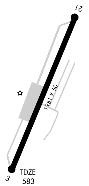
| 3/21 |
1,981 |
604 |
Asphalt |
| Statistics (2009) |
| Aircraft operations |
24,826 |
| Based aircraft |
48 |
| Source: Federal Aviation Administration |
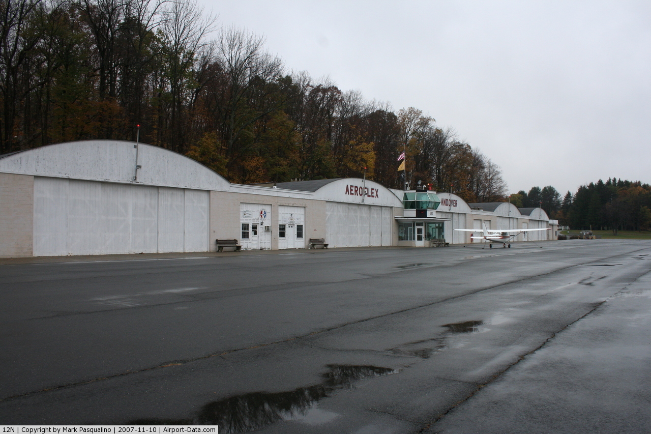
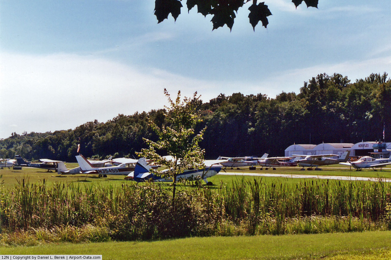
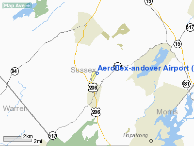
Aeroflex-Andover Airport (FAA LID: 12N) is a public-use airport located two nautical miles (3.704 km) north of Andover within Kittatinny Valley State Park in Sussex County, New Jersey, United States. The airport is publicly owned by the New Jersey Forest Fire Service and used as a base for aerial wildfire suppression.
The above content comes from Wikipedia and is published under free licenses – click here to read more.
 |
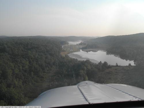
(Click on the photo to enlarge) |
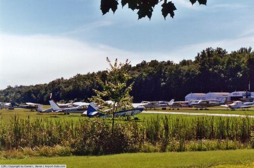
 |
(Click on the photo to enlarge) |
 |
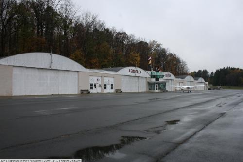
(Click on the photo to enlarge) |
 |
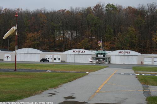
(Click on the photo to enlarge) |
Location & QuickFacts
| FAA Information Effective: | 2008-09-25 |
| Airport Identifier: | 12N |
| Airport Status: | Operational |
| Longitude/Latitude: | 074-44-16.9220W/41-00-31.0310N
-74.738034/41.008620 (Estimated) |
| Elevation: | 583 ft / 177.70 m (Estimated) |
| Land: | 12 acres |
| From nearest city: | 2 nautical miles N of Andover, NJ |
| Location: | Sussex County, NJ |
| Magnetic Variation: | 13W (2000) |
Owner & Manager
| Ownership: | Publicly owned |
| Owner: | Nj St Forest Fire Svc |
| Address: | Po Box 404
Trenton, NJ 08625 |
| Phone number: | 609-292-2977 |
| Manager: | John T Flyntz |
| Address: | Aeroflex-andover Arpt, P.o. Box 709
Andover, NJ 07821 |
| Phone number: | 973-786-5100 |
Airport Operations and Facilities
| Airport Use: | Open to public |
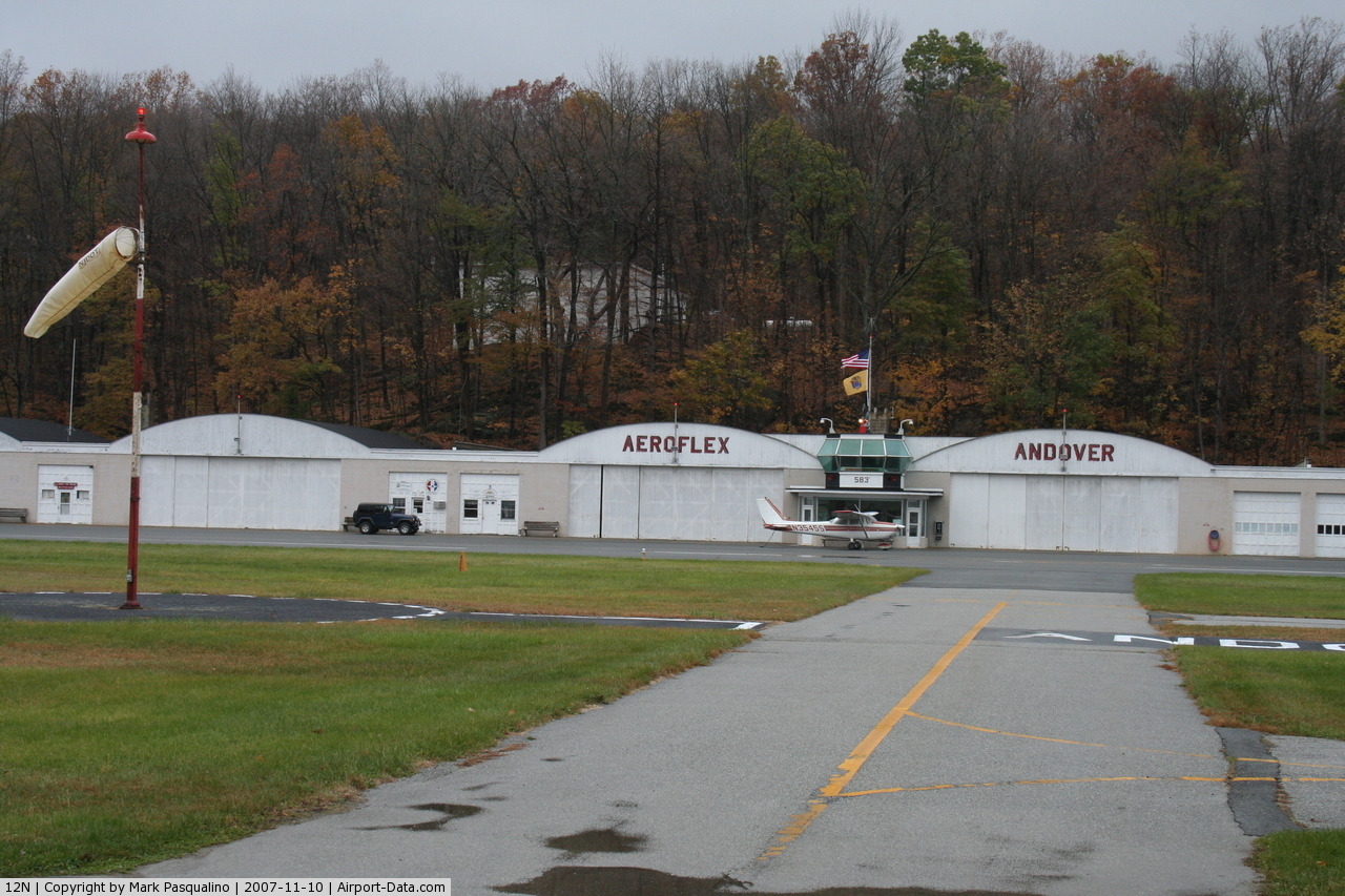
| Wind indicator: | Yes |
| Segmented Circle: | Yes |
| Control Tower: | No |
| Lighting Schedule: | DUSK-DAWN
ACTIVATE MIRL RWY 03/21 - 122.85. |
| Beacon Color: | Clear-Green (lighted land airport) |
| Landing fee charge: | No |
| Sectional chart: | New York |
| Region: | AEA - Eastern |
| Traffic Pattern Alt: | 1017 ft |
| Boundary ARTCC: | ZNY - New York |
| Tie-in FSS: | MIV - Millville |
| FSS on Airport: | No |
| FSS Toll Free: | 1-800-WX-BRIEF |
| NOTAMs Facility: | 12N (NOTAM-d service avaliable) |
Airport Communications
| CTAF: | 122.800 |
| Unicom: | 122.800 |
Airport Services
| Fuel available: | 100LL |
| Airframe Repair: | MAJOR |
| Power Plant Repair: | MAJOR |
| Bottled Oxygen: | NONE |
| Bulk Oxygen: | NONE |
Runway Information
Runway 03/21
| Dimension: | 1981 x 50 ft / 603.8 x 15.2 m |
| Surface: | ASPH, Good Condition |
| Edge Lights: | Medium |
| |
Runway 03 |
Runway 21 |
| Longitude: | 074-44-21.6280W | 074-44-12.2160W |
| Latitude: | 41-00-21.9160N | 41-00-40.1460N |
| Elevation: | 582.00 ft | 582.00 ft |
| Alignment: | 21 | 127 |
| Traffic Pattern: | Right | Left |
| Markings: | Basic, Good Condition | Basic, Good Condition |
| Obstruction: | 108 ft trees, 504.0 ft from runway, 256 ft left of centerline, 2:1 slope to clear
RWY 03 80 FT TREE AT RWY END 167 FT LEFT OF CNTRLN. | 64 ft tree, 580.0 ft from runway, 150 ft right of centerline, 5:1 slope to clear
RY 21 15 FT ROAD AT THLD. |
|
Radio Navigation Aids
| ID |
Type |
Name |
Ch |
Freq |
Var |
Dist |
| EWR | FAN MARKER | Maryann | | | 11W | 31.0 nm |
| SKU | FAN MARKER | Stanwyck | | | 12W | 44.2 nm |
| CAT | NDB | Chatham | | 254.00 | 11W | 21.3 nm |
| PNJ | NDB | Paterson | | 347.00 | 12W | 26.9 nm |
| SW | NDB | Neely | | 335.00 | 14W | 36.8 nm |
| UKT | NDB | Quakertown | | 208.00 | 12W | 43.4 nm |
| DYL | NDB | Doylestown | | 237.00 | 10W | 44.1 nm |
| SKU | NDB | Stanwyck | | 261.00 | 12W | 44.2 nm |
| MS | NDB | Monga | | 359.00 | 12W | 45.9 nm |
| OGY | NDB | Bridge | | 414.00 | 12W | 47.1 nm |
| LQX | NDB | Carbon | | 339.00 | 12W | 47.9 nm |
| PO | NDB | Meier | | 403.00 | 12W | 48.8 nm |
| STW | VOR/DME | Stillwater | 033X | 109.60 | 11W | 6.0 nm |
| BWZ | VOR/DME | Broadway | 089X | 114.20 | 11W | 13.2 nm |
| HUO | VOR/DME | Huguenot | 108X | 116.10 | 11W | 25.0 nm |
| SBJ | VOR/DME | Solberg | 076X | 112.90 | 10W | 25.6 nm |
| TEB | VOR/DME | Teterboro | 021X | 108.40 | 11W | 32.2 nm |
| LGA | VOR/DME | La Guardia | 078X | 113.10 | 12W | 41.3 nm |
| CKZ | VOR/DME | Pennridge | 025Y | 108.85 | 12W | 44.8 nm |
| CRI | VOR/DME | Canarsie | 070X | 112.30 | 11W | 45.2 nm |
| ARD | VOR/DME | Yardley | 019X | 108.20 | 10W | 46.1 nm |
| JFK | VOR/DME | Kennedy | 106X | 115.90 | 12W | 49.4 nm |
| COL | VOR/DME | Colts Neck | 101X | 115.40 | 11W | 49.5 nm |
| SAX | VORTAC | Sparta | 104X | 115.70 | 11W | 9.7 nm |
| FJC | VORTAC | Allentown | 122X | 117.50 | 10W | 36.7 nm |
| LHY | VORTAC | Lake Henry | 045X | 110.80 | 10W | 43.8 nm |
| LVZ | VORTAC | Wilkes-barre | 053X | 111.60 | 10W | 45.9 nm |
| RBV | VORTAC | Robbinsville | 085X | 113.80 | 10W | 49.7 nm |
| JFK | VOT | Kennedy | | 115.10 | | 49.1 nm |
Remarks
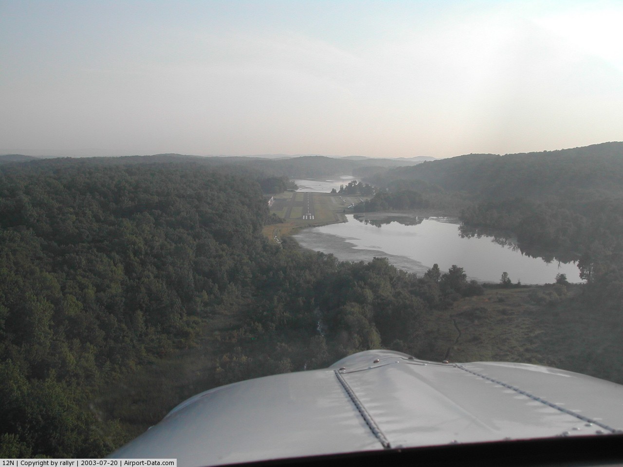
- AVOID OVERFLYING LAKE LENAPE WHILE ON DOWNWIND.
- DIRT SVC ROAD TO TRML AREA IN FRONT OF RWY 03 THLD.
- PARALLEL TURF RY RESTRICTED USE ONLY.
- ARPT RESTRICTED TO APCH CATAGORY A ACFT ONLY.
- DEER & BIRDS ON & INVOF APRT.
- NO TGL.
- RY 03/21 LAKES AT BOTH APCH ENDS.
- NOISE ABATEMENT PROCEDURES IN EFFECT. CTC AMGR 973-786-5100.
- PPR REQUIRED FOR NIGHT TRANSIENTS CTC AMGR 973-786-5100.
Images and information placed above are from
http://www.airport-data.com/airport/12N/
We thank them for the data!
| General Info
|
| Country |
United States
|
| State |
NEW JERSEY
|
| FAA ID |
12N
|
| Latitude |
41-00-31.031N
|
| Longitude |
074-44-16.922W
|
| Elevation |
583 feet
|
| Near City |
ANDOVER
|
We don't guarantee the information is fresh and accurate. The data may
be wrong or outdated.
For more up-to-date information please refer to other sources.
|
|