 |
|
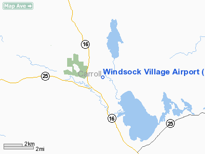
Location & QuickFacts
| FAA Information Effective: | 2008-09-25 |
| Airport Identifier: | NH69 |
| Airport Status: | Operational |
| Longitude/Latitude: | 071-11-13.2500W/43-49-50.2670N
-71.187014/43.830630 (Estimated) |
| Elevation: | 460 ft / 140.21 m (Estimated) |
| Land: | 0 acres |
| From nearest city: | 1 nautical miles E of West Ossipee, NH |
| Location: | Carroll County, NH |
| Magnetic Variation: | 17W (1990) |
Owner & Manager
| Ownership: | Privately owned |
| Owner: | Windsock Village Av Corp |
| Address: | Box 512
West Ossipee, NH 03890 |
| Phone number: | 603-539-7500 |
| Manager: | Windsock Village Av Corp |
| Address: | Box 512
West Ossipee, NH 03890 |
| Phone number: | 603-539-7500 |
Airport Operations and Facilities
| Airport Use: | Private |
| Wind indicator: | Yes |
| Segmented Circle: | No |
| Control Tower: | No |
| Lighting Schedule: | RDO-CTL
ACTVT LIRL RY 15/33 - 122.7. |
| Sectional chart: | New York |
| Region: | ANE - New England |
| Boundary ARTCC: | ZBW - Boston |
| Tie-in FSS: | BGR - Bangor |
| FSS on Airport: | No |
| FSS Toll Free: | 1-800-WX-BRIEF |
Airport Communications
Runway Information
Runway 15/33
| Dimension: | 4000 x 225 ft / 1219.2 x 68.6 m |
| Surface: | TURF, |
| Edge Lights: | Low |
| |
Runway 15 |
Runway 33 |
| Traffic Pattern: | Left | Left |
|
Radio Navigation Aids
| ID |
Type |
Name |
Ch |
Freq |
Var |
Dist |
| SZO | FAN MARKER | Grinn | | | 17W | 15.2 nm |
| LCI | FAN MARKER | Laconia | | | | 19.3 nm |
| HIE | FAN MARKER | Witey | | | 17W | 36.1 nm |
| SZO | NDB | Sebago | | 227.00 | 17W | 18.1 nm |
| LC | NDB | Blnap | | 328.00 | 16W | 23.3 nm |
| GMA | NDB | Mahn | | 386.00 | 17W | 38.5 nm |
| ESG | NDB | Rollins | | 260.00 | 16W | 39.9 nm |
| LAH | NDB | Hanover | | 276.00 | 15W | 43.7 nm |
| CO | NDB | Epsom | | 216.00 | 16W | 44.3 nm |
| HXK | NDB | Hornebrook | | 281.00 | 17W | 44.9 nm |
| LEB | VOR/DME | Lebanon | 084X | 113.70 | 15W | 45.6 nm |
| PSM | VOR/DME | Pease | 112X | 116.50 | 16W | 47.5 nm |
| BML | VOR/DME | Berlin | 041X | 110.40 | 17W | 48.3 nm |
| ENE | VORTAC | Kennebunk | 118X | 117.10 | 17W | 34.9 nm |
| CON | VORTAC | Concord | 076X | 112.90 | 15W | 40.4 nm |
| PWM | VOT | Portland Intl Jetport | | 111.00 | | 39.5 nm |
Remarks
Images and information placed above are from
http://www.airport-data.com/airport/NH69/
We thank them for the data!
| General Info
|
| Country |
United States
|
| State |
NEW HAMPSHIRE
|
| FAA ID |
NH69
|
| Latitude |
43-49-50.267N
|
| Longitude |
071-11-13.250W
|
| Elevation |
460 feet
|
| Near City |
WEST OSSIPEE
|
We don't guarantee the information is fresh and accurate. The data may
be wrong or outdated.
For more up-to-date information please refer to other sources.
|
|


