 |
|
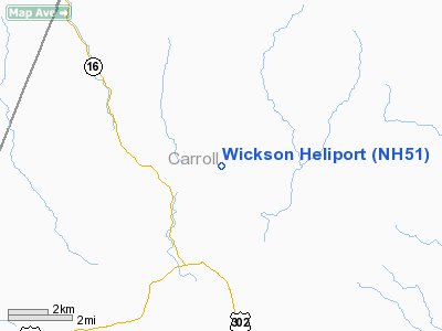
Location & QuickFacts
| FAA Information Effective: | 2008-09-25 |
| Airport Identifier: | NH51 |
| Airport Status: | Operational |
| Longitude/Latitude: | 071-09-24.7300W/44-09-21.3700N
-71.156869/44.155936 (Estimated) |
| Elevation: | 1650 ft / 502.92 m (Estimated) |
| Land: | 0 acres |
| From nearest city: | 1 nautical miles NE of Jackson, NH |
| Location: | Carroll County, NH |
| Magnetic Variation: | 17W (1995) |
Owner & Manager
| Ownership: | Privately owned |
| Owner: | Rightway Aviation, Inc. |
| Address: | 107 Gulf Rd
Derry, NH 03038 |
| Phone number: | 603-383-9720 |
| Manager: | Richard Wickson |
| Address: | 107 Gulf Rd
Derry, NH 09720 |
| Phone number: | 603-383-9720 |
Airport Operations and Facilities
| Airport Use: | Private |
| Segmented Circle: | No |
| Control Tower: | No |
| Lighting Schedule: | PHONE REQ
FOR FLOOD LGTS CALL 603-383-9720. |
| Sectional chart: | Montreal |
| Region: | ANE - New England |
| Boundary ARTCC: | ZBW - Boston |
| Tie-in FSS: | BGR - Bangor |
| FSS Toll Free: | 1-800-WX-BRIEF |
Runway Information
Helipad H1
| Dimension: | 15 x 15 ft / 4.6 x 4.6 m |
| Surface: | CONC, |
| |
Runway H1 |
Runway |
| Traffic Pattern: | Left | Left |
|
Radio Navigation Aids
| ID |
Type |
Name |
Ch |
Freq |
Var |
Dist |
| SZO | FAN MARKER | Grinn | | | 17W | 16.9 nm |
| HIE | FAN MARKER | Witey | | | 17W | 21.6 nm |
| LCI | FAN MARKER | Laconia | | | | 37.5 nm |
| SZO | NDB | Sebago | | 227.00 | 17W | 22.2 nm |
| HXK | NDB | Hornebrook | | 281.00 | 17W | 25.3 nm |
| GMA | NDB | Mahn | | 386.00 | 17W | 25.9 nm |
| LC | NDB | Blnap | | 328.00 | 16W | 40.7 nm |
| LLX | NDB | Lyndonville | | 353.00 | 16W | 43.0 nm |
| RQM | NDB | Rangeley | | 221.00 | 18W | 49.9 nm |
| BML | VOR/DME | Berlin | 041X | 110.40 | 17W | 28.7 nm |
| ENE | VORTAC | Kennebunk | 118X | 117.10 | 17W | 49.8 nm |
| PWM | VOT | Portland Intl Jetport | | 111.00 | | 47.7 nm |
Remarks
- INGRESS TO SE; EGRESS TO NW.
- PRVDD VFR; INGRESS TO SE & EGRESS TO THE NW; USERS ARE NOTIFIED OF CONDITIONS 1 & 2.
Images and information placed above are from
http://www.airport-data.com/airport/NH51/
We thank them for the data!
| General Info
|
| Country |
United States
|
| State |
NEW HAMPSHIRE
|
| FAA ID |
NH51
|
| Latitude |
44-09-21.370N
|
| Longitude |
071-09-24.730W
|
| Elevation |
1650 feet
|
| Near City |
JACKSON
|
We don't guarantee the information is fresh and accurate. The data may
be wrong or outdated.
For more up-to-date information please refer to other sources.
|
|


