 |
|
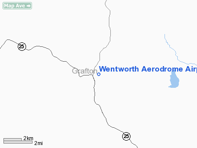
Wentworth Aerodrome Airport |
Location & QuickFacts
| FAA Information Effective: | 2008-09-25 |
| Airport Identifier: | NH96 |
| Airport Status: | Operational |
| Longitude/Latitude: | 071-54-17.0000W/43-52-24.4000N
-71.904722/43.873444 (Estimated) |
| Elevation: | 610 ft / 185.93 m (Estimated) |
| Land: | 0 acres |
| From nearest city: | 0 nautical miles W of Wentworth, NH |
| Location: | Grafton County, NH |
| Magnetic Variation: | () |
Owner & Manager
| Ownership: | Privately owned |
| Owner: | Common Realty Trust
OWNERS ARE JOHN P. MEADE & GEORGE S. PETERSON. TRUSTEE IS JENNIFER P. MEADE. |
| Address: | 104 Barker St.
Pembroke, MA 02359 |
| Phone number: | 781-293-1200 |
| Manager: | John P. Meade |
| Address: | P.o. Box 5
Wentworth, NH 03282 |
| Phone number: | 781-308-2451 |
Airport Operations and Facilities
| Airport Use: | Private |
| Wind indicator: | Yes |
| Control Tower: | No |
| Sectional chart: | New York |
| Region: | ANE - New England |
| Boundary ARTCC: | ZBW - Boston |
| Tie-in FSS: | BGR - Bangor |
| FSS Toll Free: | 1-800-WX-BRIEF |
Runway Information
Runway 01/19
| Dimension: | 1500 x 150 ft / 457.2 x 45.7 m |
| Surface: | TURF, |
| |
Runway 01 |
Runway 19 |
| Traffic Pattern: | Left | Left |
|
Radio Navigation Aids
| ID |
Type |
Name |
Ch |
Freq |
Var |
Dist |
| LCI | FAN MARKER | Laconia | | | | 27.3 nm |
| HIE | FAN MARKER | Witey | | | 17W | 33.1 nm |
| MPV | FAN MARKER | Brook | | | | 42.1 nm |
| SZO | FAN MARKER | Grinn | | | 17W | 44.6 nm |
| R | FAN MARKER | Chitt | | | 14W | 48.6 nm |
| LAH | NDB | Hanover | | 276.00 | 15W | 15.7 nm |
| LC | NDB | Blnap | | 328.00 | 16W | 25.8 nm |
| IVV | NDB | White River | | 379.00 | 16W | 30.8 nm |
| GMA | NDB | Mahn | | 386.00 | 17W | 30.9 nm |
| CNH | NDB | Claremont | | 233.00 | 16W | 36.5 nm |
| LLX | NDB | Lyndonville | | 353.00 | 16W | 38.3 nm |
| VKN | NDB | Mount Mansfield | | 268.00 | 16W | 45.9 nm |
| DYO | NDB | Smuto | | 221.00 | 15W | 46.8 nm |
| SXD | NDB | Springfield | | 265.00 | 15W | 46.9 nm |
| SZO | NDB | Sebago | | 227.00 | 17W | 48.7 nm |
| CO | NDB | Epsom | | 216.00 | 16W | 49.5 nm |
| LEB | VOR/DME | Lebanon | 084X | 113.70 | 15W | 17.9 nm |
| MPV | VOR/DME | Montpelier | 045X | 110.80 | 16W | 26.8 nm |
| CON | VORTAC | Concord | 076X | 112.90 | 15W | 41.8 nm |
Remarks
- 75 FT TREES 100 FT FM RY ALL QUADRANTS.
- PRVDD VFR OPNS & PR USE.
Images and information placed above are from
http://www.airport-data.com/airport/NH96/
We thank them for the data!
|
|


