 |
|
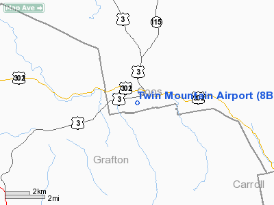
Location & QuickFacts
| FAA Information Effective: | 2008-09-25 |
| Airport Identifier: | 8B2 |
| Airport Status: | Operational |
| Longitude/Latitude: | 071-32-48.2953W/44-15-50.6307N
-71.546749/44.264064 (Estimated) |
| Elevation: | 1459 ft / 444.70 m (Surveyed) |
| Land: | 33 acres |
| From nearest city: | 1 nautical miles SW of Twin Mountain, NH |
| Location: | Coos County, NH |
| Magnetic Variation: | 17W (1985) |
Owner & Manager
| Ownership: | Privately owned |
| Owner: | Dr. Evan Karpf |
| Address: | Po Box 97
Twin Mountain, NH 03595 |
| Phone number: | 603-846-5505 |
| Manager: | Dr. Evan Karpf |
| Address: | Po Box 97
Twin Mountain, NH 03595 |
| Phone number: | 603-846-5505 |
Airport Operations and Facilities
| Airport Use: | Open to public |
| Wind indicator: | Yes |
| Segmented Circle: | No |
| Control Tower: | No |
| Lighting Schedule: | PHONE REQ
ADVANCE NOTICE REQUIRED FOR RY LGTS CALL 1-603-846-5505. |
| Landing fee charge: | No |
| Sectional chart: | Montreal |
| Region: | ANE - New England |
| Boundary ARTCC: | ZBW - Boston |
| Tie-in FSS: | BGR - Bangor |
| FSS on Airport: | No |
| FSS Toll Free: | 1-800-WX-BRIEF |
| NOTAMs Facility: | BGR (NOTAM-d service avaliable) |
Airport Communications
| CTAF: | 122.800 |
| Unicom: | 122.800 |
Airport Services
| Bottled Oxygen: | NONE |
| Bulk Oxygen: | NONE |
Runway Information
Runway 09/27
| Dimension: | 2660 x 60 ft / 810.8 x 18.3 m |
| Surface: | ASPH, Fair Condition |
| Weight Limit: | Single wheel: 8500 lbs. |
| Edge Lights: | Non-standard lighting system
RY LGTS 15-20 FT FM RY EDGE. |
| |
Runway 09 |
Runway 27 |
| Longitude: | 071-33-05.8723W | 071-32-30.7182W |
| Latitude: | 44-15-47.0005N | 44-15-54.2608N |
| Traffic Pattern: | Left | Left |
| Obstruction: | 40 ft trees, 200.0 ft from runway
+40 FT TREES 110 FT FM THLD 0B. | 30 ft trees, 200.0 ft from runway
+30 FT TREES 90 FT FM THLD 0B. |
|
Radio Navigation Aids
| ID |
Type |
Name |
Ch |
Freq |
Var |
Dist |
| HIE | FAN MARKER | Witey | | | 17W | 6.2 nm |
| SZO | FAN MARKER | Grinn | | | 17W | 34.1 nm |
| LCI | FAN MARKER | Laconia | | | | 42.2 nm |
| MPV | FAN MARKER | Brook | | | | 47.9 nm |
| GMA | NDB | Mahn | | 386.00 | 17W | 8.4 nm |
| HXK | NDB | Hornebrook | | 281.00 | 17W | 24.6 nm |
| LLX | NDB | Lyndonville | | 353.00 | 16W | 25.3 nm |
| SZO | NDB | Sebago | | 227.00 | 17W | 39.5 nm |
| LAH | NDB | Hanover | | 276.00 | 15W | 43.4 nm |
| LC | NDB | Blnap | | 328.00 | 16W | 43.7 nm |
| JRV | NDB | Morrisville/stowe | | 375.00 | 16W | 48.5 nm |
| EFK | NDB | Newport | | 242.00 | 17W | 49.4 nm |
| VKN | NDB | Mount Mansfield | | 268.00 | 16W | 49.9 nm |
| BML | VOR/DME | Berlin | 041X | 110.40 | 17W | 27.1 nm |
| MPV | VOR/DME | Montpelier | 045X | 110.80 | 16W | 40.4 nm |
| LEB | VOR/DME | Lebanon | 084X | 113.70 | 15W | 45.6 nm |
Remarks
- ACFT ARE REQUESTED TO STAY ON PAVED SURFACES ONLY.
- MOOSE; DEER & BEAR ON & INVOF ARPT.
- FOR WINTER CONDS CALL 603-846-5505.
- VFR OPNS ONLY
Images and information placed above are from
http://www.airport-data.com/airport/8B2/
We thank them for the data!
| General Info
|
| Country |
United States
|
| State |
NEW HAMPSHIRE
|
| FAA ID |
8B2
|
| Latitude |
44-15-50.229N
|
| Longitude |
071-32-51.292W
|
| Elevation |
1459 feet
|
| Near City |
TWIN MOUNTAIN
|
We don't guarantee the information is fresh and accurate. The data may
be wrong or outdated.
For more up-to-date information please refer to other sources.
|
|


