 |
|
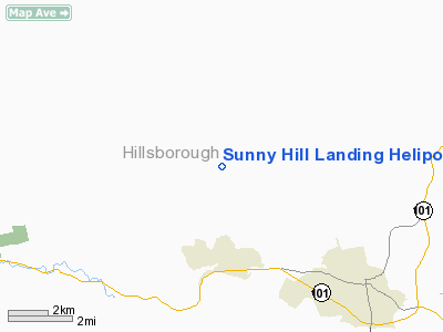
Sunny Hill Landing Heliport |
Location & QuickFacts
| FAA Information Effective: | 2008-09-25 |
| Airport Identifier: | 29NH |
| Airport Status: | Operational |
| Longitude/Latitude: | 071-44-16.1000W/42-53-18.3000N
-71.737806/42.888417 (Estimated) |
| Elevation: | 822 ft / 250.55 m (Estimated) |
| Land: | 0 acres |
| From nearest city: | 14 nautical miles E of Lyndeborough, NH |
| Location: | Hillsborough County, NH |
| Magnetic Variation: | () |
Owner & Manager
| Ownership: | Privately owned |
| Owner: | Charles & Cristina Kalil |
| Address: | Rr1 West Side Road
North Conway, NH 03860 |
| Phone number: | 603-654-2317 |
| Manager: | Charles & Cristina Kalil |
| Address: | Rr1 West Side Road
North Conway, NH 03860 |
| Phone number: | 603-881-3465 |
Airport Operations and Facilities
| Airport Use: | Private |
| Segmented Circle: | No |
| Control Tower: | No |
| Region: | ANE - New England |
| Boundary ARTCC: | ZBW - Boston |
| Tie-in FSS: | BGR - Bangor |
| FSS Toll Free: | 1-800-WX-BRIEF |
Runway Information
Helipad H1
| Dimension: | 100 x 100 ft / 30.5 x 30.5 m |
| Surface: | TURF, |
| |
Runway H1 |
Runway |
| Traffic Pattern: | Left | Left |
|
Radio Navigation Aids
| ID |
Type |
Name |
Ch |
Freq |
Var |
Dist |
| BVY | FAN MARKER | Beverly | | | | 38.8 nm |
| LCI | FAN MARKER | Laconia | | | | 42.8 nm |
| AS | NDB | Chern | | 359.00 | 16W | 7.1 nm |
| DRY | NDB | Derry | | 338.00 | 16W | 15.0 nm |
| CO | NDB | Epsom | | 216.00 | 16W | 18.7 nm |
| FIT | NDB | Fitchburg | | 365.00 | 15W | 20.3 nm |
| ORE | NDB | Orange | | 205.00 | 15W | 30.9 nm |
| SKR | NDB | Shaker Hill | | 251.00 | 16W | 35.9 nm |
| TOF | NDB | Topsfield | | 269.00 | 16W | 38.1 nm |
| LC | NDB | Blnap | | 328.00 | 16W | 39.9 nm |
| CNH | NDB | Claremont | | 233.00 | 16W | 40.1 nm |
| LQ | NDB | Lyndy | | 382.00 | 16W | 43.1 nm |
| SXD | NDB | Springfield | | 265.00 | 15W | 43.7 nm |
| ESG | NDB | Rollins | | 260.00 | 16W | 44.6 nm |
| VWD | NDB | Mount Snow | | 224.00 | 15W | 49.6 nm |
| MHT | VOR/DME | Manchester | 091X | 114.40 | 15W | 16.3 nm |
| LWM | VOR/DME | Lawrence | 072X | 112.50 | 15W | 29.7 nm |
| PSM | VOR/DME | Pease | 112X | 116.50 | 16W | 41.5 nm |
| CON | VORTAC | Concord | 076X | 112.90 | 15W | 21.2 nm |
| GDM | VORTAC | Gardner | 043X | 110.60 | 14W | 25.0 nm |
| EEN | VORTAC | Keene | 031X | 109.40 | 14W | 25.1 nm |
| BOS | VORTAC | Boston | 074X | 112.70 | 16W | 46.0 nm |
| BED | VOT | Laurence G Hanscom Fld | | 110.00 | | 32.1 nm |
| ORH | VOT | Worcester | | 108.20 | | 37.8 nm |
| BOS | VOT | Boston Logan Intl | | 111.00 | | 44.2 nm |
Remarks
- PRVDD APCH & DEP FM 360 DEG TO 280 DEG; WIND INDICATOR INSTALLED; TURF BE KEPT SHORT; VFT OPNS, PRIVATE USE ONLY; ALL USERS COMPLY WITH THESE CONDITIONS.
Images and information placed above are from
http://www.airport-data.com/airport/29NH/
We thank them for the data!
|
|


