 |
|
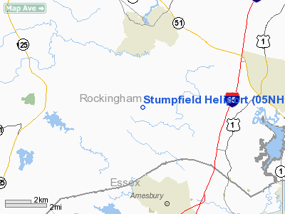
Location & QuickFacts
| FAA Information Effective: | 2008-09-25 |
| Airport Identifier: | 05NH |
| Airport Status: | Operational |
| Longitude/Latitude: | 070-57-05.2200W/42-55-25.9900N
-70.951450/42.923886 (Estimated) |
| Elevation: | 200 ft / 60.96 m (Estimated) |
| Land: | 0 acres |
| From nearest city: | 2 nautical miles SE of Kensington, NH |
| Location: | Rockingham County, NH |
| Magnetic Variation: | 16W (2000) |
Owner & Manager
| Ownership: | Privately owned |
| Owner: | C. Daniel Swift |
| Address: | 20 Stumpfield Road
Kensington, NH 03833 |
| Phone number: | 603-778-0595 |
| Manager: | C. Daniel Swift |
| Address: | 20 Stumpfield Road
Kensington, NH 03833 |
| Phone number: | 603-778-0595 |
Airport Operations and Facilities
| Airport Use: | Private |
| Segmented Circle: | No |
| Control Tower: | No |
| Sectional chart: | New York |
| Region: | ANE - New England |
| Boundary ARTCC: | ZBW - Boston |
| Tie-in FSS: | BGR - Bangor |
| FSS Toll Free: | 1-800-WX-BRIEF |
Runway Information
Helipad H1
| Dimension: | 100 x 100 ft / 30.5 x 30.5 m |
| Surface: | TURF, |
| |
Runway H1 |
Runway |
| Traffic Pattern: | Left | Left |
|
Radio Navigation Aids
| ID |
Type |
Name |
Ch |
Freq |
Var |
Dist |
| BVY | FAN MARKER | Beverly | | | | 18.8 nm |
| LCI | FAN MARKER | Laconia | | | | 44.2 nm |
| ORW | FAN MARKER | Canton | | | 15W | 46.9 nm |
| TOF | NDB | Topsfield | | 269.00 | 16W | 18.3 nm |
| ESG | NDB | Rollins | | 260.00 | 16W | 18.6 nm |
| DRY | NDB | Derry | | 338.00 | 16W | 19.9 nm |
| CO | NDB | Epsom | | 216.00 | 16W | 24.9 nm |
| LQ | NDB | Lyndy | | 382.00 | 16W | 28.4 nm |
| AS | NDB | Chern | | 359.00 | 16W | 29.3 nm |
| SKR | NDB | Shaker Hill | | 251.00 | 16W | 29.9 nm |
| FIT | NDB | Fitchburg | | 365.00 | 15W | 42.0 nm |
| LC | NDB | Blnap | | 328.00 | 16W | 44.9 nm |
| NZW | TACAN | South Weymouth | 061X | | 15W | 46.6 nm |
| PSM | VOR/DME | Pease | 112X | 116.50 | 16W | 11.0 nm |
| LWM | VOR/DME | Lawrence | 072X | 112.50 | 15W | 12.7 nm |
| MHT | VOR/DME | Manchester | 091X | 114.40 | 15W | 18.7 nm |
| CON | VORTAC | Concord | 076X | 112.90 | 15W | 32.7 nm |
| ENE | VORTAC | Kennebunk | 118X | 117.10 | 17W | 33.6 nm |
| BOS | VORTAC | Boston | 074X | 112.70 | 16W | 34.1 nm |
| BED | VOT | Laurence G Hanscom Fld | | 110.00 | | 31.2 nm |
| BOS | VOT | Boston Logan Intl | | 111.00 | | 33.0 nm |
Remarks
- PRVDD VFR OPNS; INGRESS/EGRESS IS FM THE EAST (80 TO 300 DEGS); ALL USERS ARE NOTIFIED & COMPLY WITH THESE CONDITIONS; AND USERS EXERCISE CAUTION SO THAT APCHS & DEPS DO NOT OVERLY HOMES IN THE DEVELOPMENT.
Images and information placed above are from
http://www.airport-data.com/airport/05NH/
We thank them for the data!
| General Info
|
| Country |
United States
|
| State |
NEW HAMPSHIRE
|
| FAA ID |
05NH
|
| Latitude |
42-55-25.990N
|
| Longitude |
070-57-05.220W
|
| Elevation |
200 feet
|
| Near City |
KENSINGTON
|
We don't guarantee the information is fresh and accurate. The data may
be wrong or outdated.
For more up-to-date information please refer to other sources.
|
|


