 |
|
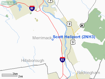
Location & QuickFacts
| FAA Information Effective: | 2008-09-25 |
| Airport Identifier: | 2NH3 |
| Airport Status: | Operational |
| Longitude/Latitude: | 071-29-53.6400W/43-06-51.5400N
-71.498233/43.114317 (Estimated) |
| Elevation: | 580 ft / 176.78 m (Estimated) |
| Land: | 0 acres |
| From nearest city: | 8 nautical miles SW of Bow, NH |
| Location: | Merrimack County, NH |
| Magnetic Variation: | () |
Owner & Manager
| Ownership: | Privately owned |
| Owner: | R. R. Scott |
| Address: | 142 Bow Bog Road
Bow, NH 03304 |
| Phone number: | 603-224-1864 |
| Manager: | Joseph Brigham |
| Address: | 23 Poor Richards Drive
Bow, NH 03304 |
| Phone number: | 603-496-7755 |
Airport Operations and Facilities
| Airport Use: | Private |
| Control Tower: | No |
| Sectional chart: | New York |
| Region: | ANE - New England |
| Boundary ARTCC: | ZBW - Boston |
| Tie-in FSS: | BGR - Bangor |
| FSS Toll Free: | 1-800-WX-BRIEF |
Runway Information
Helipad H1
| Dimension: | 80 x 80 ft / 24.4 x 24.4 m |
| Surface: | TURF, |
| |
Runway H1 |
Runway |
| Traffic Pattern: | Left | Left |
|
Radio Navigation Aids
| ID |
Type |
Name |
Ch |
Freq |
Var |
Dist |
| LCI | FAN MARKER | Laconia | | | | 27.3 nm |
| BVY | FAN MARKER | Beverly | | | | 38.9 nm |
| CO | NDB | Epsom | | 216.00 | 16W | 2.0 nm |
| DRY | NDB | Derry | | 338.00 | 16W | 15.3 nm |
| AS | NDB | Chern | | 359.00 | 16W | 18.1 nm |
| LC | NDB | Blnap | | 328.00 | 16W | 25.4 nm |
| ESG | NDB | Rollins | | 260.00 | 16W | 30.1 nm |
| FIT | NDB | Fitchburg | | 365.00 | 15W | 35.7 nm |
| TOF | NDB | Topsfield | | 269.00 | 16W | 38.1 nm |
| CNH | NDB | Claremont | | 233.00 | 16W | 41.2 nm |
| SKR | NDB | Shaker Hill | | 251.00 | 16W | 42.0 nm |
| LAH | NDB | Hanover | | 276.00 | 15W | 46.1 nm |
| LQ | NDB | Lyndy | | 382.00 | 16W | 46.3 nm |
| ORE | NDB | Orange | | 205.00 | 15W | 47.8 nm |
| SXD | NDB | Springfield | | 265.00 | 15W | 48.6 nm |
| MHT | VOR/DME | Manchester | 091X | 114.40 | 15W | 15.8 nm |
| LWM | VOR/DME | Lawrence | 072X | 112.50 | 15W | 28.6 nm |
| PSM | VOR/DME | Pease | 112X | 116.50 | 16W | 29.3 nm |
| LEB | VOR/DME | Lebanon | 084X | 113.70 | 15W | 46.2 nm |
| CON | VORTAC | Concord | 076X | 112.90 | 15W | 7.2 nm |
| EEN | VORTAC | Keene | 031X | 109.40 | 14W | 39.9 nm |
| GDM | VORTAC | Gardner | 043X | 110.60 | 14W | 42.1 nm |
| ENE | VORTAC | Kennebunk | 118X | 117.10 | 17W | 43.0 nm |
| BED | VOT | Laurence G Hanscom Fld | | 110.00 | | 39.9 nm |
| BOS | VOT | Boston Logan Intl | | 111.00 | | 49.1 nm |
Remarks
- PRVDD VFR OPNS; PVT USE; RESOLVE INGRESS/EGRESS TFC PAT CONFLICTS WITH CONCORD MUNI AND ALL PVT ARPTS WITHIN 7 NM; ALL USERS ARE NOTIFIED AND COMPLY WITH THESE CONDS.
Images and information placed above are from
http://www.airport-data.com/airport/2NH3/
We thank them for the data!
|
|


