 |
|
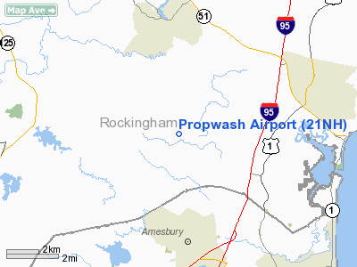
Location & QuickFacts
| FAA Information Effective: | 2008-09-25 |
| Airport Identifier: | 21NH |
| Airport Status: | Operational |
| Longitude/Latitude: | 070-56-07.0000W/42-55-01.0000N
-70.935278/42.916944 (Estimated) |
| Elevation: | 190 ft / 57.91 m (Estimated) |
| Land: | 0 acres |
| From nearest city: | 1 nautical miles SE of Kensington, NH |
| Location: | Rockingham County, NH |
| Magnetic Variation: | () |
Owner & Manager
| Ownership: | Privately owned |
| Owner: | Geert Frank |
| Address: | 21 Cottage Road
Kensington, NH 03833-6727 |
| Phone number: | 603-772-4635 |
| Manager: | Geert Frank |
| Address: | 21 Cottage Road
Kensington, NH 03833-6727 |
| Phone number: | 603-772-4635 |
Airport Operations and Facilities
| Airport Use: | Private |
| Segmented Circle: | No |
| Control Tower: | No |
| Sectional chart: | New York |
| Region: | ANE - New England |
| Boundary ARTCC: | ZBW - Boston |
| Tie-in FSS: | BGR - Bangor |
| FSS Toll Free: | 1-800-WX-BRIEF |
Runway Information
Runway 13/31
| Dimension: | 1450 x 80 ft / 442.0 x 24.4 m |
| Surface: | TURF, |
| |
Runway 13 |
Runway 31 |
| Traffic Pattern: | Left | Left |
| Obstruction: | 40 ft trees, 1000.0 ft from runway | 50 ft trees, 1000.0 ft from runway |
|
Radio Navigation Aids
| ID |
Type |
Name |
Ch |
Freq |
Var |
Dist |
| BVY | FAN MARKER | Beverly | | | | 18.4 nm |
| LCI | FAN MARKER | Laconia | | | | 44.9 nm |
| ORW | FAN MARKER | Canton | | | 15W | 46.6 nm |
| TOF | NDB | Topsfield | | 269.00 | 16W | 17.9 nm |
| ESG | NDB | Rollins | | 260.00 | 16W | 18.8 nm |
| DRY | NDB | Derry | | 338.00 | 16W | 20.5 nm |
| CO | NDB | Epsom | | 216.00 | 16W | 25.8 nm |
| LQ | NDB | Lyndy | | 382.00 | 16W | 28.0 nm |
| SKR | NDB | Shaker Hill | | 251.00 | 16W | 29.7 nm |
| AS | NDB | Chern | | 359.00 | 16W | 29.9 nm |
| FIT | NDB | Fitchburg | | 365.00 | 15W | 42.4 nm |
| LC | NDB | Blnap | | 328.00 | 16W | 45.6 nm |
| NZW | TACAN | South Weymouth | 061X | | 15W | 46.1 nm |
| PSM | VOR/DME | Pease | 112X | 116.50 | 16W | 11.0 nm |
| LWM | VOR/DME | Lawrence | 072X | 112.50 | 15W | 12.7 nm |
| MHT | VOR/DME | Manchester | 091X | 114.40 | 15W | 19.3 nm |
| CON | VORTAC | Concord | 076X | 112.90 | 15W | 33.5 nm |
| ENE | VORTAC | Kennebunk | 118X | 117.10 | 17W | 33.7 nm |
| BOS | VORTAC | Boston | 074X | 112.70 | 16W | 33.7 nm |
| BED | VOT | Laurence G Hanscom Fld | | 110.00 | | 31.2 nm |
| BOS | VOT | Boston Logan Intl | | 111.00 | | 32.7 nm |
Remarks
- PRVDD APCH/DEP OPNS FM 130 DEGS TO 310 DEGS; RESOLVE TRAFFIC PATTERN CONFLICTS WITH HAMPTON, PLUM ISLAND, AND PEASE INTL; PRIVATE USE ONLY; AND USERS COMPLY WITH THESE CONDITIONS.
Images and information placed above are from
http://www.airport-data.com/airport/21NH/
We thank them for the data!
|
|


