 |
|
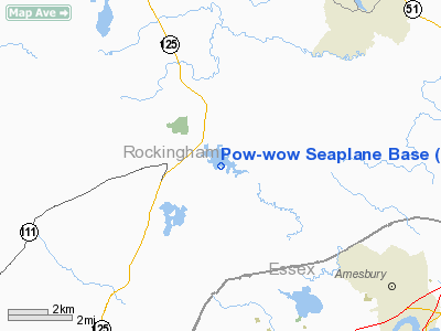
Pow-wow Seaplane Base Airport |
Location & QuickFacts
| FAA Information Effective: | 2008-09-25 |
| Airport Identifier: | NH64 |
| Airport Status: | Operational |
| Longitude/Latitude: | 071-02-02.7070W/42-54-40.3180N
-71.034085/42.911199 (Estimated) |
| Elevation: | 116 ft / 35.36 m (Estimated) |
| Land: | 0 acres |
| From nearest city: | 2 nautical miles S of Kingston, NH |
| Location: | Rockingham County, NH |
| Magnetic Variation: | 16W (1985) |
Owner & Manager
| Ownership: | Privately owned |
| Owner: | Forrest V. Smith |
| Address: | 9 Maple St
Kingston, NH 03848 |
| Phone number: | 603-642-4006 |
| Manager: | Forrest V. Smith |
| Address: | 9 Maple St
Kingston, NH 03848 |
| Phone number: | 603-642-4006 |
Airport Operations and Facilities
| Airport Use: | Private |
| Segmented Circle: | No |
| Control Tower: | No |
| Sectional chart: | New York |
| Region: | ANE - New England |
| Boundary ARTCC: | ZBW - Boston |
| Tie-in FSS: | BGR - Bangor |
| FSS Toll Free: | 1-800-WX-BRIEF |
Runway Information
Runway 13/31
| Dimension: | 4000 x 250 ft / 1219.2 x 76.2 m |
| Surface: | WATER, |
| |
Runway 13 |
Runway 31 |
| Traffic Pattern: | Left | Left |
|
Radio Navigation Aids
| ID |
Type |
Name |
Ch |
Freq |
Var |
Dist |
| BVY | FAN MARKER | Beverly | | | | 18.5 nm |
| LCI | FAN MARKER | Laconia | | | | 43.3 nm |
| ORW | FAN MARKER | Canton | | | 15W | 45.5 nm |
| DRY | NDB | Derry | | 338.00 | 16W | 16.2 nm |
| TOF | NDB | Topsfield | | 269.00 | 16W | 17.9 nm |
| ESG | NDB | Rollins | | 260.00 | 16W | 20.7 nm |
| CO | NDB | Epsom | | 216.00 | 16W | 22.2 nm |
| AS | NDB | Chern | | 359.00 | 16W | 25.6 nm |
| LQ | NDB | Lyndy | | 382.00 | 16W | 27.8 nm |
| SKR | NDB | Shaker Hill | | 251.00 | 16W | 28.1 nm |
| FIT | NDB | Fitchburg | | 365.00 | 15W | 38.6 nm |
| LC | NDB | Blnap | | 328.00 | 16W | 43.6 nm |
| NZW | TACAN | South Weymouth | 061X | | 15W | 46.0 nm |
| LWM | VOR/DME | Lawrence | 072X | 112.50 | 15W | 10.6 nm |
| PSM | VOR/DME | Pease | 112X | 116.50 | 16W | 13.7 nm |
| MHT | VOR/DME | Manchester | 091X | 114.40 | 15W | 15.0 nm |
| CON | VORTAC | Concord | 076X | 112.90 | 15W | 30.2 nm |
| BOS | VORTAC | Boston | 074X | 112.70 | 16W | 33.3 nm |
| ENE | VORTAC | Kennebunk | 118X | 117.10 | 17W | 36.0 nm |
| BED | VOT | Laurence G Hanscom Fld | | 110.00 | | 28.9 nm |
| BOS | VOT | Boston Logan Intl | | 111.00 | | 32.1 nm |
Remarks
- PROVIDED OPERATIONS ARE CONDUCTED IN DAY VFR WEATHER CONDITIONS.
Images and information placed above are from
http://www.airport-data.com/airport/NH64/
We thank them for the data!
| General Info
|
| Country |
United States
|
| State |
NEW HAMPSHIRE
|
| FAA ID |
NH64
|
| Latitude |
42-54-40.318N
|
| Longitude |
071-02-02.707W
|
| Elevation |
116 feet
|
| Near City |
KINGSTON
|
We don't guarantee the information is fresh and accurate. The data may
be wrong or outdated.
For more up-to-date information please refer to other sources.
|
|


