 |
|
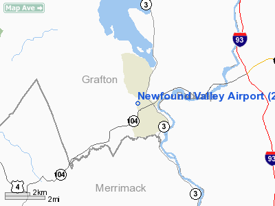
Location & QuickFacts
| FAA Information Effective: | 2008-09-25 |
| Airport Identifier: | 2N2 |
| Airport Status: | Operational |
| Longitude/Latitude: | 071-45-05.2850W/43-35-31.2650N
-71.751468/43.592018 (Estimated) |
| Elevation: | 510 ft / 155.45 m (Estimated) |
| Land: | 15 acres |
| From nearest city: | 1 nautical miles W of Bristol, NH |
| Location: | Grafton County, NH |
| Magnetic Variation: | 16W (1985) |
Owner & Manager
| Ownership: | Privately owned |
| Owner: | Mrs. Nathan H. Morrison |
| Address: | 12 Willow Street
Bristol, NH 03222 |
| Phone number: | 603-744-2467 |
| Manager: | Mr. Doug Williams |
| Address: | 94 Browns Beach Road
Bristol, NH 03222 |
| Phone number: | 603-481-4159 |
Airport Operations and Facilities
| Airport Use: | Open to public |
| Wind indicator: | Yes |
| Segmented Circle: | No |
| Control Tower: | No |
| Landing fee charge: | No |
| Sectional chart: | New York |
| Region: | ANE - New England |
| Boundary ARTCC: | ZBW - Boston |
| Tie-in FSS: | BGR - Bangor |
| FSS on Airport: | No |
| FSS Toll Free: | 1-800-WX-BRIEF |
| NOTAMs Facility: | BGR (NOTAM-d service avaliable) |
Airport Communications
Airport Services
| Airframe Repair: | NONE |
| Power Plant Repair: | NONE |
Runway Information
Runway 03/21
| Dimension: | 1900 x 40 ft / 579.1 x 12.2 m |
| Surface: | ASPH, Good Condition
RY RE-SURFACED SUMMER 2002 |
| |
Runway 03 |
Runway 21 |
| Traffic Pattern: | Left | Left |
| Obstruction: | 95 ft tree, 369.0 ft from runway, 112 ft left of centerline, 2:1 slope to clear
RWY 03 +15 FT ROAD AT THLD; +50 FT TREES AND +30 FT POWER LINES AT THLD 45 FT L; +50 FT TREES AT THLD 105 FT R. | 54 ft tree, 383.0 ft from runway, 88 ft right of centerline, 3:1 slope to clear
+25 FT BLDG 50 FT FM THLD 150 FT R; +80 FT TREE 90 FT FM THLD 80 R; -60 FT EMBANKMENT 90 FT FM RY END; 65 FT TREES 80 FT FM THLD 90 FT L. |
|
Radio Navigation Aids
| ID |
Type |
Name |
Ch |
Freq |
Var |
Dist |
| LCI | FAN MARKER | Laconia | | | | 13.6 nm |
| SZO | FAN MARKER | Grinn | | | 17W | 43.7 nm |
| HIE | FAN MARKER | Witey | | | 17W | 47.3 nm |
| LC | NDB | Blnap | | 328.00 | 16W | 9.9 nm |
| LAH | NDB | Hanover | | 276.00 | 15W | 19.7 nm |
| CNH | NDB | Claremont | | 233.00 | 16W | 30.2 nm |
| IVV | NDB | White River | | 379.00 | 16W | 31.2 nm |
| CO | NDB | Epsom | | 216.00 | 16W | 31.3 nm |
| SXD | NDB | Springfield | | 265.00 | 15W | 41.3 nm |
| SZO | NDB | Sebago | | 227.00 | 17W | 46.1 nm |
| DRY | NDB | Derry | | 338.00 | 16W | 46.1 nm |
| ESG | NDB | Rollins | | 260.00 | 16W | 46.1 nm |
| GMA | NDB | Mahn | | 386.00 | 17W | 46.4 nm |
| AS | NDB | Chern | | 359.00 | 16W | 46.7 nm |
| LEB | VOR/DME | Lebanon | 084X | 113.70 | 15W | 20.9 nm |
| MPV | VOR/DME | Montpelier | 045X | 110.80 | 16W | 42.4 nm |
| MHT | VOR/DME | Manchester | 091X | 114.40 | 15W | 46.6 nm |
| CON | VORTAC | Concord | 076X | 112.90 | 15W | 23.7 nm |
Remarks
- RWY PLOWED DEC. THRU MAR. CALL ARPT MGR FOR CURRENT CONDITIONS (603)481-4159.
- VFR USE ONLY.
Images and information placed above are from
http://www.airport-data.com/airport/2N2/
We thank them for the data!
| General Info
|
| Country |
United States
|
| State |
NEW HAMPSHIRE
|
| FAA ID |
2N2
|
| Latitude |
43-35-31.265N
|
| Longitude |
071-45-05.285W
|
| Elevation |
510 feet
|
| Near City |
BRISTOL
|
We don't guarantee the information is fresh and accurate. The data may
be wrong or outdated.
For more up-to-date information please refer to other sources.
|
|


